Overview
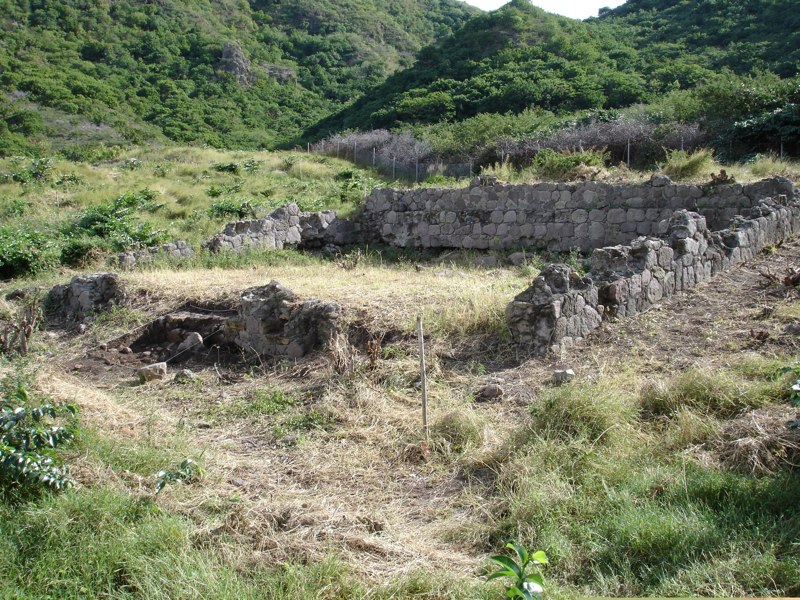
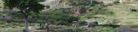
View across the Little Bay site, looking north toward Manor House.
The Little Bay Plantation site is the core area of what was once an extensive plantation extending well beyond the current boundaries of the site; it is owned by the Montserrat National Trust. It is preserved as a park within an area being developed as the new capital for Montserrat. Massive construction projects have been undertaken on three sides of the site; to the east and north there are new roads, to the west, a huge cricket pitch, and directly adjacent to the northern edge of the site, a new national museum. The museum houses the offices and collections of the Montserrat National Trust, which has sponsored several seasons of archaeological investigation at the Little Bay Plantation site.
Documentary Evidence
Robert Piper obtained the title to a parcel of land known as Carr’s Little Bay Plantation near the northern tip of Montserrat sometime between 1710 and 1712 and renamed it Little Bay Plantation. Robert Piper was described in a 1729 census as a “Planter and Cooper” with a house and plantation, a household of nine members, and owner of 39 enslaved men, women, and children. His real estate included a cattle mill and three houses—a boiling house and still, a curing house, and a dwelling house—and 100 acres of land with thirty-six acres planted in cane and four in cotton. The nine people in Piper’s household included Robert and his wife Jane, their sons Christopher, Robert, Jr., William, and John and daughters Elizabeth and Sarah, and a “White Man Servant.”
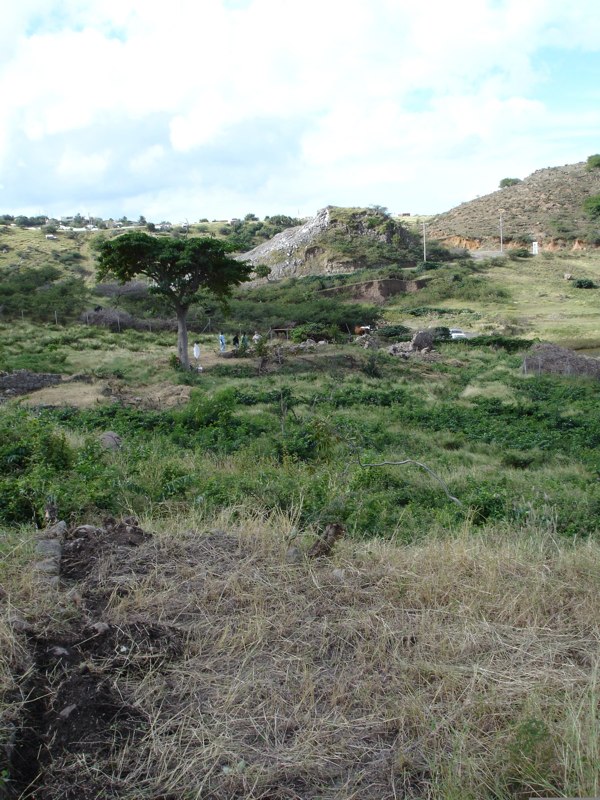
A view of Little Bay Plantation and Monserrat Volcano from the ocean.
In his will, written about a year before his death in 1740, Robert Piper left all of his real estate to his four sons and their lawful heirs, but the sons soon divided the property among themselves. William and John, the younger sons, retained the Little Bay Plantation. William died in 1762 without heirs, leaving the plantation to his brother John, who survived him for five years before his own death; also childless, John willed the plantation to his nephew Robert Piper. In the ensuing years two Piper cousins, Hugh Allen Piper and John Hugh Allen, contested ownership of the property. It is unclear who among these three was living on the plantation when the planter’s dwelling house burned to the ground in 1783. The plantation was abandoned after the fire and never reoccupied, although in the 19th and 20th centuries the area was planted in cotton and sometime in the 19th century stones and bricks from the 18th-century plantation structures were robbed and reused in the construction of a cotton warehouse just northeast of the former sugar works.
Documentary research was conducted by Casey Pecoraro and Jessica Striebel MacLean at the john RylandsLibrary (Manchester, UK), Monserrat Public Library Special Collections (Monserrat, WI), and the National Archives of the United Kingdom (Kew, London).
History of Archaeological Investigations
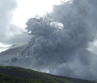
Eruption of Monserrat Volcano.
In 2005 the heart of the 18th-century plantation complex, comprising a little over one acre, was deeded to the Montserrat National Trust (MNT) to insure its long-term preservation. The MNT contacted Dr. Lydia Pulsipher, a geographer at the University of Tennessee, who with archaeologist Dr. Conrad M. Goodwin had spent many years excavating the site of Galways Plantation, which, along with the island’s former capital, Plymouth, was destroyed in the l990s by a series of volcanic eruptions and pyroclastic flows. Goodwin and Pulsipher had located the site in the 1980s and had brought students from a University of Tennessee field school and Earthwatch volunteers to the site to excavate a test pit in the ruins of a structure they thought might be the curing house and another within the foundation of what they referred to as the manor house. In 1989, Pulsipher identified the site as William Carr’s 17th-century plantation and recommended to the MNT that the site be preserved, and in 2000 Pulsipher and Goodwin submitted a white paper to the MNT emphasizing the significance of the plantation as a heritage site and outlining actions needed to investigate it and interpret it to the public. At that time, island residents were still recovering from the devastation caused by the volcano’s 1997 eruption, so it was not until 2005 that the MNT was able to take action on Pulsipher and Goodwin’s recommendations (Beaudry and Pulsipher 2007).
2005
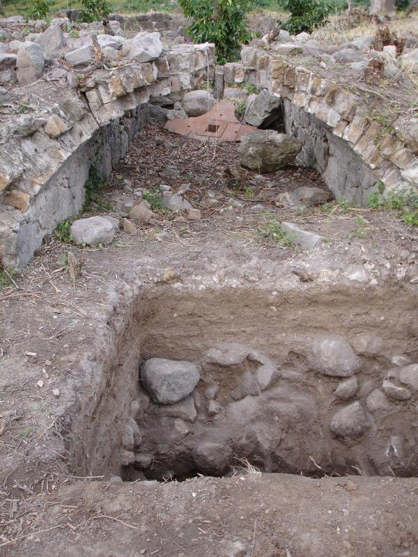
1-x-1 meter excavation unit (Test Unit A) under the Little Bay Cattle Mill arch. January 2006.
Pulsipher and Goodwin invited Dr. Mary Beaudry of Boston University to accompany them to Montserrat in December, 2005, to investigate the feasibility of conducting fieldwork at the site. The site was heavily overgrown and required clearing, which took up much of the first two days of a week-long effort. During that week, with the help of local volunteers, the team excavated a 1 × 1 meter test pit just south of the arch of the cattle mill and a 1 meter × 50 centimeter test trench across the north.
Methods of excavation initiated in 2005 have been followed in all subsequent field seasons. Excavation was conducted according to visually recognizable stratigraphic levels, using shovels and trowels. All soil was screened through ¼-inch hardware mesh. Measurements were in meters and centimeters (Beaudry and Pulsipher 2007).
2006

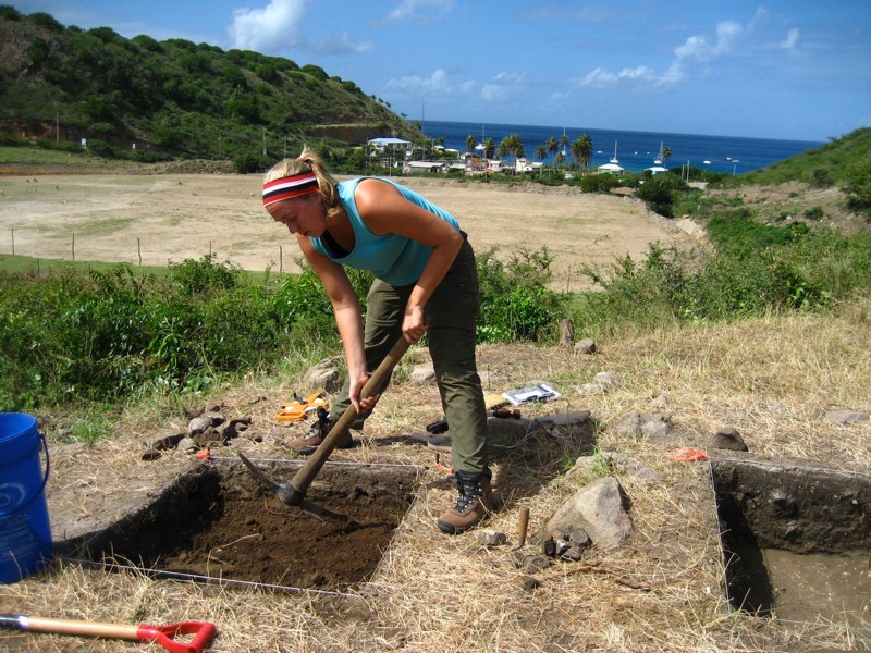
Kaitlin DesLattes opens a unit on terrace south of the Little Bay manor house, March 2007.
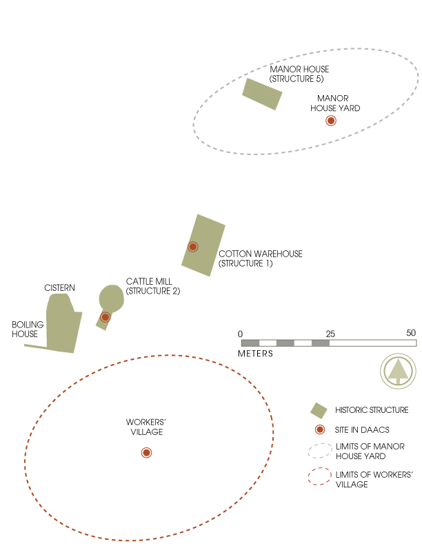
Archaeologists returned to the site in January 2006. A map of the site was plotted, with the assistance of John Beatty, retired and former head of Montserrat Lands and Survey Office. Excavations were then conducted on the three of the four main structures: the Manor House (Structure 5), Cotton Warehouse (Structure 1) and the Cattle Mill (Structure 2). Assemblages from the test units excavated in 2006 are comprise the data in DAACS (Pulsipher 2006).
2007
During March 2007, excavation and mapping at the archaeological site of the Carr Estate at Little Bay, Montserrat, focused on the laborers’ village, the bulk of which lies outside the fenced area deeded to the Montserrat National Trust (MNT) as a heritage site. The rationale for this work at this time was the impending road construction aimed at creating necessary infrastructure for the new town planned at Little Bay. We knew the road building might destroy archaeological evidence in this laborers’ village locale.
The archaeological effort was conducted at the request of Chief Minister Lowell Lewis and the MNT, with the aim of recording and saving information about the laborers’ village in advance of construction. The information recovered and finds from this effort are currently undergoing detailed study, a process that will take several months.
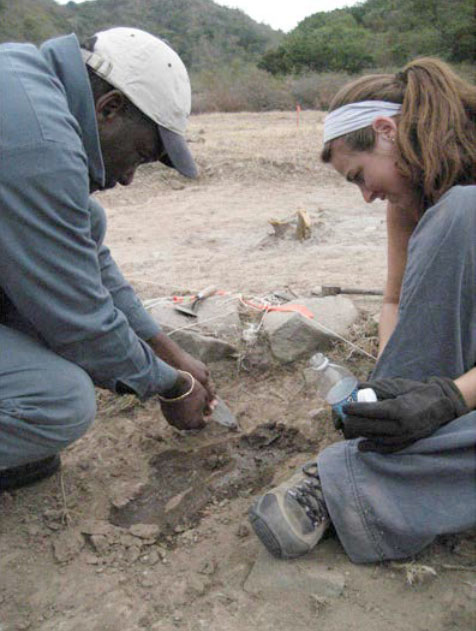
Silvester Silcott and Kate DesCoteaux excavate an emedded sherd of Afro-Caribbean ceramic from Area 1 at the Worker’s Village.
The March 2007 field season was 10 days in duration, approximately twice as long as both of our earlier, short episodes of fieldwork in January 2006 and in December 2006/January 2007. Two of the project directors, Dr. Mary Beaudry and Dr. Lydia Pulsipher, were present; the field crew consisted of Krysta Ryzewski, a PhD student at Brown University, and Kaitlin DesLatte and Katherine DesCoteaux, both Master of Arts students at the University of Massachusetts in Boston. Dr. Barbara Heath, a historical archaeologist at the University of Tennessee, also assisted on several days, though her main role was to work on the Galways artifacts that had to be transported and stored under emergency circumstances in 1996 during the volcano crisis. All have extensive excavation experience at historical archaeological sites, including sites in the Caribbean. Members of the crew were assisted in their efforts by Montserratian volunteers Sylvester Silcott and Abraham Piper and by Douglas Anderson, a visitor who also volunteered his help (Beaudry and Pulsipher 2007).
Mary Beaudry, Boston University, with contributions from Lydia Pulsipher, the University of Tennessee, and Jillian Galle, The Digital Archaeological Archive of Comparative Slavery
May 2015