Located on the windward side of Nevis, the New River Estate was established in the early 1720s and operated as a large-scale sugar plantation throughout much of the 18th century. By the 1750s, nearly 130 enslaved Africans worked and lived at New River. Archaeological data indicates that the estate supported two slave villages, one dating from the mid-1700s to around 1780 and a second dating from the early 1780s through emancipation in 1834.
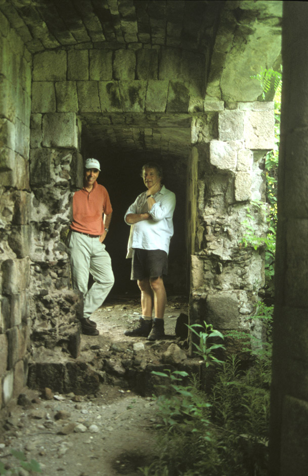
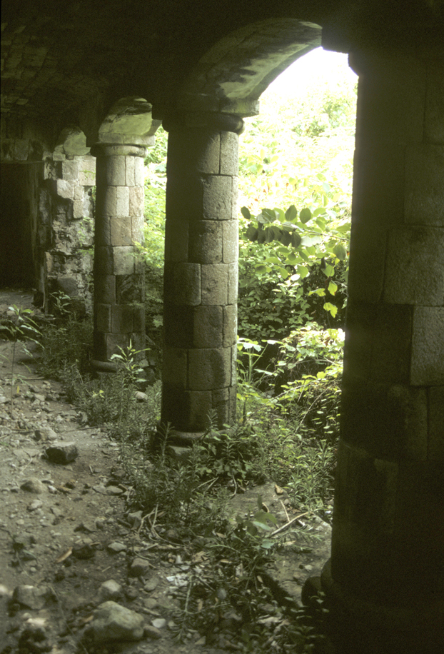
Today, the New River Estate remains relatively undeveloped. Ruins of the great house, cisterns, and sugar works, including an early windmill and a later steam mill, all indicate substantial owner investment in the plantation in the 18th and 19th centuries. Relocation of the slave village in the 1780s, as well as the upgrade in sugar works technology demonstrate that New River owners upgraded their sugar works in order to maximize sugar production in the face of abolition of the slave trade (1807) and emancipation (1834).
History of the New River Estate
Located on the windward side of Nevis, the New River Estate was established in the early 1720s. The first recorded mention of the plantation was in 1794, when William Earle, planter, conveyed the plantation to Thomas Butler, a merchant who was listed as formerly of Nevis but now of Great Britain. The deed located the New River plantation in the parish of St James and noted that it was around 50 acres, bounded on the northeast with the sea, on the southwest by the lands of William Earle and Charles Williams, to the northeast with lands belonging to Elizabeth Hill, Charles Williams and the lands formerly of John Wilkinson, and to the southeast with the land of Robert Easter (Common Records 1707-1728, fols.553-4).
A listing of the militia made in 1698 listed three male heads-of-household who were named Earle, as well as their family members and the number of enslaved Africans that they owned at the time. Roger Leech, who conducted the historical research on The New River Estate for this project, concludes that this family most likely owned New River.
| Owners | White Men | White Women | White Children | Negro Men | Negro Women | Negro Children |
| Captain Edward Earle | 3 | 3 | 4 | 7 | 14 | 10 |
| Mr. Roger Earle | 4 | 2 | 4 | 9 | 8 | 9 |
| Samuel Earle | 2 | 1 | 3 | 2 | 1 | 0 |
The origin of the name ‘New River’ has not been established. Leech theorizes that there may have been an ownership, family, investment or some other association with the New River Company established in the early 17th century to provide a new water supply to London. The naming of a nearby ghut as ‘New River Gutt’ need not mean that this was a new watercourse named as ‘New River’. The ghut ¬¬might simply be named after the plantation.
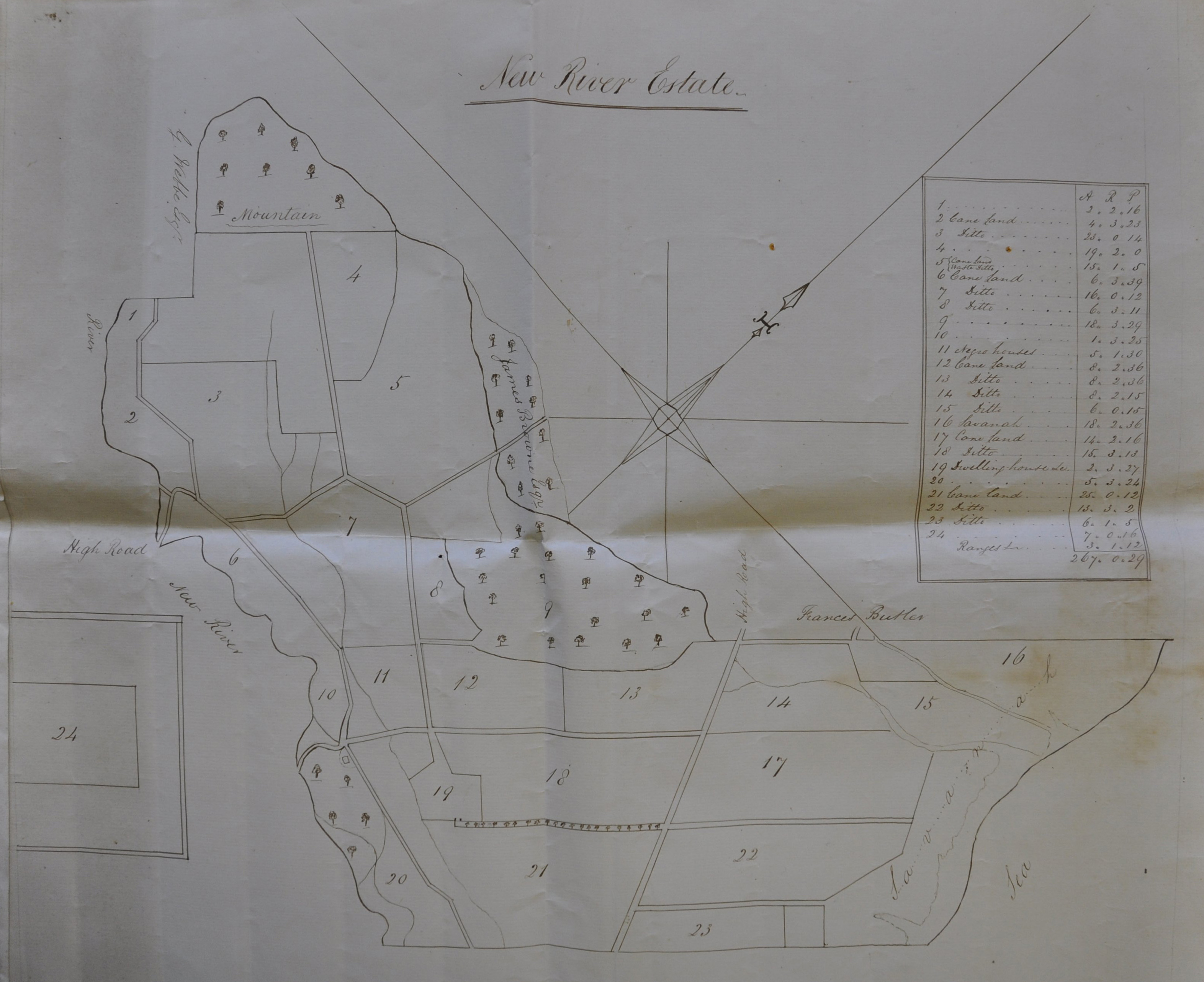
A late-18th/early-19th century plat of New River Estate found in the Maynard Family Papers at the Suffolk Record Office by Roger Leech. Parcel #11 is labeled as “Negro Houses”, the location of the slave village, and parcel #19 is where the dwelling hous
By 1739 Thomas Butler lived in Camberwell, Surrey, a suburb of London on the south bank of the Thames. In his will of that year all his plantations and slaves on Nevis were left to his three sons, John, James and Duke Butler (Oliver 1913-14, 60). John Butler was later linked by marriage to the families of Pemberton and Maynard, the latter subsequently the owners of New River. In 1745 Thomas Butler’s three sons sold or mortgaged an estate in the parish of St James, probably New River, to William Clarke of Camberwell and John Hooke of Portsmouth in Hampshire (ibid., 63). By 1785 the one third share of the estate of Duke Butler, the minister of Okeford Fitzpaine in Dorset, had descended to his children, Thomas, James, William, Mary (the wife of George Ryves Hawker) and Jane (the wife of Robert Frome), who then sold their share to Thomas Coxhead, a merchant of Great Hermitage Street, St George’s, Middlesex, by then part of the west end of London (Common Records 1788-9, 121-154; the conveyance that can be viewed through a DAACS document query gives a full list of the slaves included in the sale).
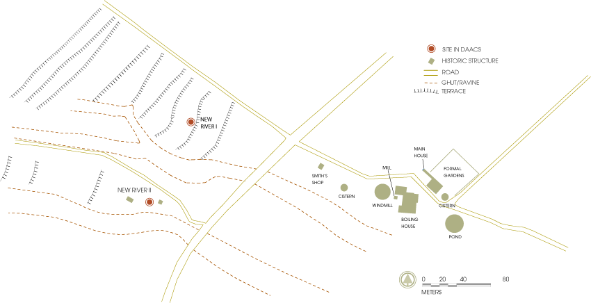
By 1765 the estate was said to be late of Josiah Webbe of New River esq. decd. and now of Walter Nisbett and William Maynard esqs. (Common Records 1764-7, fol.167). These were probably the lands that belonged by the early nineteenth century to the Maynard family of Suffolk (Suffolk Record Office HA178). The records of the Maynard family include a plat of New River made in the late eighteenth or early nineteenth centuries, which has enabled the location of the slave village to be identified. It was located to the west of the plantation house and works. The plat also shows the southern boundary of the estate as the New River ghut, the boundary between the parishes of St James and St George. The New River estate contained by this date c.267 acres (Suffolk Record Office HA178/1/55).
Walter Maynard’s will, made in 1804, noted that he had expended ‘large sums on New River Estate, now belonging to Messrs. Lane, Son, & Fraser, under a promise … that he should become the purchaser, and … have contracted, or are about to contract, with … [his] son Walter Maynard for sale of such estate, he directs that should the sale be completed on terms in contemplation, son Walter shall have no share in the Gingerland Estate’ (Oliver 1913-1914, 340).
Slavery at New River
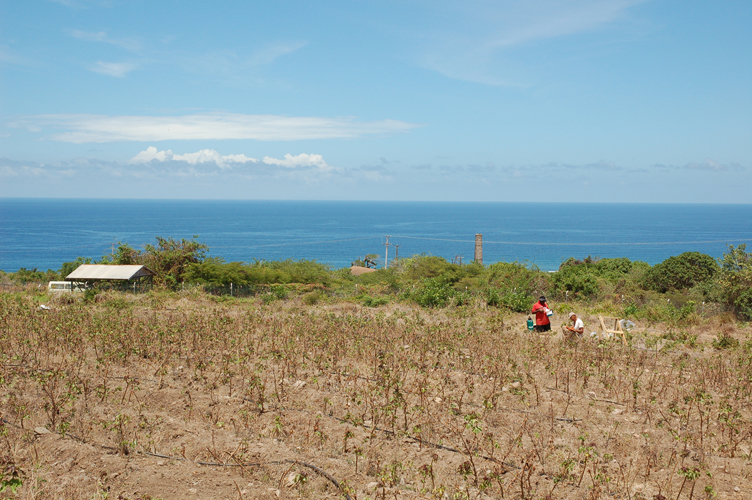
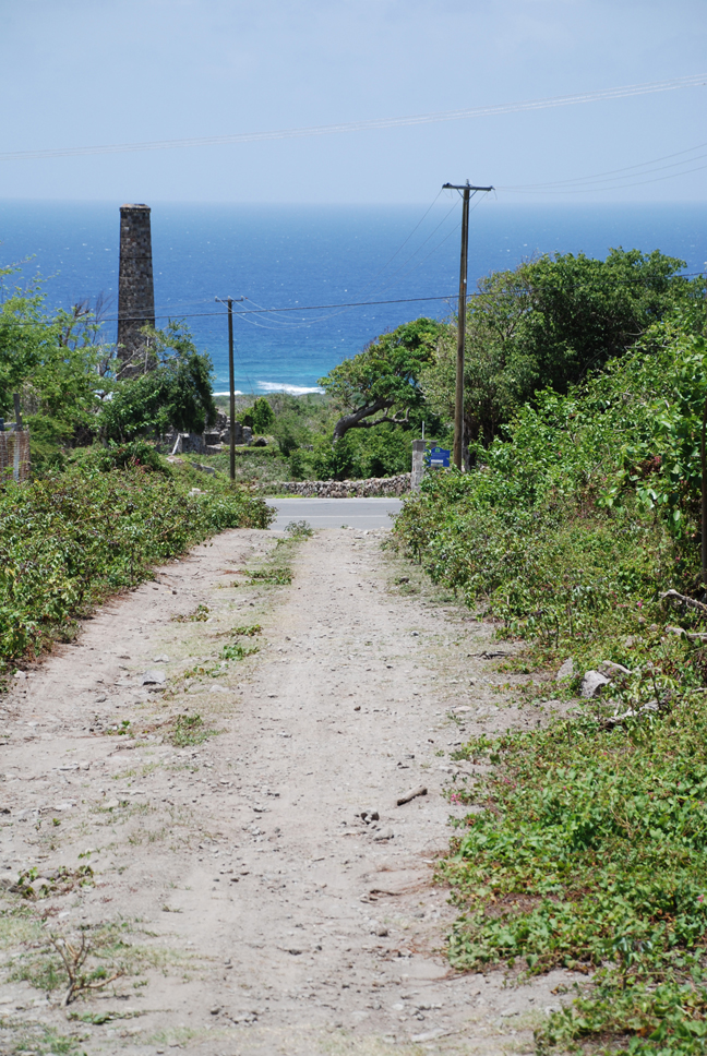
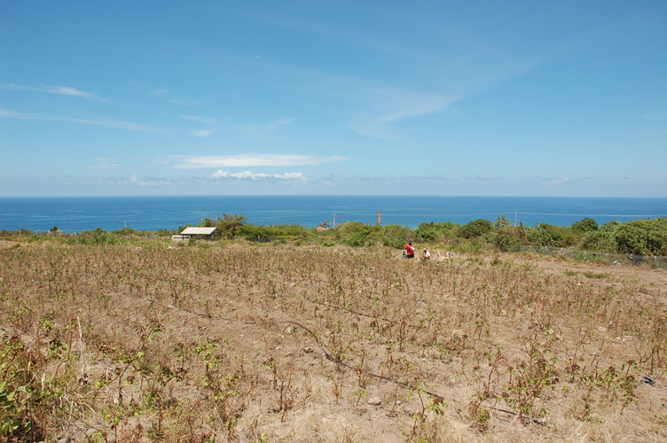
View of the New River works and ocean, looking to the southeast across the field that was once the village for enslaved laborers.
The 1785 indenture between Duke Butler and other provides the names and general ages of each of the 129 enslaved individuals laboring at New River. That year 21 men, 46 women, 34 boys, and 28 girls lived at New River. Several names are embedded with clues to a person’s ethnicity, age, origin or parentage. In these cases, two names are provided for a single individual, one proper name and one descriptor. For example, three men carried names that allude to their ethnicity, Indian Robin, Africa Lawrey and Cubenna Billey.
No men or women had occupations linked to their names but two women carried names suggestive of their origins in Africa or the creolized Caribbean. These women included ‘Ebbo Frankey’ and ‘Mulatto Rittah’. ‘Old Juggy’ and ‘Old Betty’ were most likely amongst the oldest enslaved women on the property. Children’s names such as ‘Young Juggy’ and ‘Little Abba’ and ‘Mulatto Jemmy’ may also provide clues to parentage and family structure at New River Plantation.
One boy and one girl had names indicating they had been born on or purchased from another plantation, ‘Tom Maden’ and ‘Maria Maden’ were both probably connected to Madan’s Plantation a few miles to the north of New River in the same parish of St James.
Archaeological Research at New River
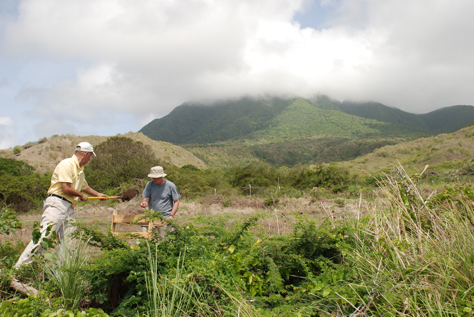
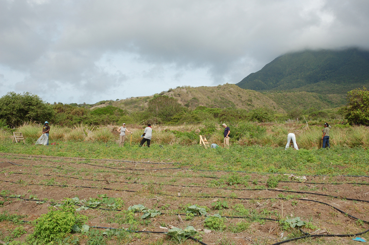
View of Mount Nevis and excavators digging shovel-test-pits at the New River I village, looking to the west.
Archaeologists affiliated with the St. Kitts-Nevis Digital Archaeology Initiative (SKNDAI) began work at the site of the New River estate’s slave village in May 2008. Three hundred and eighty-one shovel-test-pits were excavated at the New River I village between May and July 2008. In addition, total stations and GPS units were used to digitally map the landscape and extant structures related to the estate, which was established in the mid-1700s and was occupied through emancipation in 1834. Instrumental Neutron Activation Analysis (INAA) and petrography were conducted on a sample of the Afro-Caribbean ceramics from this village. These reports can be found on the DAACS Research Page. The raw INAA and petrographic data will be launched on the DAACS website in early 2011. Preliminary analysis on the archaeological data from New River I and New River II suggest that enslaved people lived at New River I from about 1750 until around 1780, when the village was moved to the area identified as New River II. New River II was occupied from 1800-1830.
The shovel-test-pit surveys at New River are part of an international collaborative fieldwork project in the Caribbean known as The St. Kitts-Nevis Digital Archaeology Initiative. The Initiative was funded by a Joint Information Systems Committee (JISC)-National Endowment for the Humanities (NEH) Transatlantic Digitization Grant to The Digital Archaeological Archive of Comparative Slavery (DAACS), Monticello and The University of Southampton. The International Slavery Museum, Liverpool, is also a major collaborator on the project. All data recovered from archaeological research at the New River villages can be searched and downloaded through the queries available on the DAACS Query Page. Detailed background and chronological information, as well as site maps and images, can be found on the individual site pages for New River I and New River II.
The New River villages are also a key component of a multiple-year research program in the Caribbean spearheaded by DAACS, known as the DAACS Caribbean Initiative (DCI). DCI’s immediate goal is to document archaeologically, through survey, excavation and collections analysis, the trajectories of change in slave lifeways on the north and south coasts of Jamaica and on the small islands of Nevis and St. Kitts during the 17th and 18th centuries. DCI’s ultimate goal is to improve our understanding of the causal forces that shaped the evolution of slave societies throughout the early-modern Atlantic world by giving researchers access to easily searchable and comparable data from archaeological sites throughout the Atlantic World.
Jillian Galle and Roger Leech
DAACS and The University of Southampton
October 2010