
| Location: | Monticello, Charlottesville, VA, United States |
|---|---|
| Occupation Dates: | 1780s. Phasing and mean ceramic dates can be found on the Chronology page. |
| Excavator(s): | William Kelso; Susan Kern |
| Dates excavated: | 1979, 1980, 1982, and 1994. |

Overview
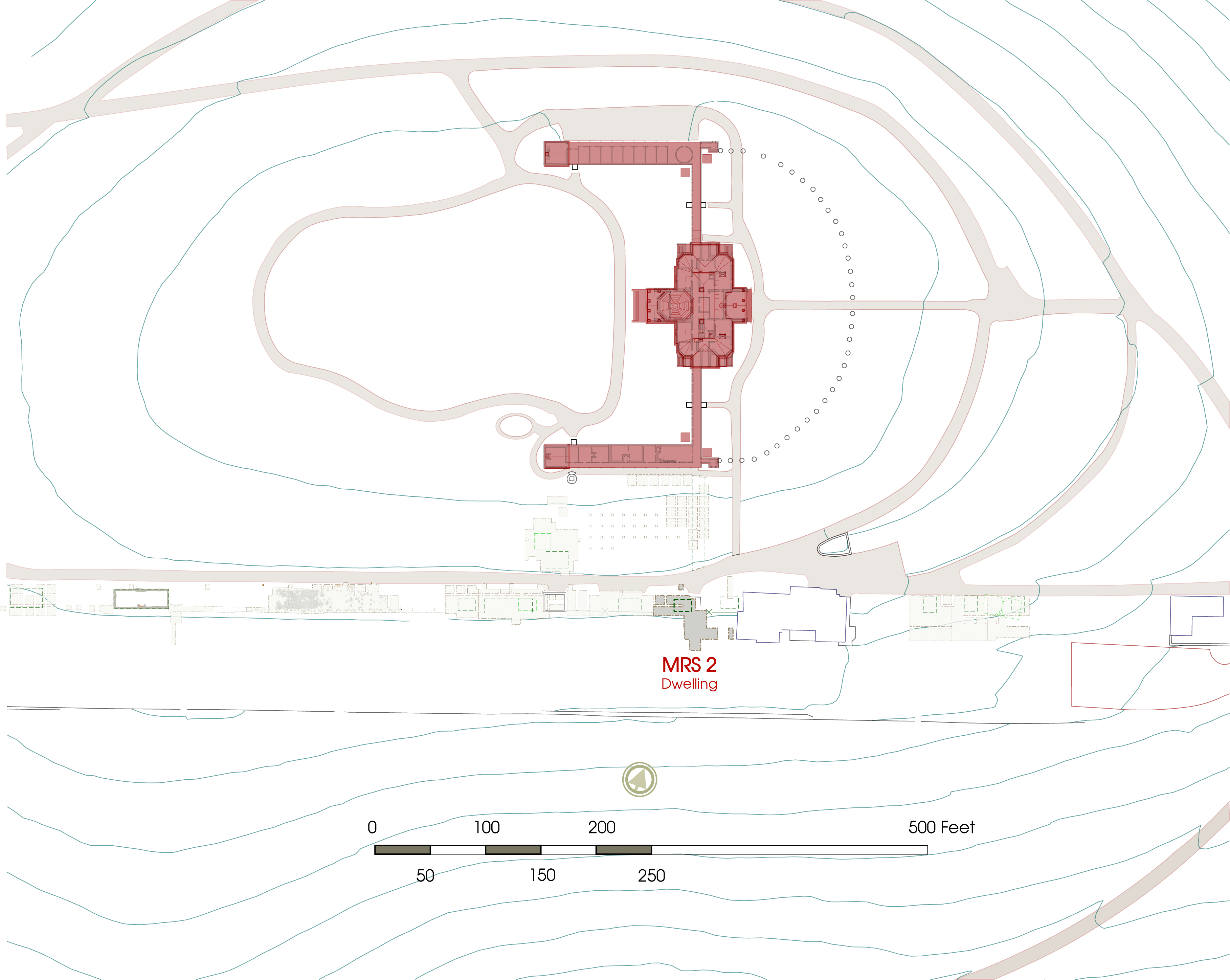
Location of project area.
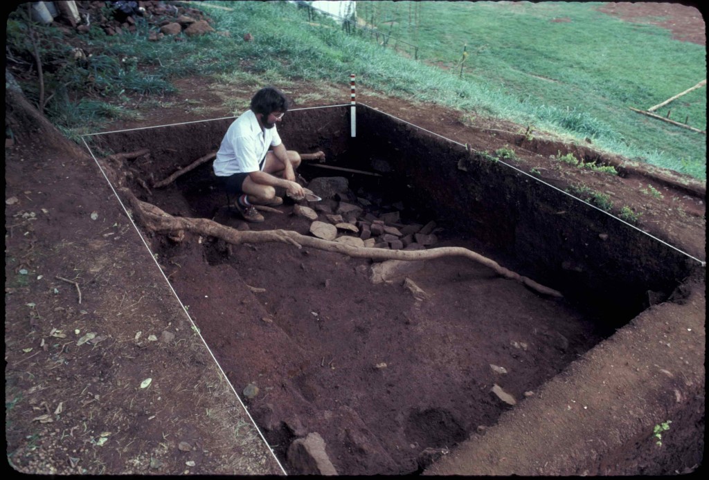
Mulberry Row Structure 2 (MRS 2) was discovered during excavations led by Dr. William Kelso while he searched for the garden gate between Building o and Building E on Mulberry Row. Excavated primarily during the 1979, 1980, and 1982 field seasons, the site consists of a 6-by-6 foot cellar (F09), post holes with ambiguous association, post holes from the two eras of garden fence line (FG01, FG02), the remains of modern stiars from Mulberry Row down to the garden, numerous modern utility trenchs, and the warming bed (F24) at the north end of the garden terrace.
Current analysis suggests MRS 2 may have been occupied during the 1780s as a dwelling for enslaved or free workers.
Documentary evidence
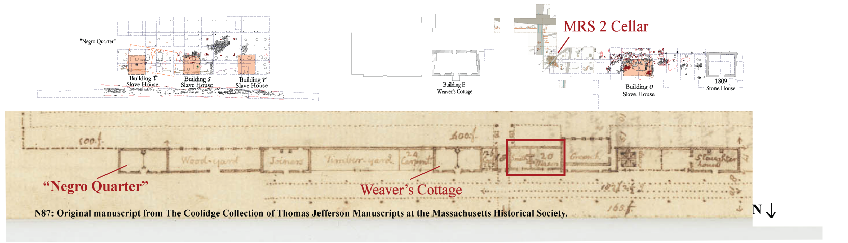
N87; speculative plan of Mulberry Row c. 1776-78 aligned with excavations. The MRS 2 cellar aligns with the proposed plan for building a “Smith Mason’s” structure.
The only documentary suggestion that a building may have been located on the site of MRS 2 is found on Jefferson’s c.1776-78 speculative plan for Mulberry Row, which shows a structure with two non-communicating rooms separated by an H-shape fireplace. (Jefferson: N87). One room is labeled “Smith” and the other “mason” apparently designating the callings of their imagined occupants, who were presumably free-white workmen. Without additional architectural evidence, MRS 2 cannot be definitively linked to the “smith mason’s” structure.
MRS 2 is not pictured on Jefferson’s 1796 insurance plat, and as this plat seems to have been extremely thorough, including buildings, privies and even coal piles that were not insured, the absence of MRS 2 suggests that it did not exist at that time (Jefferson: N133).
Excavation history, procedure and methods
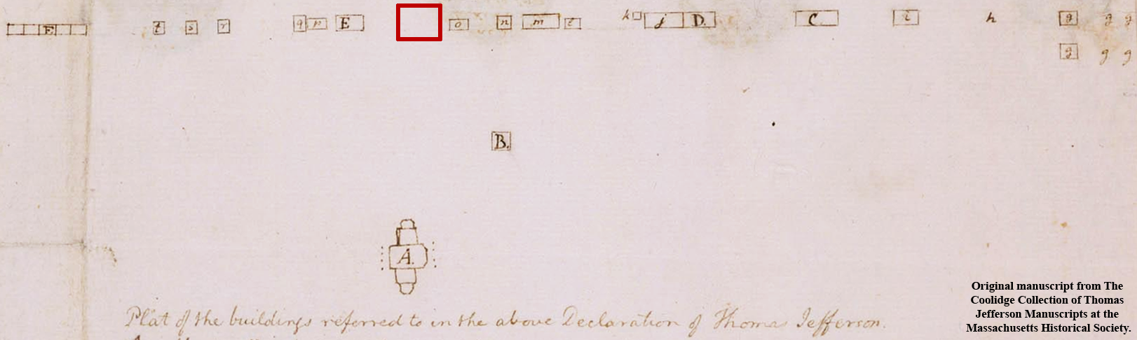
N133; Jefferson’s 1796 Mutual Insurance Plat. Note the lack of any structure located at the MRS 2 site (outlined in red).
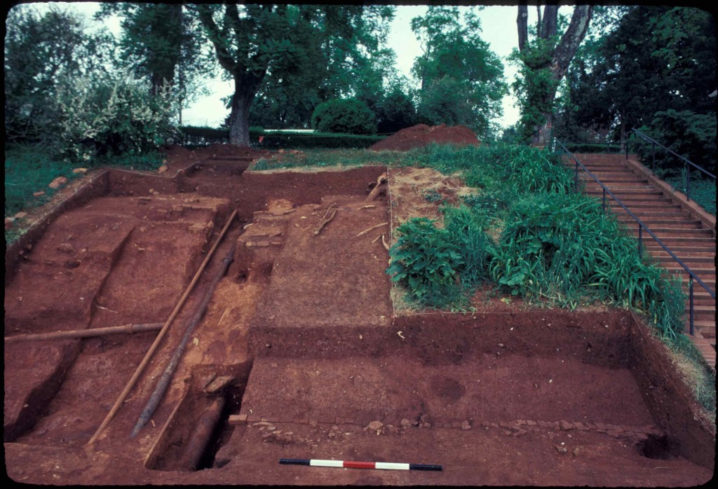
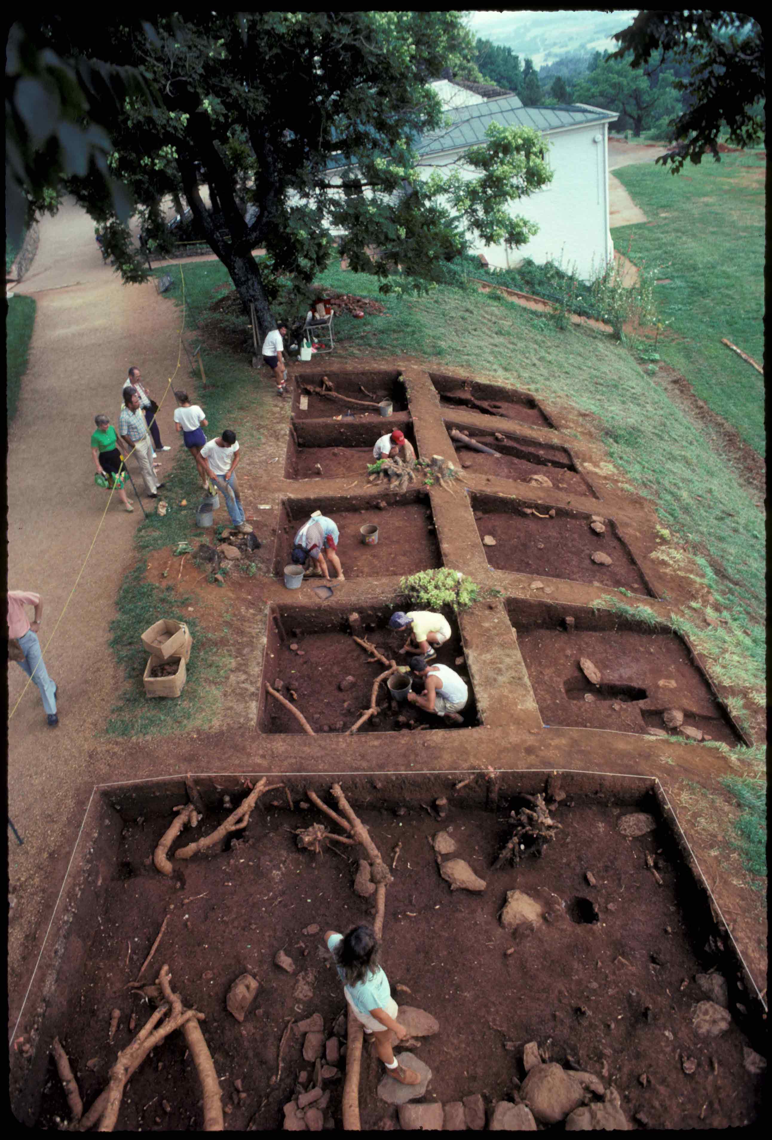
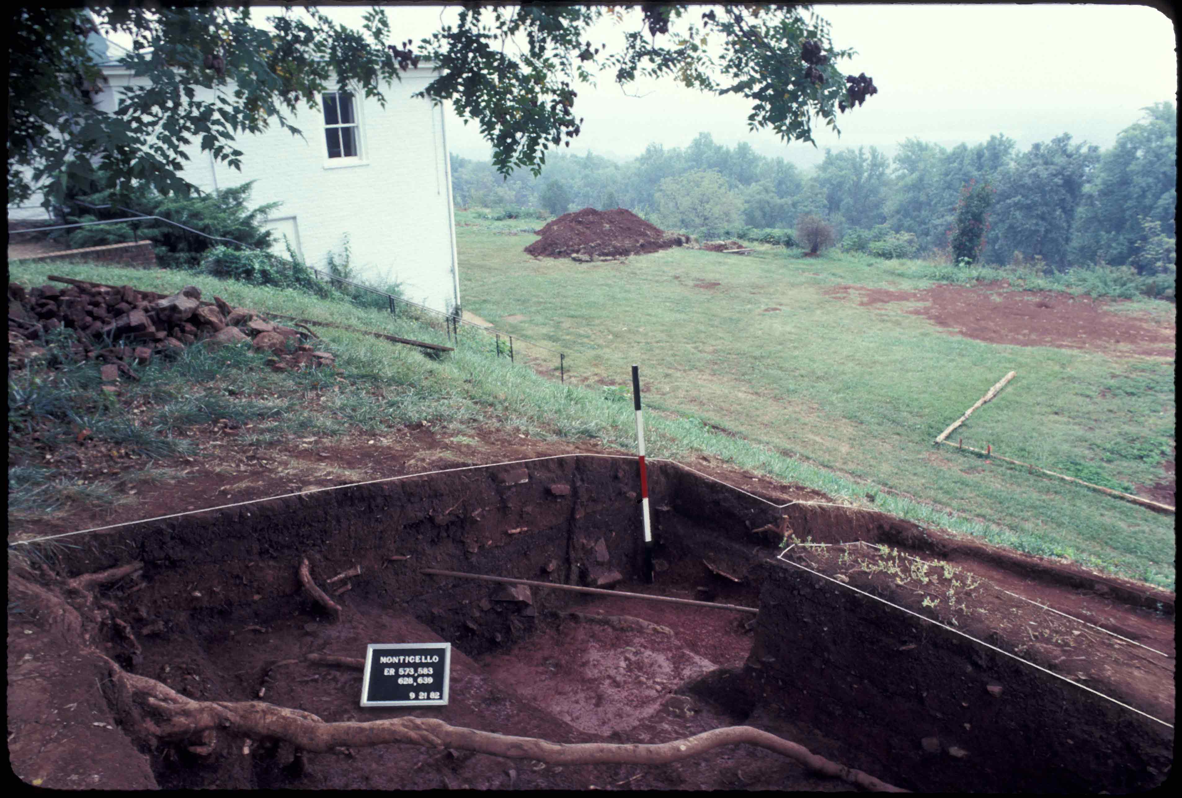
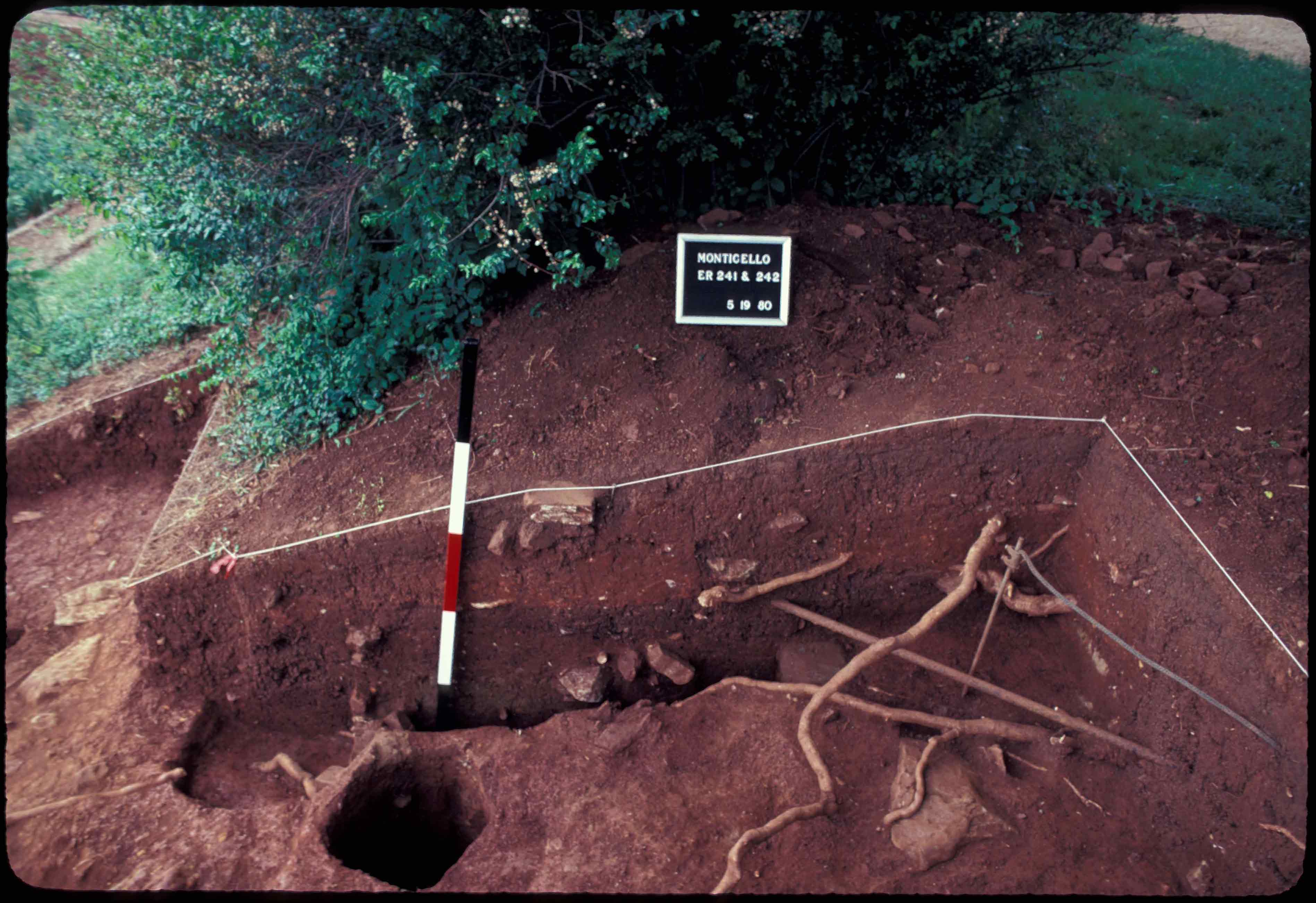
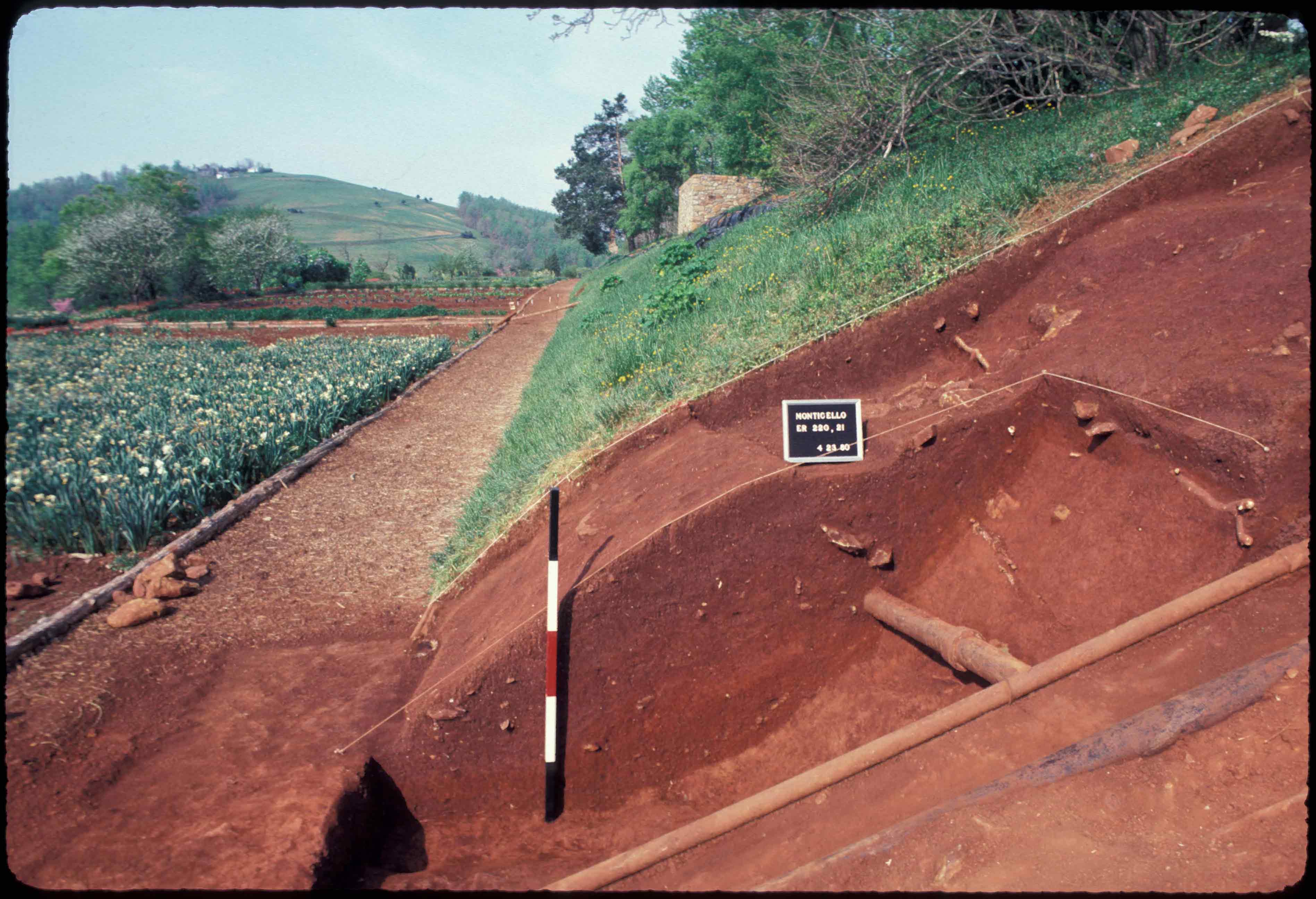
MRS 2 was identified during the 1980 season of Mulberry Row excavations led by Dr. William Kelso. These excavations, focused on the location of the gate in the wooden fence that surrounded Jeffersons’ terraced vegetable garden after its expansion in 1809. Several 10-by-10-foot test units (102, 220, 221, 222, 223, 243) were extended from the 1979 fence line excavations south along the stairs to the garden and north towards Mulberry Row in 2 roughly 5-by-5-foot excavation units (241, 242). These latter two test units included the east edge of the MRS 2 cellar.
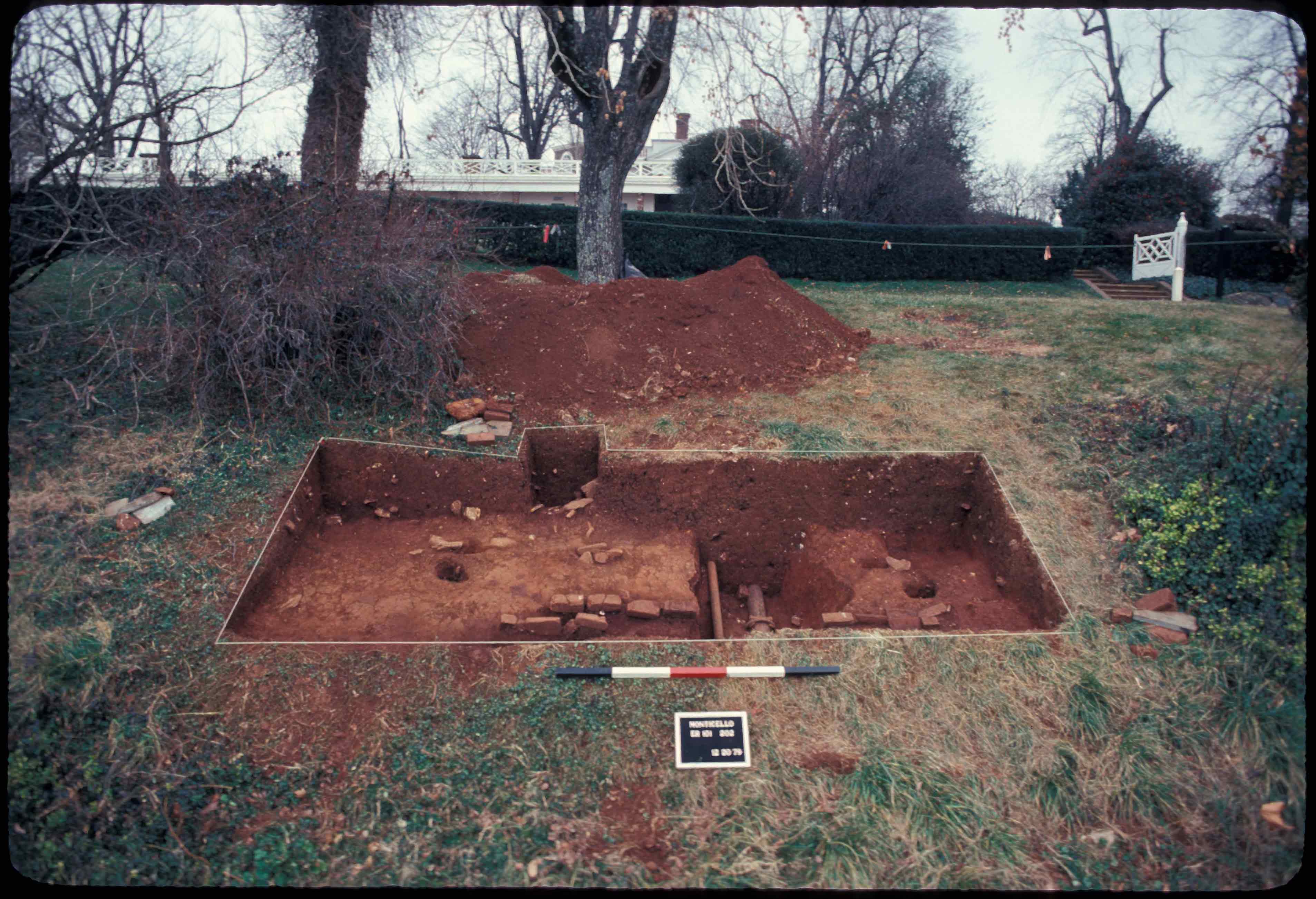
In 1982, during excavation of adjacent Building o, six more test units (571, 572, 573, 576, 577, 578) were dug to the west along Mulberry Row according to the Wheeler Box method: a grid of 10-by-10-foot test units with 2-foot balks. As work proceeded, removal of the balks and extension of the site resulted in the excavation of quadrats varying in size from 2-by-2-feet to 8-by-8 feet. These test units uncovered the rest of the cellar, two lines of posts running parallel to Mulberry Row (FG01 and FG02), and numerous additional post holes.
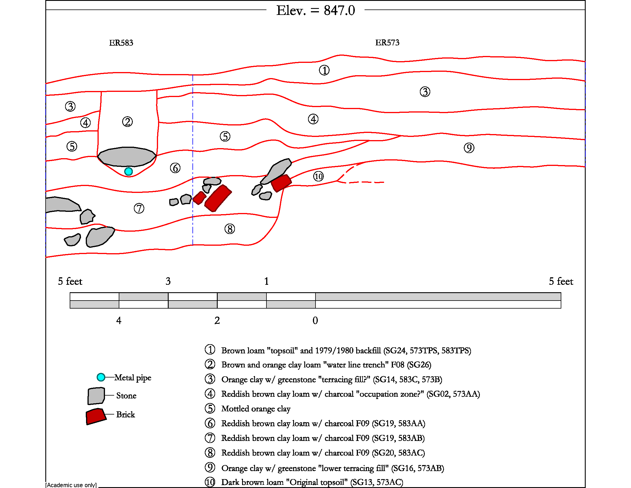
Recovery of artifacts in all excavation units employed a method of careful troweling without the use of screens. Some lapses in stratigraphic control occurred. Notably, a portion of the contents of the large cellar were removed in layers (e.g., 583AA, 583AB, 583AC) while the rest were excavated as a single deposit (e.g., 242J and 241I). Although excavators recorded opening and closing elevations for most quadrats, these measurements are not related to a known, fixed datum point.
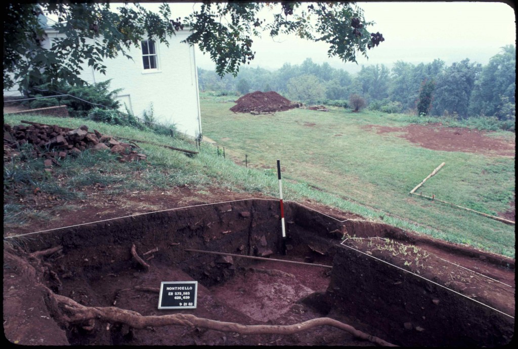
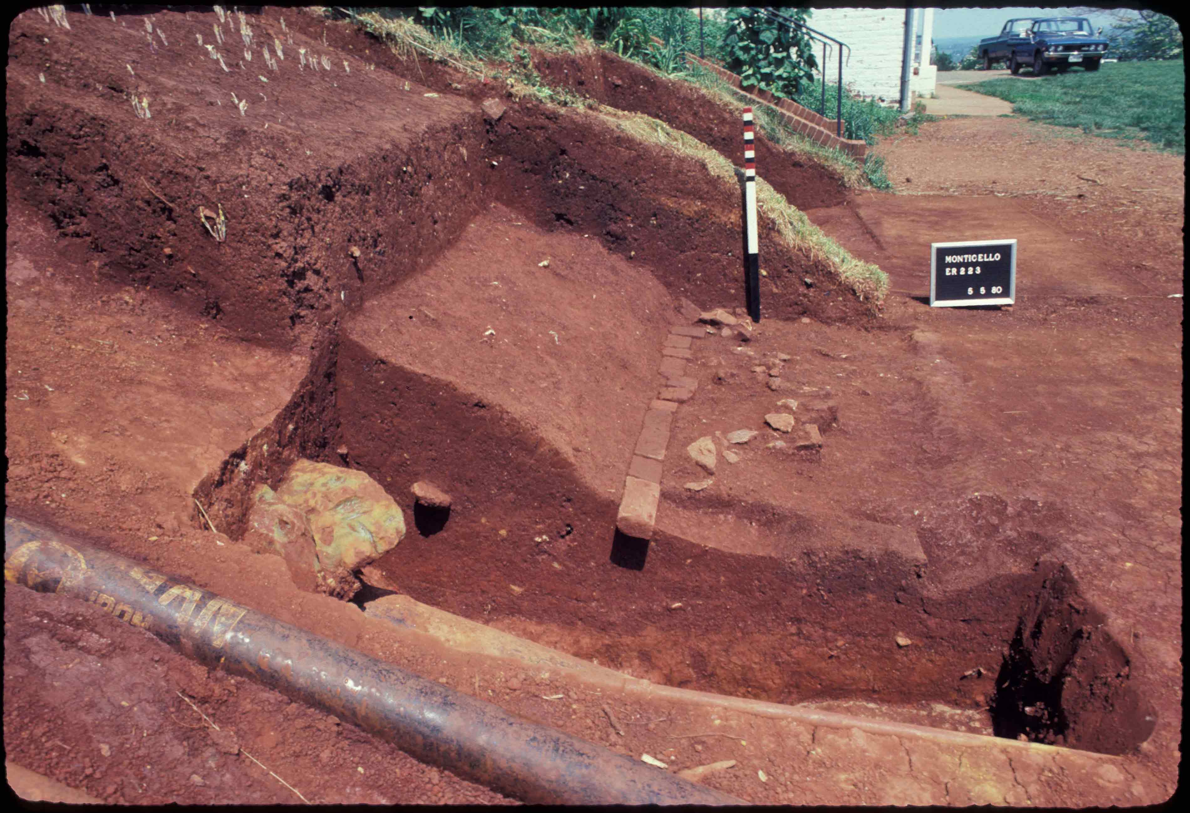
There was significant modern intrusion to the MRS 2 site. One large utility trench (F01) was placed right in the middle of the stairs from Mulberry Row to the Garden, and three other utility trenches (F06, F08, and F10) cut through other sections of the site (Kelso 1984: 21).
Summary of research and analysis
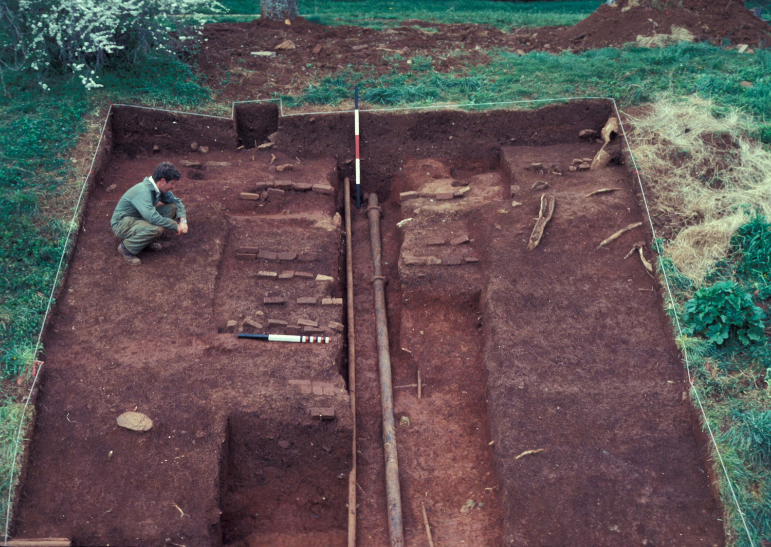
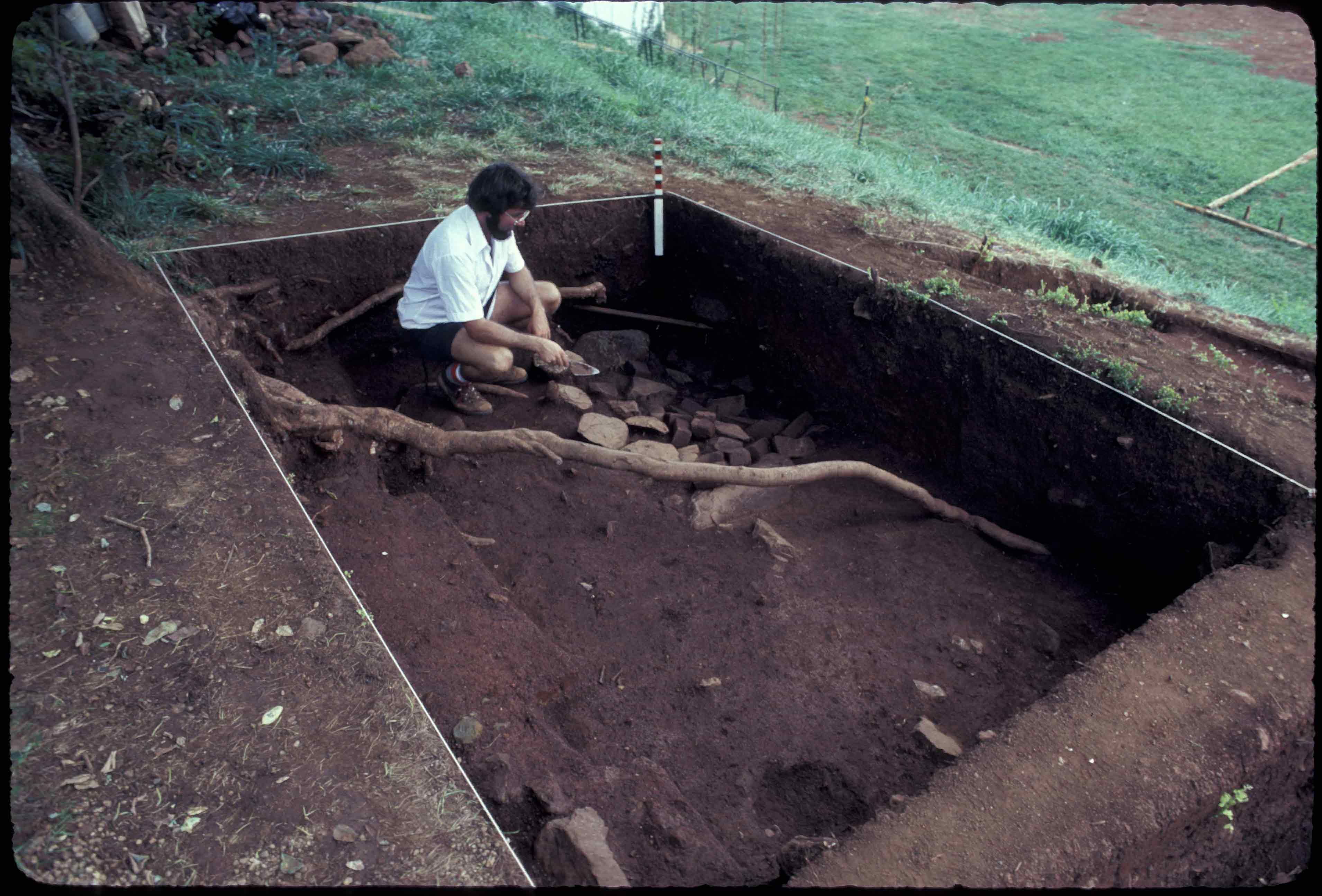
MRS 2 excavations (facing grid north).
MRS 2 was likely used as a dwelling, not as a workshop or storage building (Clites & McCray 2010). Ceramic analysis indicates MRS 2 was occupied during the 1780s, and its absence on the 1796 insurance plat suggests the building was gone by that time.
However, the occupants of MRS 2 remain a mystery. The location of MRS 2 on the eastern half of Mulberry Row suggests the occupants, like those nearby, worked either in or on the construction of the mansion.
Elizabeth Sawyer
Monticello Department of Archaeology
August 2011
Things you need to know about MRS 2 before you use the data:
- The entire site was carefully hand-troweled and screens were not used for artifact recovery.
- Measurements are in feet and tenths of feet.
- MRS 2 was partially excavated using the “Wheeler Box” excavation system of 8-by-8 foot quadrats with 2-foot balks. Unit size varies from 8-by-8 foot and 2-by-2 foot quadrats to 2-by-8 foot quadrats. The rest of the units were placed south along the staircase without balks between them. Quadrat 101 is irregularly shaped.
- MRS 2 was impacted by activity related to the installation of 20th-century utility lines, and the area to the north of the cellar (F09) was disturbed during construction of a concrete water main junction box.
- In the DAACS database, the MRS 2 project is designated as Project “103”. Artifact ID numbers for artifacts associated with the project therefore begin with the 103 prefix.
Feature Numbers
The original excavators of the Building m site did not assign numbers to individual features. DAACS staff has assigned feature numbers using the original excavation records. Feature Numbers assigned by DAACS have a F-prefix, which precedes the number (i.e. F01 equals Feature 1).
Excavated contexts that belong to the same depositional basin (e.g. a posthole and postmold or the layers in a single pit) have been assigned a single feature number. In addition, single contexts have been given feature numbers when the original field records indicate that the excavators recognized a context’s spatial distinctiveness from surrounding contexts.
Feature Groups
Feature groups are sets of features whose spatial arrangements indicate they were part of a single structure (e.g. structural postholes, subfloor pits, and hearth) or landscape element (e.g. postholes that comprise a fenceline). Feature Groups assigned by DAACS have a FG-prefix, which precedes the number (i.e. FG01 equals Feature Group 1).
| Feature | Feature Type | Contexts |
|---|---|---|
| F14 | Posthole | 577G, 577H |
| F17 | Posthole | 621D, 621E |
| F19 | Posthole | 626C, 626D |
| Feature | Feature Type | Contexts |
|---|---|---|
| F18 | Posthole | 621F, 621G |
| F20 | Posthole | 626E, 626F |
| Feature | Feature Type | Contexts |
|---|---|---|
| F01 | Trench, utility | 101E, 131C, 220B, 222C, 223C, 223D, 241D, 242D |
| F04 | Unidentified | 131E |
| F06 | Trench, utility | 220C |
| F07 | Posthole | 241G, 241H |
| F08 | Trench, utility | 242F, 583B, 627B, 628A |
| F09 | Cellar | 241L, 242J, 583AA, 583AB, 583AC, 628AB, 628AC, 639AB, 639D, 639AC |
| F10 | Trench, utility | |
| F11 | Posthole | 576C |
| F12 | Posthole, possible | 576D |
| F13 | Posthole | 577C, 577D |
| F16 | Posthole | 578E, 578F |
| F21 | Posthole, possible | 639A |
| F22 | Walkway | 221A, 223E, 243C, 244D |
| F23 | Trench, utility | 244E |
| F24 | Planting Bed | 244J |
| F02 | Posthole | 101F, 101G |
| F03 | Posthole | 101H, 101J |
| F05 | Posthole | 202E, 202F |
| F15 | Posthole | 578C |
Intra-Site Chronologies
Figure 4. Histogram of ceramics from the Project plotted along CA Dimension 1. The lines indicate DAACS phase divisions.
We perform a standard set of analyses to infer intra-site chronologies for the sites included in the Archive. Using them, we have assigned most excavated contexts at each site to a set of site-specific phases. The use of common analytical methods is designed to increase comparability among phases at different sites. The methods and the phase assignments they produced are summarized below. For some sites, the original excavators developed intra-site chronologies and, where these exist, they are included on the Background page for the site. DAACS encourages users of Archive data to help explore improvements.
DAACS Seriation Method
This page summarizes a frequency-seriation based chronology we developed for the MRS 2 site (see Neiman, Galle, and Wheeler 2003 for technical details).
As with other sites in the Archive, the seriation chronology for MRS 2 was derived from ceramic assemblages aggregated at the level of contexts and stratigraphic groups, and not at the level of features. This is because most contexts and stratigraphic groups on the site were not parts of features. For the relatively few cases where seriated contexts and stratigraphic groups were parts of features, the relevant feature numbers and descriptions are included in the seriation chronology table below. The seriation chronology is the result of a correspondence analysis of MCD-type frequencies in each stratigraphic group and each individual context that had no stratigraphic group assignment (Figures 1 and 2). Not all contexts have stratigraphic group assignments.
To reduce the noise introduced by sampling error, only ceramic assemblages with more than 5 sherds and more than one ceramic type from individual excavated contexts and from stratigraphic groups were included. Redware was removed from the seriation of MRS 2 due to unusually high contributions of this ware type to inertia. The subsequent results produced a strong correlation between Dimension 1 scores and MCDs (Figure 3). Based on the dips in ceramic counts observed in a histogram of Dimension 1, we divided the Building m site into four phases (Figure 4).
MRS 2 Phases
Phases are groups of assemblages that have similar correspondence-analysis scores, similar MCDs, or both, and are therefore inferred to be broadly contemporary. Phases have a P-prefix that precedes the phase number (e.g. P01 equals Phase 1).
Mean ceramic dates for the site-specific phases are given in the table below. The table also includes two estimates of the ceramic TPQ for each phase. The first TPQ estimate is the usual one – the maximum beginning manufacturing date among all the MCD types in the assemblage. The second estimate — TPQp90 — is the 90th percentile of the beginning manufacturing dates among all the sherds in the assemblage, based on their MCD-types. This TPQ estimate is more robust against excavation errors and taphonomic processes that might have introduces a few anomalously late sherds in an assemblage.
| Phase | MCD | TPQ | TPQp90 | Total Count |
|---|---|---|---|---|
| P01 | 1787 | 1820 | 1775 | 386 |
| P02 | 1798 | 1840 | 1795 | 228 |
| P03 | 1829 | 1840 | 1820 | 1636 |
| P04 | 1851 | 1840 | 1820 | 710 |
Phase one assemblages are generally lower stratigraphically and include one deposit within the cellar (F09) of MRS 2 as well as layers cut by (SG13) and sealing (SG02) the feature. Phase two assemblages come from two important SGs, a garden fenceline deposit (SG27) and a clay layer with greenstone (SG16). The latter, SG16, although stratigraphically between two Phase one fills, contains only creamware and chinese porclain, suggesting it too may be a phase one assemblage. Its small sample, with no mid 18th century types, may have set it off from the other phase one assemblages in the CA. Phases three and four have increasingly substantial amounts of post-Jefferson material, as indicated by the late MCD, TPQ, and TPQp90.
A Seriation Chronology for MRS 2
The following table presents a seriation chronology for the MRS 2 site. We use the indefinite article to signify that it is not the only chronology possible, nor the best. We encourage users of Archive data to help explore improvements.
The stratigraphic relationships among stratigraphic groups and unassigned contexts are summarized in the Harris Matrix for the site. Phase assignments from the seriation are shown on the Harris Matrix in color, facilitating comparison of the seriation chronology and the stratigraphic chronology of the site.
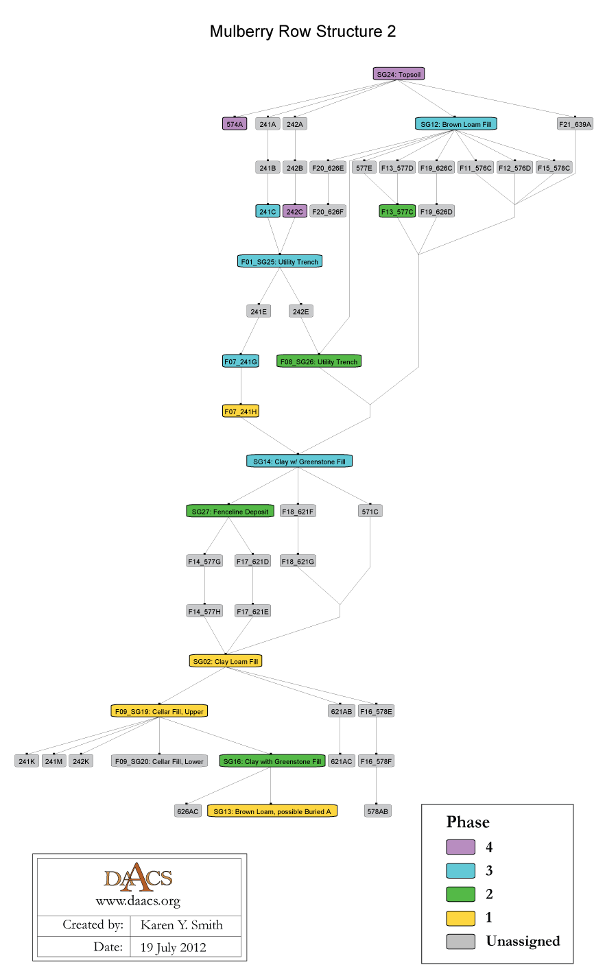
MRS 2 Harris Matrix
The Harris Matrix summarizes stratigraphic relationships among excavated contexts and groups of contexts that DAACS staff have identified as part of the same stratigraphic group. Stratigraphic groups and contexts are represented as boxes, while lines connecting them represent temporal relationships implied by the site’s stratification, as recorded by the site’s excavators (Harris 1979).
Stratigraphic groups, which represent multiple contexts, are identified on the diagram by their numeric designations (e.g. SG02), followed by descriptions of them (e.g. “Clay Loam Fill”). Contexts that could not be assigned to stratigraphic groups are identified by their individual context numbers (e.g. 241E).
Boxes with color fill represent contexts and stratigraphic groups with ceramic assemblages large enough to be included in the DAACS seriation of the site (see Chronology). Their seriation-based phase assignments are denoted by different colors, to facilitate evaluation of the agreement between the stratigraphic and seriation chronologies. Grey boxes represent contexts that were not included in the seriation because of small ceramic samples.
This Harris Matrix is based on data on stratigraphic relationships recorded among contexts in the DAACS database. It was drawn with the ArchEd application. See http://www.ads.tuwien.ac.at/arched/index.html.
See MRS 2 Chronology for stratigraphic and phase information. Contexts from quadrats 101, 201, 202, 224 and south to the garden were not assigned to SGs and are not included in the Harris Matrix at this time.
For a printable version, download the Harris Matrix [179.72 KB PDF].


PDF of composite excavator’s plan, compiled by Monticello staff from original field drawings, with excavation units and features labeled.
PDF of composite excavator’s plan, compiled by Monticello staff from original field drawings, with only features labeled.
PDF of composite excavator’s plan, compiled by Monticello staff from original field drawings, with only excavation units labeled.
Clites, Elizabeth , and Brian McCray
2010 Monticello Before the Mansion: A Comparative Study of Early Domestic and Industrial Structures on Mulberry Row Poster presented at the annual meeting of the Society for American Archaeology, St. Louis, Missouri. On file at the Department of Archaeology, Thomas Jefferson Foundation, Charlottesville, Virginia.
Harris, Edward C.
1979 Principles of Archaeological Stratigraphy. Academic Press, London, England.
Jefferson, Thomas
1776a Monticello: outbuildings and garden (study), circa 1776-1778. N87; K56. Thomas Jefferson Papers: An Electronic Archive. Massachusetts Historical Society, Boston, MA. http://www.thomasjeffersonpapers.org
Jefferson, Thomas
1796 Monticello: building insurance. N133; K136. Thomas Jefferson Papers: An Electronic Archive. Massachusetts Historical Society, Boston, MA. http://www.thomasjeffersonpapers.org
Kelso, William M.
1982 A Report on the Archaeological Excavations at Monticello, Charlottesville, Virginia, 1979-1981. Manuscript on file at the Department of Archaeology, Thomas Jefferson Foundation, Charlottesville, Virginia.
Kelso, William M., Sondy Sanford , Diana C. Johnson , Anna Gruber , and Douglas W. Sanford
1984 A Report on the Archaeological Excavations at Monticello, Charlottesville, Virginia, 1982-1983. Submitted to the National Endowment for the Humanities. Appendix A (D. Sanford), Appendix B (Crader), Appendix C (S. Sanford), Appendix E (Gruber). Manuscript on file at the Department of Archaeology, Thomas Jefferson Foundation, Charlottesville, Virginia.
Neiman, Fraser D., Jillian E. Galle , and Derek Wheeler
2003 Chronological Inference and DAACS. Unpublished paper presented at the annual meeting of the Society for Historical Archaeology, Providence, Rhode Island. On file at the Department of Archaeology, Thomas Jefferson Foundation, Charlottesville, Virginia.