Introduction
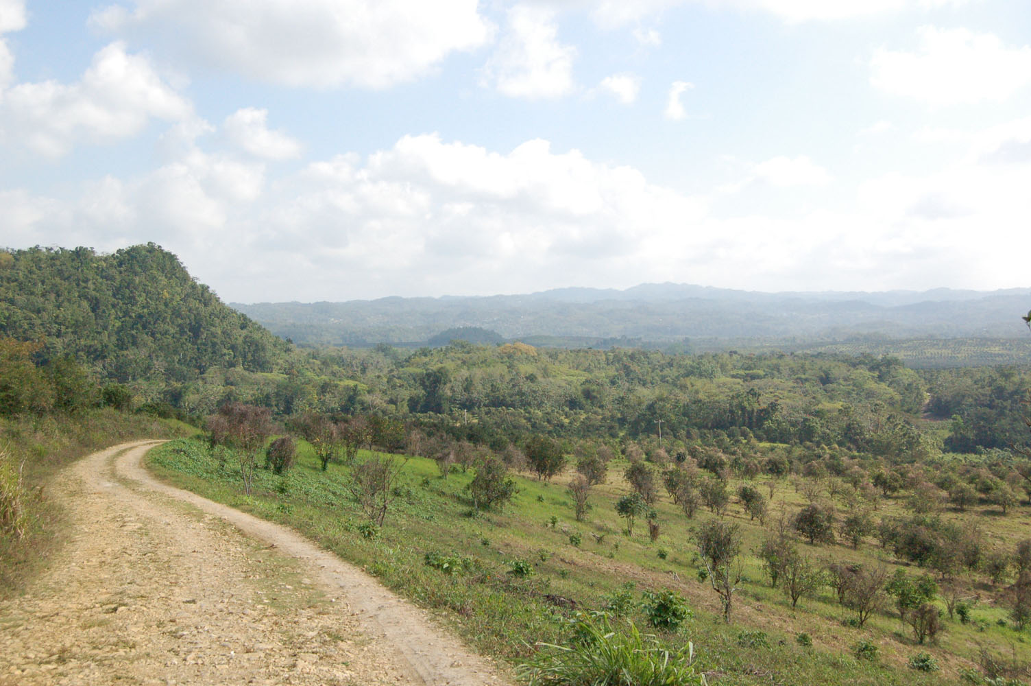
Landscape formerly part of Montpelier and Shettlewood Plantations now in citrus cultivation, March 2006
Montpelier is located in western Jamaica, inland from the north coast town of Montego Bay. The district falls on the western boundary of the parish of St James, where the Great River separates it from the parish of Hanover. Immediately to the west of the river, in Hanover, is Shettlewood, a property and district that was long associated in ownership and community with Montpelier. The district is centred on a polje or inland valley, the product of long-term solution of the limestone that provides the geological underpinning, with limited level lands to the east of the Great River surrounded by small conical hills and tower karst formations that quickly blend into larger hills and mountainous ridges.
Plantation settlement came relatively late to the Montpelier region. The Spanish, who held Jamaica as a colony from 1494 to 1655, failed to establish a population, and before them the Taino people had concentrated themselves in the nearby coastal zones. Thus the English found the valley heavily forested, with very large trees creating a canopy for lower growths, vines, bromeliads, ferns, and wild orchids. The first grants of land were made by the English crown in the 1670s but the area remained sparsely settled. The famous Cockpit Country, located immediately to the east, was a special product of limestone-solution topography and dramatically well-suited to guerilla warfare as practised by the Maroons, the African people who had escaped slavery to successfully fight the British forces and colonial militia.
Sugar production was not attempted at Montpelier until a treaty was negotiated with the Maroons in 1739, guaranteeing the liberty of the Maroons and at the same time securing the peace of the region as a site of slave economy. Sugar and slavery continued hand in hand at Montpelier until the abolition of slavery in 1838. Sugar production came to an end in 1855. Livestock production then dominated until 1990 when citrus suddenly spread across the fields to once again transform the landscape.
People and Proprietors
New Montpelier Slave Village, March 2006
In the period of sugar, the owners of Montpelier were first Francis Sadler, who acquired the lands in 1739, and his widow Janet Guthrie-Hynes-Sadler. She sold the property in 1752 to John Ellis, a third-generation Jamaican whose family had come from Wales in 1665 and also owned plantations in the eastern end of the island. The most important owner of Montpelier was John’s son Charles Rose Ellis (1771-1845), who was created Lord Seaford in 1826 and was a prominent leader of the West Indian interest in the British Parliament. He was born in Jamaica but became an absentee from an early age. In 1792 he added to Montpelier by purchase the neighbouring pen Shettlewood, thus increasing the total extent of the property to 10,000 acres. The Ellis family held Montpelier through four generations, almost always as absentees, down to 1912 when the land was sold. A series of local owners followed until 1973 when Montpelier was acquired by the Government of Jamaica. In the 1990s parts of the land were subdivided and sold in small lots, and in 1992 a large block of 3,000 acres sold to the Jamaica Orange Company.
During the period of sugar and slavery, the people who actually lived at Montpelier were concentrated in two main settlements clustered around the sugar factories. The first factory was located in the eastern sector of the property, to the east of the main road that connected Montego Bay with Savanna la Mar. Water was drawn from a spring and carried through a lengthy aqueduct to turn the wheel of the factory’s mill. This site came to be known as the Old Works after 1775 when a second factory was constructed to the west, nearer the Great River, which in turn became known as the New Works or New Montpelier. Here the mill was driven by a waterwheel, powered by water drawn from a spring located in Shettlewood, collected there in a dam, carried over the Great River through a wooden conduit, and then around the hillside in a massive aqueduct. In 1790 the total number of enslaved people at Old Montpelier was 321 and at New Montpelier 176. By 1817, a decade after the abolition of the British Atlantic slave trade, there were 426 enslaved peopled at Old Montpelier, 303 at New Montpelier, and 229 at Shettlewood. All of these people lived in tightly defined villages, close to the works and to the great houses and other residences of the free and white people who managed the slave system. The number of whites was always small and most were men, employed as overseers, book-keepers, and tradespeople.
In the great rebellion of 1831/32 there were major battles at Montpelier, between the enslaved people and the island militia. The works buildings were largely destroyed and only the sugar factory at New Montpelier was rebuilt, the cane lands of Old Montpelier sending their crop to that single site. After the abolition of slavery in 1838, some of the people formerly living in the villages on Montpelier quickly left for other locations and became small farmers or labourers on other properties. Many however sought to retain residence in the villages. Struggles over rent and wages followed, and new settlements sprang up on new locations within the plantation boundaries. The abandonment of sugar in 1855 reduced demand for skilled and field labour and during the period down to 1900 there was a rapid attrition in the plantation village populations. By the beginning of the twentieth century all three village sites had been effectively abandoned and transformed into pasture or food-crop grounds. There were then a few concentrations of population on Montpelier, particularly in the eastern edge at Mafoota, but overall the extensive property was empty of people and buildings of any sort. Densely settled villages were located immediately beyond the edges of Montpelier’s boundaries, particularly at Mount Carey, Bickersteth and Chester Castle, and these villages supplied many of the workers for the economic activities of Montpelier throughout the twentieth century.
Documentary History

New Montpelier Overseer’s House, March 2006
Montpelier produced a relatively rich archive, partly because of the size of the property and the wealth it generated for its owners, and partly because of the absenteeism of the planters which created a need for regular written records and for maps to facilitate management. Only a fraction of the documentary record originally produced has survived but there are good collections of letters exchanged between some of the proprietors and their planter correspondents, and some important series of letters written by the attorneys who had responsibility for the upper levels of management (particularly the letters of Isaac Jackson 1839-1842). Meticulous accounts survive from Old Montpelier in the 1820s and long-term changes in output and profits can be traced in the public Accounts Produce held at the Jamaica Archives in Spanish Town. Detailed large-scale maps and plans exist for the early nineteenth century.
Most importantly, from the point of view of historical interpretation, Lord Seaford ordered in August 1825 a listing and description of the households of enslaved people living in the villages at Old and New Montpelier and at Shettlewood. These lists survive in their original manuscript form only partially for Old Montpelier, but the entire set was published in 1832. For each household, there is a list of the names of the people living in a single house or group of two or three houses, followed by a description of the buildings, a count of the livestock (cattle, hogs and poultry) owned by the people, and the area of land held in gardens and grounds, together with a list of the crops grown therein. This record is unusual, almost unique, in the documentary record for slavery in Jamaica. Using additional sources (notably the public Returns of Registrations of Slaves and church records) it has been possible to reconstitute the family households and to show that nuclear and extended families played an important role in the community. Detailed maps of the Montpelier properties were surveyed and drafted in 1821 and 1830.
Archaeological Investigations, 1973-1980
An important finding to come out of the documentary record of family households at Montpelier in 1825 was the suggestion that at least some of the houses were arranged into groups or compounds, with several units contained within an enclosing fence or wall. Only for Shettlewood did the maps detail the layout of houses (in straight lines) but it was known at least that the enslaved people lived in free-standing houses rather than barracks. Thus a number of questions arose from the documentary analysis that seemed amenable to investigation through surface and excavation archaeology.
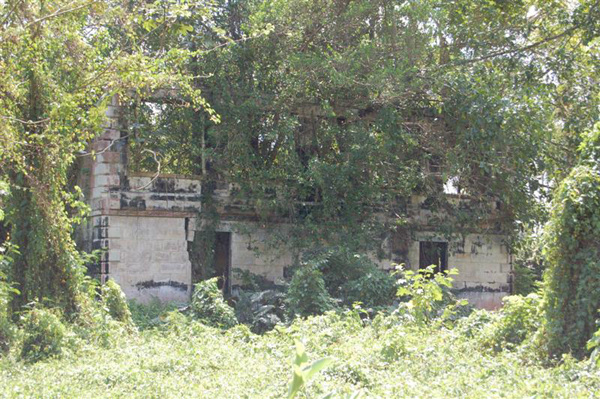
Initial visits to Montpelier in 1973, soon after that family household reconstitution studies had been published, proved that the sites of the villages could be precisely identified on the ground and that none of them were then occupied. At Old Montpelier the site was covered by growing crops and the stone that had formed the walls of some of the houses of 1825 had been largely pushed into heaps. At New Montpelier, however, the village site of 1825 was in the 1970s an open pasture or parkland, easy of access and with the shapes of house foundations visible in the shape of the grassy cover. Fruit trees were scattered about the site. Similar conditions were found at Shettlewood but that site was thought inherently less interesting because of its smaller population and lack of a sugar complex. At New Montpelier, the great house was occupied by the current overseer and some the works buildings still used as stores and stables.
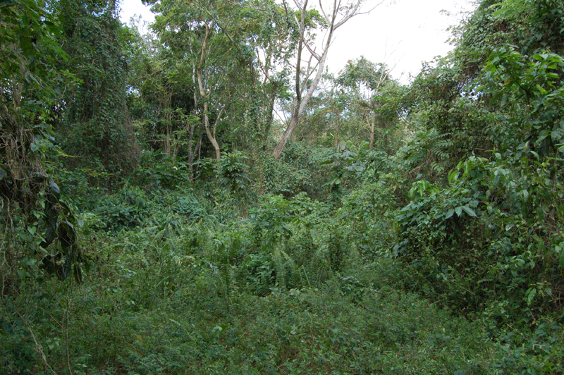
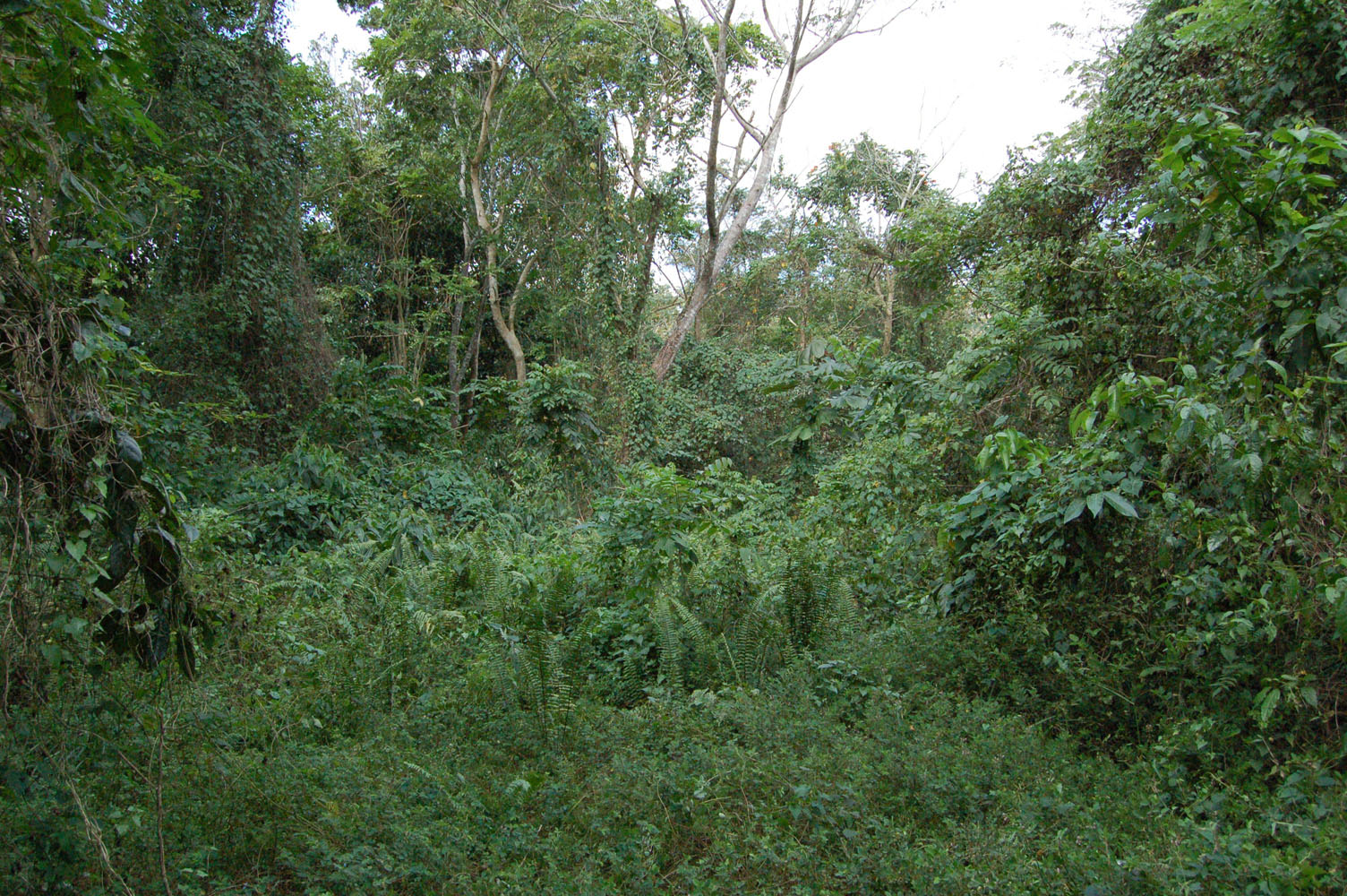
Excavations commenced in 1973 and continued to 1980. In the 1990s, when Montpelier passed into the hands of the Jamaica Orange Company, conservation of the village site at New Montpelier was negotiated. The land was not cleared of its aqueducts or planted in citrus, nor was it grazed. The unexpected consequence of the conservation was that by 2005 the village lands were covered by thick, almost-impenetrable forest, that had grown up rapidly once given the opportunity, making it very difficult to locate the sites of the excavated house sites. The great house and former works buildings are still identifiable but similarly occupied by large trees and vines.
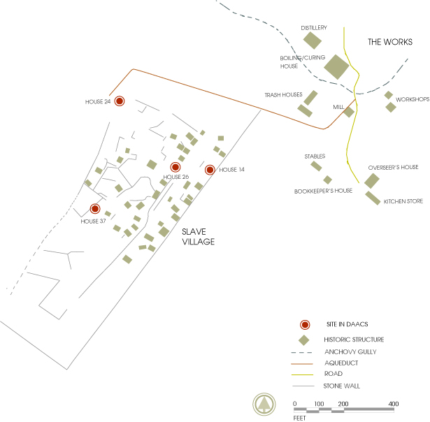
The former village site at New Montpelier was a long rectangle, divided into three fairly distinct topographic zones. At the northern end, near the factory site, the land was low and level, parts of it becoming boggy after rain. An intermediate zone, towards the south, was relatively steep. The southern zone, near the Great River, was elevated but generally level and rocky. Most of the excavations and most of houses with stone foundations were found in the first two of these zones. The sequence of excavation was: House 26 (1973-1975), House 14 (1975-1976), House 37 (1976-1978), House 24 (1980). Houses 26 and 14 proved to have much in common. Houses 37 and 24 had much in common with one another but differed significantly from the pattern established for the first two houses.
Barry Higman
Australia National University
October 2006