
| Location: | Seville Plantation, St. Ann Parish, Jamaica |
|---|---|
| Occupation Dates: | 1670s-1850s. Phasing and mean ceramic dates can be found on the Chronology Page. |
| Excavator(s): | Douglas V. Armstrong |
| Dates excavated: | 1987-1993 |

Overview
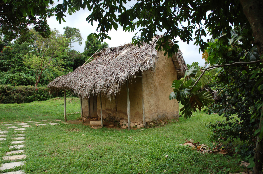
A reconstruction of an early-period wattle and daub slave house at Seville Plantation. This reconstruction was based on data recovered during Armstrong’s excavations at Houses 15 and 16.
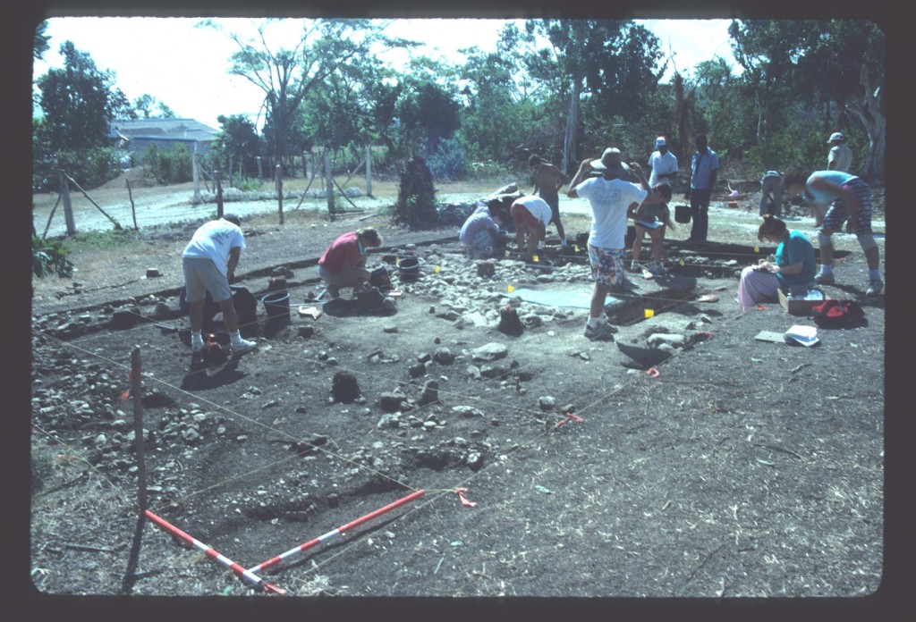
In 1987, excavations at Seville Plantation, an 18th-century sugar plantation situated on the north coast of Jamaica at St. Ann’s Bay, were initiated by the Seville African Jamaican Archaeological Project. Led by Douglas Armstrong of Syracuse University, these excavations concentrated on two slave villages, one dating from the early-to-mid 18th century and the other dating from the late 18th-through mid-19th century. Houses 15 and 16 are located in the first-period African settlement of the plantation. These structures are located to the southwest of the planter’s residence.
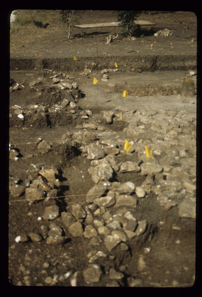
Excavations occurred at House 16 between 1987 and 1993. Archaeological features include structural postholes (F01-F15) and two types of flooring, marl (F17) and cobble (F20). Together, these architectural features confirm that this dwelling was constructed of wattle and daub . Armstrong discovered and excavated one human burial at House 16 (F16), which is believed to be the first African burial recovered from a house compound in the New World. Spatial distribution analyses indicate that the yard around House 16 was swept routinely. Both European and locally-made artifacts were excavated from House 16, and they represent a wide range of activities from food production and consumption to spiritual practices.
Documentary evidence
The early African village at Seville, where House 15 and 16 are located, is represented on a 1721 map of St. Ann’s Bay A portion of the 1721 plat of Seville Plantation showing the main house and early slave village. This map included a number of accurate details, such as navigational vectors used to guide mariners entering St. Ann’s Bay. In addition, the early map locates the village behind and upslope from the main house. Two linear rows of tightly spaced houses are arrayed along a road or path. The road heads south from the planter’s residence. This is the only identified map showing the location of the early village and the approximate locations of Houses 15 and 16 (Armstrong 1990, 1991).
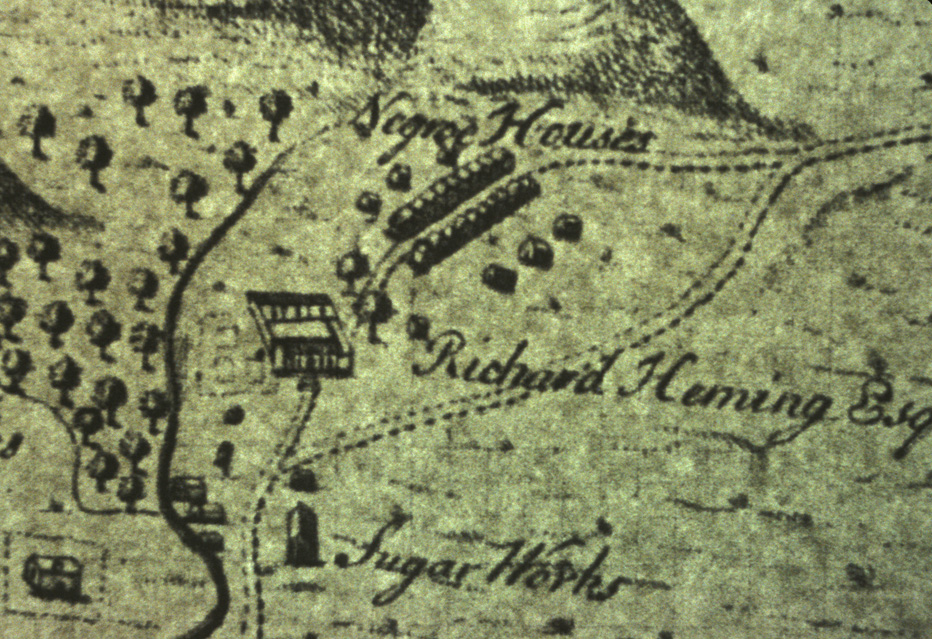
A 1721 estate plan shows the location of a early slave village that dates to the first half of the 18th-century.
A 1792 plat of the property shows a later village with houses clustered together, oriented independently, and with significantly more yard space between each house (Armstrong and Kelly 1992).
These maps are the main textual sources for Seville. In 1982, Armstrong conducted several oral histories with Mr. Carpy Rose, who was born in one of the last houses to remain standing in the later village. These interviews are discussed in a number of presented papers and publications (Armstrong 1990, 1991).
Excavation history, procedure and methods
Archaeological and historical research associated with the early slave village at Seville was initiated in 1987. It built on an initial survey of the area conducted by Armstrong in 1981 (Armstrong 1991). This early survey indicated that there were two distinctive village areas at Seville. Prior to that time only the more recent slave village was recognized. The later village is clearly shown on a map dating to 1792. It was assumed that an earlier 1721 map of St. Ann’s Bay (which at the time was misattributed by the National Library as being made in 1691), was thought to simply show the same village. In examining this map, Armstrong was able to determine that it was made in 1721. Based on this map, he decided to survey not only the area to the west of the planter’s residence, where ruins of a village were known, but also the area uphill and behind the planter’s house, as indicated on the map. Slipware, delftware, and local earthenware were present on the surface and Armstrong hypothesized that this may have been the location of an early village site on the property.
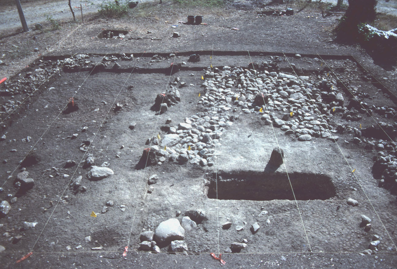
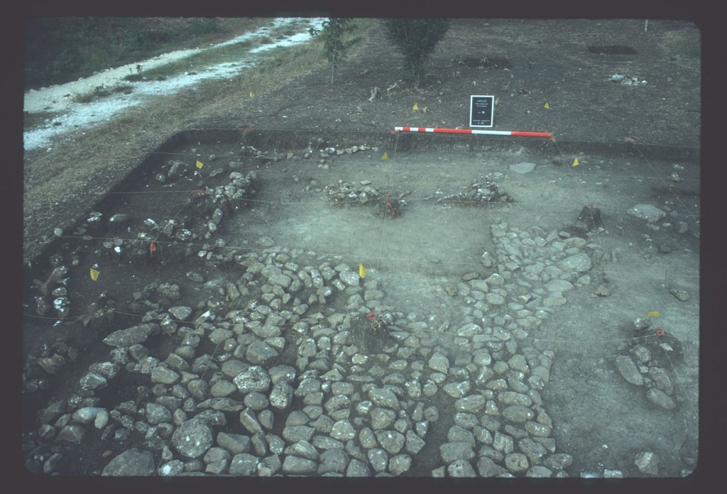
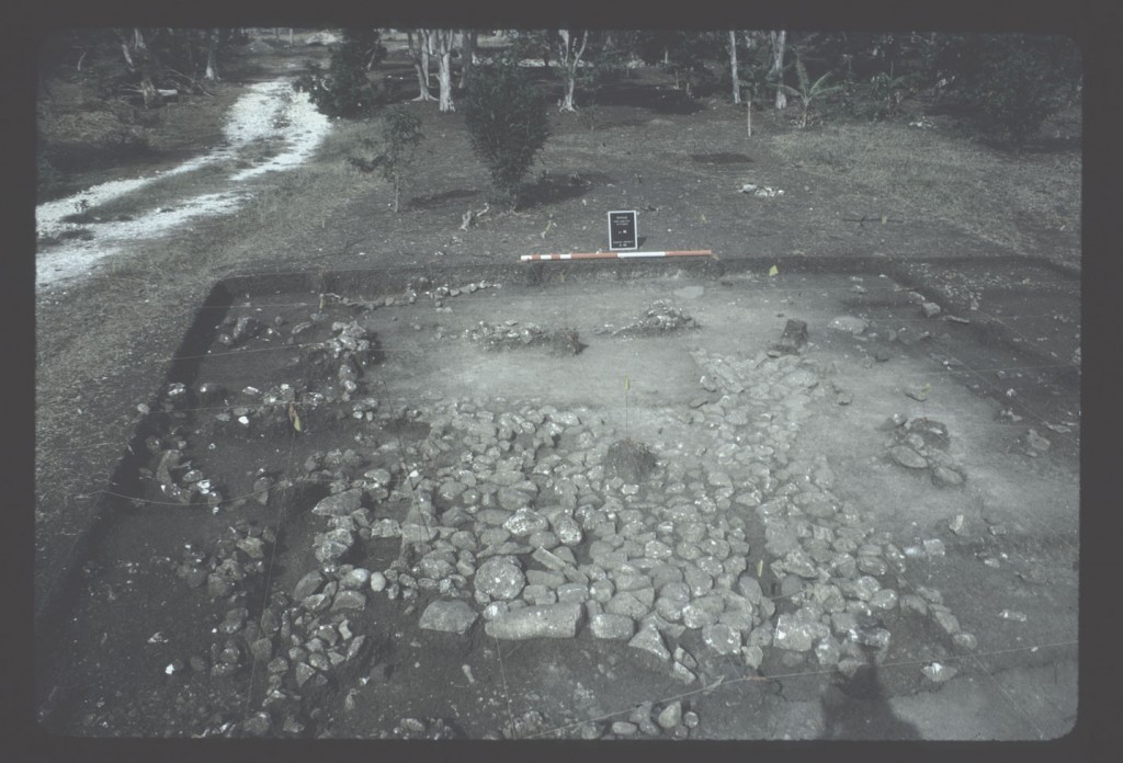
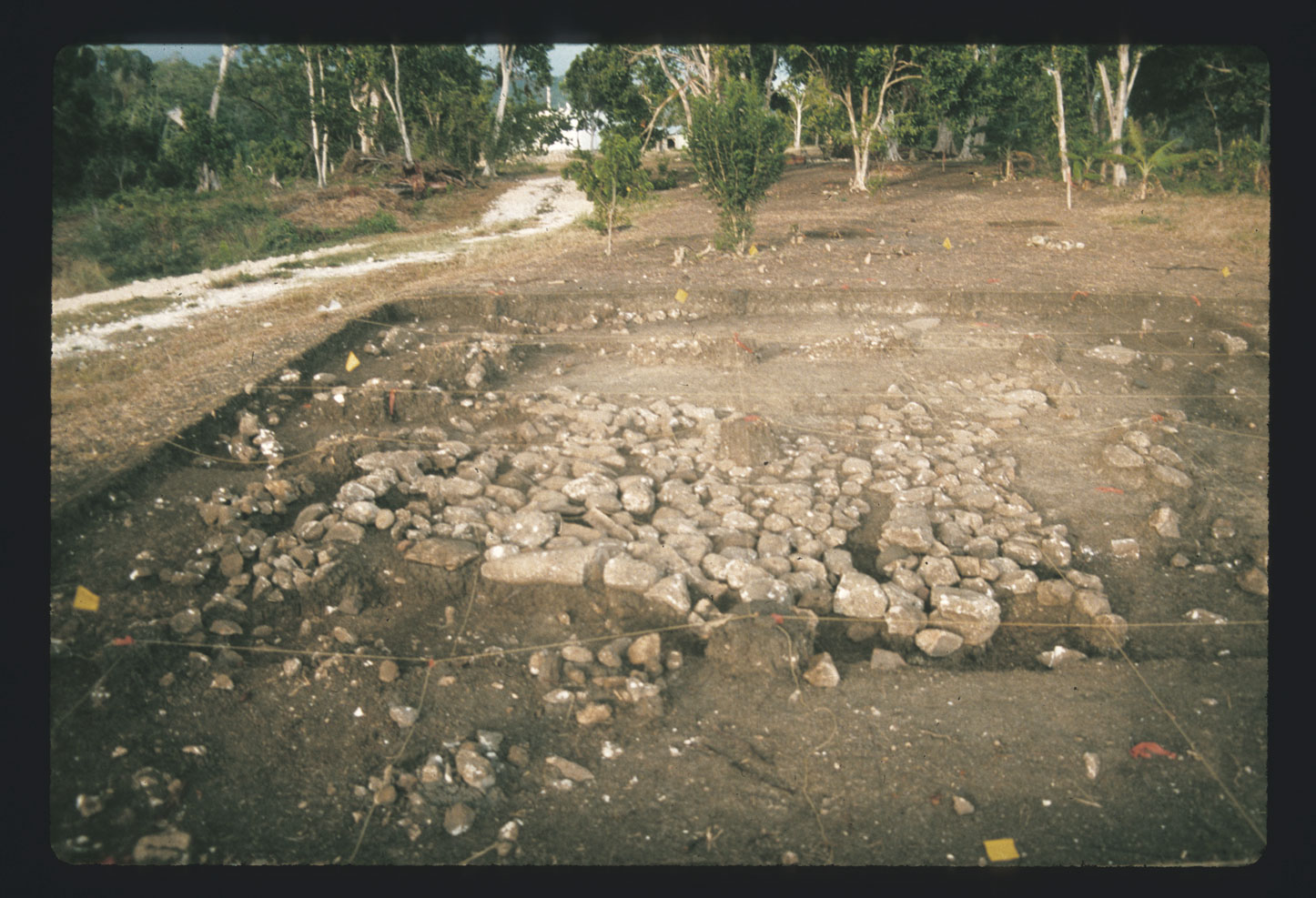
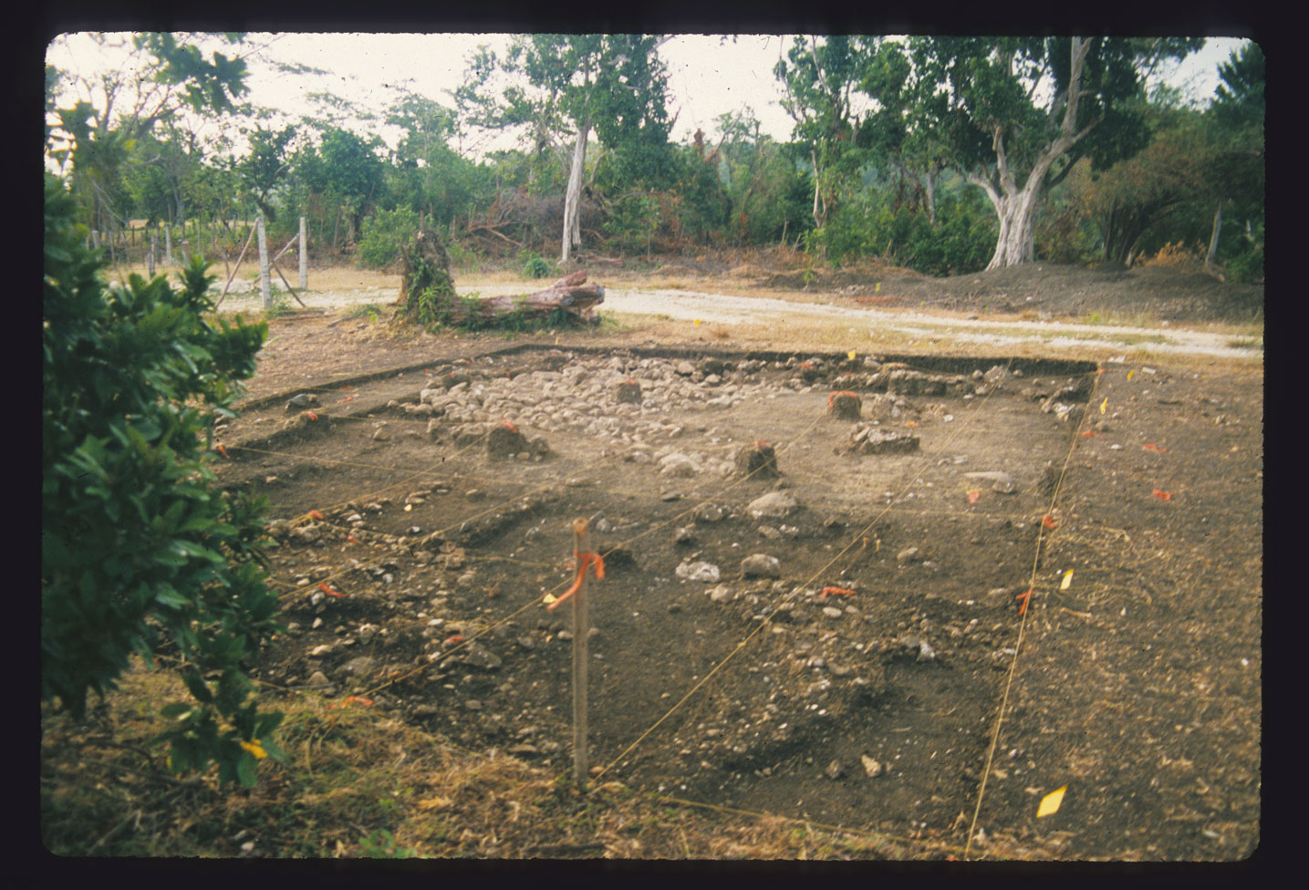
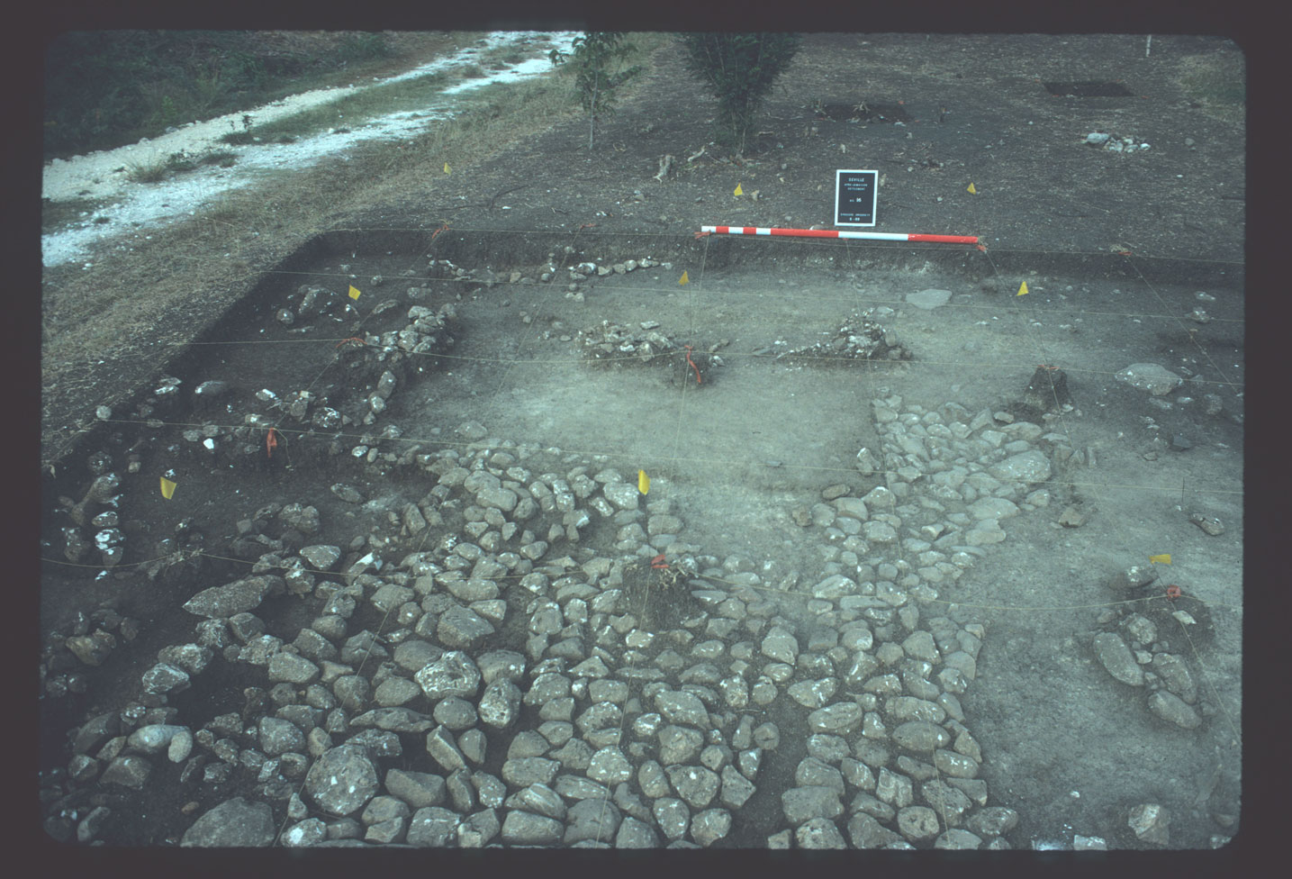
View of House 16, taken from the south. The marl floor, cobble floor, and yard burial are visible in this photograph.
When the Seville African Jamaican archaeological project was initiated in 1987, the idea was to first define the boundaries of both slave settlements and then compare data relating to early and late residences on the property. An intensive walking survey in 1987 confirmed the findings from the 1981 survey: there were two distinct loci of slave occupation on the property. The area uphill and behind (south and southwest) of the planter’s residence was included in the preliminary walking survey, even though it was owned by the St. Ann’s water company rather than the National Trust. At the time, the Jamaica National Heritage Trust owned all of the other areas associated with industrial production and residential life on Seville sugar estate. When the study began in 1987, local farmers were in the process of expanding their banana fields into the area of the early village site. The project convinced them to expand in another direction and ultimately got support from the land owner for the protection of the property. This information was used by the JNHT to later acquire this area and include it in the heritage park.
The house sites were identified via a walking survey traversing the study area. The area defined as House 16 was selected for excavation based on the combination of surface indices which included a linear pattern of rocks suggesting the presence of a foundation, surface artifacts that dated to the late 17th and early 18th century (including slipware and delftware), along with the presence of local earthenware.
The objective was to define both the house structure and any associated features. Excavation was initiated with a single test unit then expanded for aerial coverage. A grid of 1-x-1 meter quadrats was laid across the site. Grid north was 35 degrees east of magnetic north. Excavation units were labeled using an alphanumeric system with each one-meter unit designated using a letter and number. Letters increase to the north and numbers increase to the west (i.e. C1, C2, D1, D2, and so forth). The southeasterly most quadrat at House 16 was C9.
In order to generate spatial distribution data that was compatible with DAACS, DAACS analysts assigned a new coordinate system, expressed as northings and eastings, to Armstrong’s existing alphanumeric grid. DAACS established a datum (0/0 as opposed to A1) that was located to the south and west of the excavated area. Quadrat boundary data in DAACS for House 16 are therefore represented in the number of meters away from the DAACS datum, i.e. E9N1.
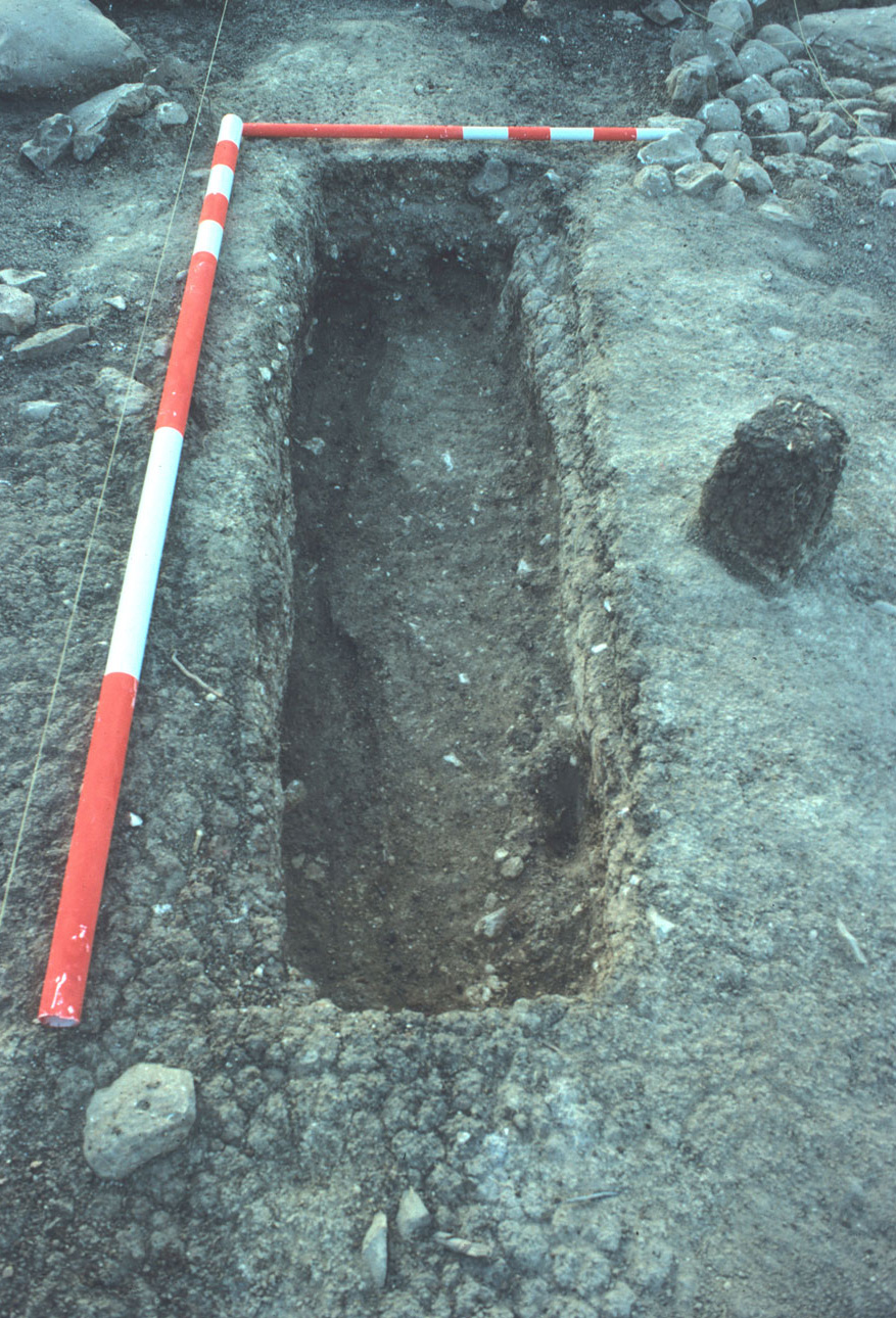
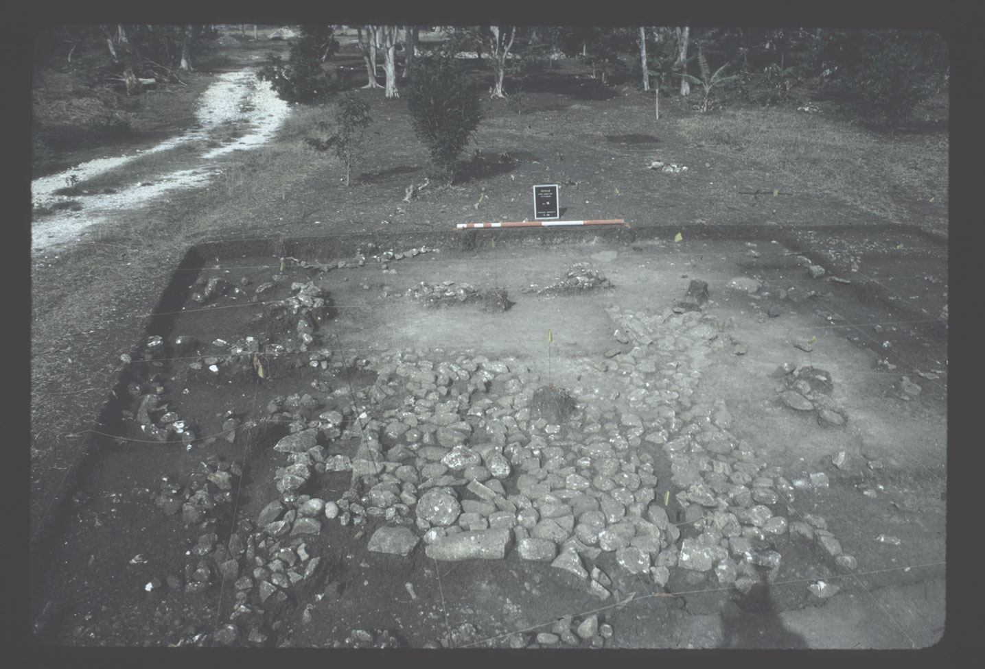
View of House 16 burial, taken from the east.
A total of 66 1-x-1 meter units were excavated at House 16. All units were excavated by hand and all sediment recovered was passed through screens with 1/8 inch mesh. Every unit was excavated following a combination of natural and arbitrary stratigraphic designations. Each level was dug to a maximum of 10 centimeters unless a cultural feature was encountered or until there was a natural change in soil color and/or texture. In most cases the upper 10 centimeters included a mix of materials that dated from the 17th century through the 20th centuries. The second level, 10-20 centimeters in depth, contained primarily early material culture. The third level was of variable depth and it was in this level that the foundations and features of the house were fully exposed. Given the slope of the hill, generally the northern units, or down-slope portions of the house site, had structural features that were exposed on or near the surface. However, features in the southern units, or upslope portions of the house, were covered with 20-30 centimeters of sediment.
Levels are represented numerically. For example, C11.1 stands for level 1 in unit C11. C11.2 stands for level 2 in unit C11, and so forth. In the original field records, 0 (zero) was used to represent surface levels. DAACS replaced the 0 with a “S”, therefore C11.S in DAACS represents the surface level in unit C11.
Excavation within the house identified structural features such as foundation stones, post-holes (F01-F15), stone cobble flooring (F20), and crushed marl flooring (F17), as well as evidence of doorways. Evidence of a probable porch (post-holes without foundations) was found in the front yard, facing the path through the village. Evidence of a variety of features including hearths, crushed marl surface exterior courtyard flooring, isolated post-holes, and a burial, were found in the back yard. The edge of the yard for this house was defined by an increase in stones and artifacts away from the house and about half the distance from the neighboring house. A burial (F16) was also located in the yard and it was excavated to subsoil. All sediment from the burial was screened through 1/8 inch mesh.
The majority of the features identified at House 16 were postholes and postmolds (F1-F15). None of the identified House 16 posthole/mold features were excavated. As a result, there are no context records or artifacts associated with these postholes/postmolds. The features are also not represented on the site-wide Harris Matrix but the final site map and conversations with Douglas Armstrong indicate that the postholes were found at subsoil. The location and size of the House 16 postholes/molds were recorded on the final measured site map.
One area of the early village was later reused in the mid-19th century when a house thought to be associated with East Indian laborers was constructed. This later occupation, identified as a distinct later assemblage, overlays part of the early village. This East Indian household, defined as House Area 14, provides an important comparative base for studies of ethnicity and social cultural attributes associated with laborers on the property (see Armstrong and Hauser 2003). Fortunately, even though the site has relatively shallow stratigraphy, only two of the early African context house sites (Houses 12 and 13) were directly disturbed and even these two retained stratified contexts and sequential layers of house construction materials. Although only Houses 12 and 13 were directly impacted by this later 19th century occupation, the presence of these later contexts, along with other more casual discarding of materials in the area, accounts for more recent materials found in the upper layers of all house sites in the early village.
This same pattern of reconnaissance was used for all of the house sites in the early village with a similar procedure used for the later village. Excavation of House 16 was completed in 1988 with excavation and additional testing in the area continuing through field seasons extending to 1993.
Site plans and detailed photographic documentation was done for all excavated house sites at the early village. Dates were compiled in the field using field recording forms and transferred to a dBase 4 database in the field. The data were downloaded into AUTOCAD and SURFER in order to carry out spatial analyses. Much of the data was then compiled and analyzed using Lotus spreadsheet and graphs. Artifacts recovered from House 15 are curated by the Jamaica National Heritage Trust.
Summary of research and analysis
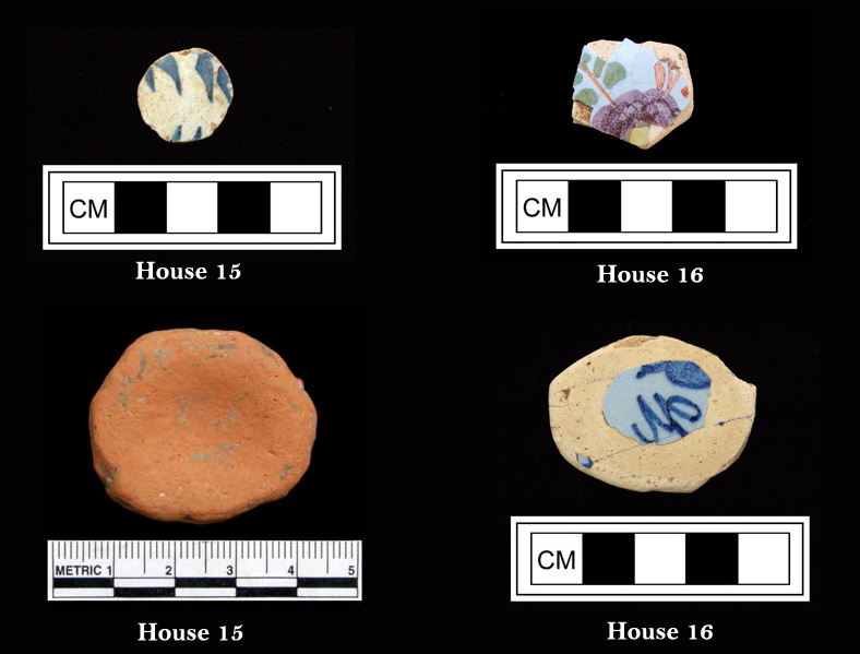
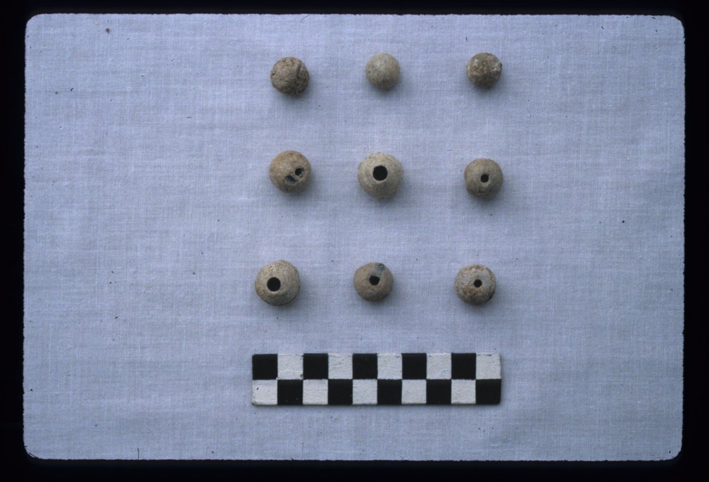
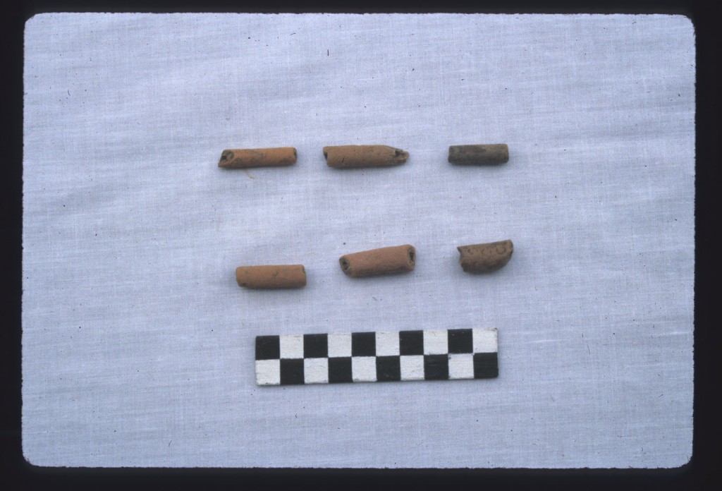
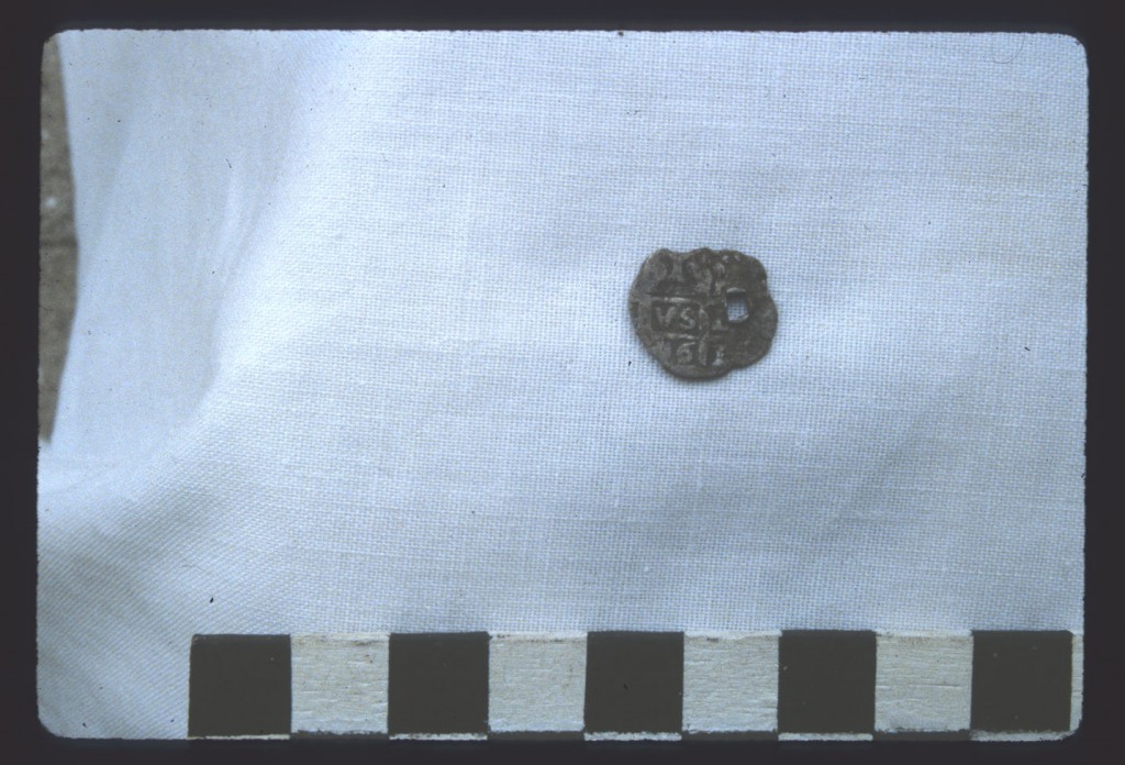
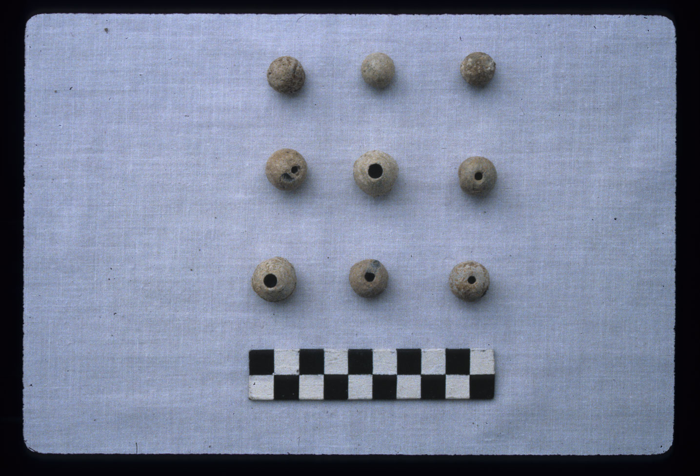
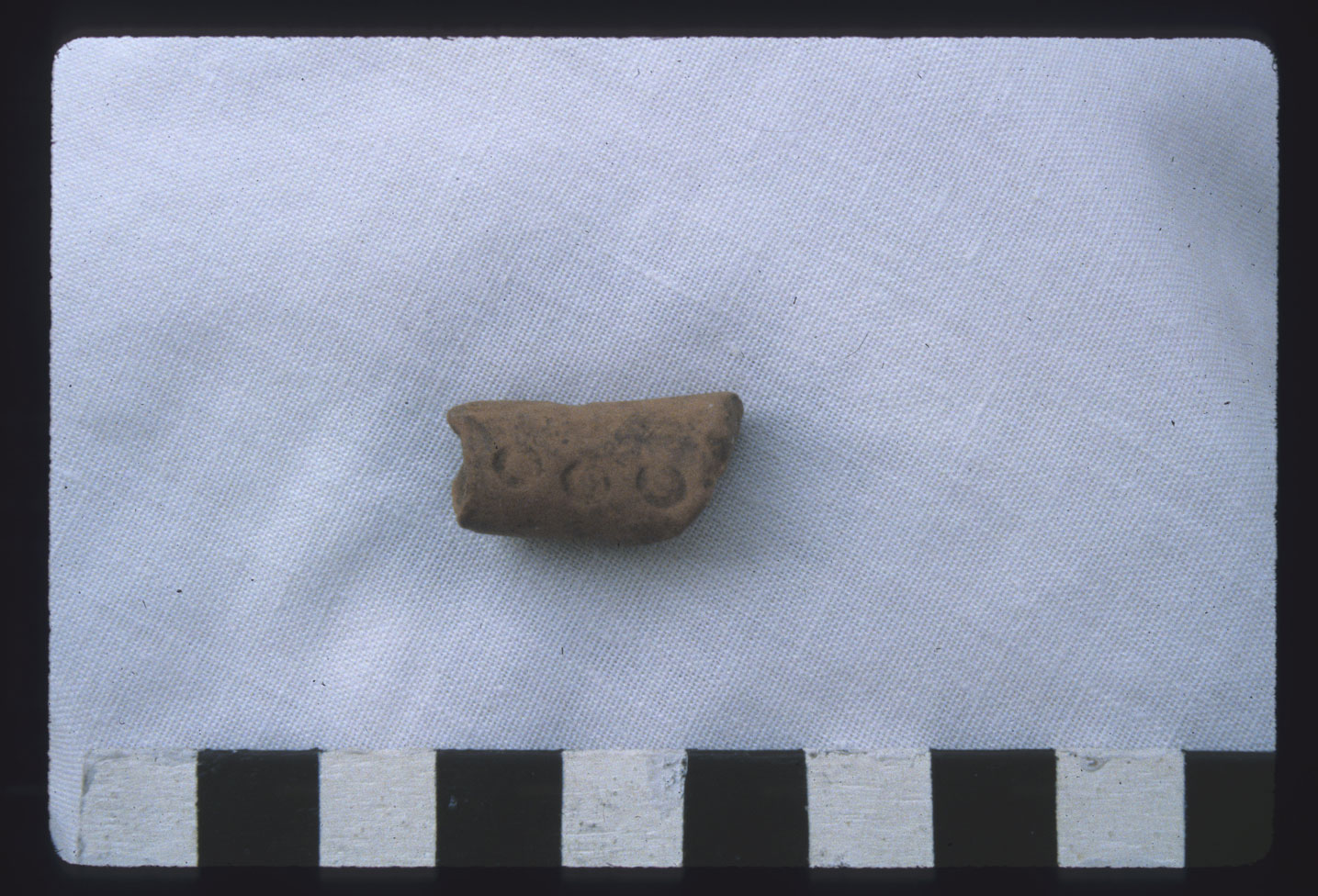
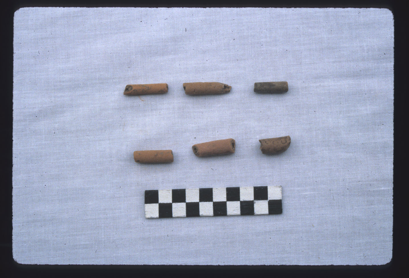
Carved ceramic “gaming pieces” found at Houses 15 and 16.
House 16 was the most clearly defined of the 20 house areas identified within the early African Jamaican slave settlement at Seville Plantation. The house was initially recognized in the 1987 survey due to the presence of a prominent row of rocks demarking the down slope (north) foundation stones of the structure. This type of stone foundation base was common at house sites at Drax Hall (Armstrong 1990); hence, it was easily recognized as part of our survey. More than forty-five probable house sites were defined during the initial survey of both early and late villages. Ultimately twenty houses were located in the old village. All of these house sites date from circa the 1670s to 1780s (Armstrong 2005).
House 16 was one of a series of houses lining the west side of a path leading up the hill from the planter’s residence, with industrial works and cane fields cane fields, and industrial works based on the observation of House area (see illustration in Scupin and DeCorse 2002:35 based on drawing by Armstrong). When excavation of the site was initiated in 1988, this was the first house studied. The foundation stones were followed to a point where it made an abrupt turn allowing us to define the corner of the building. It included a well defined two room house with a doorway and small porch on the east side, which may have been the formal entry side.
The house was approximately five meters by three meters and was built upon a foundation of rock and brick. The house was made of wattle-and-daub with a thatch roof. Post-holes for the structure were visible as dark circles of soil discoloration spaced relatively evenly along the outer foundation walls (between the foundation stones). The doorway was defined by a double row of rocks creating a step down from the house. The division of the house into two rooms is demarked by a series of post holes and by a differentiation of flooring material. One room has a rock floor that was covered by fine crushed limestone marl while the second room has some stone used to level out the house but is primarily a crushed limestone floor.
The doorway to the house faced the path in a manner consistent with the linear pattern found throughout the village. However, much of the activities associated with the house were actually in the yard, which is to the south and west of the house. As described by Armstrong and Kelly (2000) it is felt that the house itself provided a buffer blocking external supervision of household and community activities of the house. In the yard we found a hearth and evidence of post-holes that may have served a variety of functions related to household activities. Much of the yard near the house was covered with the same crushed limestone marl used to create the floor surface within the house. Thus, in a very real sense the house extended into the yard and much of the activities took place in that area. It was both practical in terms of the tropical environment and consistent with cultural practices to have a hearth detached from the formal structure but central to the activities of the yard, which is considered to be much like the outside courtyard activities commonly found in archaeological contexts such as Begho and Elmina in Ghana.
The yard-area itself was apparently swept clean of artifacts on a regular basis, with artifacts found most frequently near the foundation and at the outside edges of the yard. In fact, this pattern of cleared space bordered by artifact accumulation was used to define boundaries between house sites.
A significant find in the yard was the presence of a burial placed in a hole dug into the bedrock within the house yard compound. This burial (defined as SAJ-B1, known as Feature 16 in DAACS) was initially thought to have been within the house as it was found beneath the same crushed white marl flooring or surface material that was found within the southern room of the house. Upon closer inspection it was determined to be in the yard immediately outside of the house. Subsequent excavations uncovered three other house-yard burials in similar contexts associated with specific house sites in the old village (Armstrong and Fleischman 2003: 53). The House 16 burial contained materials that suggest a mid-1750s date of burial. The fact that the burial site was covered with a thin lens of crushed marl indicates that this individual was buried prior to the destruction of the house and that the house and yard continued in use, with probable new layers of marl surface coats applied to the yard and the house floors periodically. The individual was a male, who was between the ages of 20-30 at the time of his death. Osteological evidence indicate that he was of African ancestry and that he had some severe chronic health problems prior to his death. Pathologies of the bone suggest that this individual may have even been a paraplegic at the time of his death and that he had lived for some time with these conditions (see Armstrong and Fleischman 2003:53). The study did not determine a cause of death but does suggest that this individual was cared for by the community and the placement of the burial within the house-yard projects the possibility that this individual represented a special person within the community. These remains, along with the remains found in three other burials at Seville, were returned to the site following analysis and were reburied in 1997 in a formal ceremony (Armstrong and Kelly 2000).
Collectively, the burials from Seville provide important insight into the importance of the house-yard compounds to the life of the community. These areas represented one of the few spaces controlled and internally defined by the laborers. Burial in the yard is seen to tie with West African burial practices and to relate to behavioral practices of the community. The burial in the yard at House 16 was significant as it was the first African burial recovered from a household context. More recent studies, including research on the free black settlement on St. John, Danish West Indies, have confirmed this as a more general practice among persons of African descent in the Caribbean region (see Armstrong 2003).
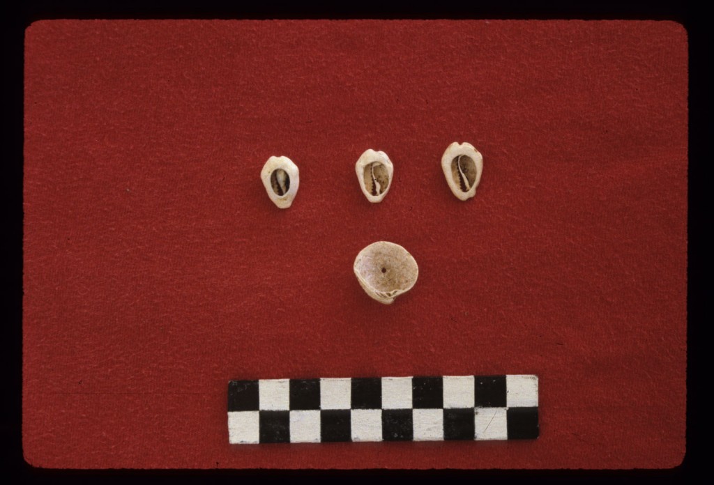
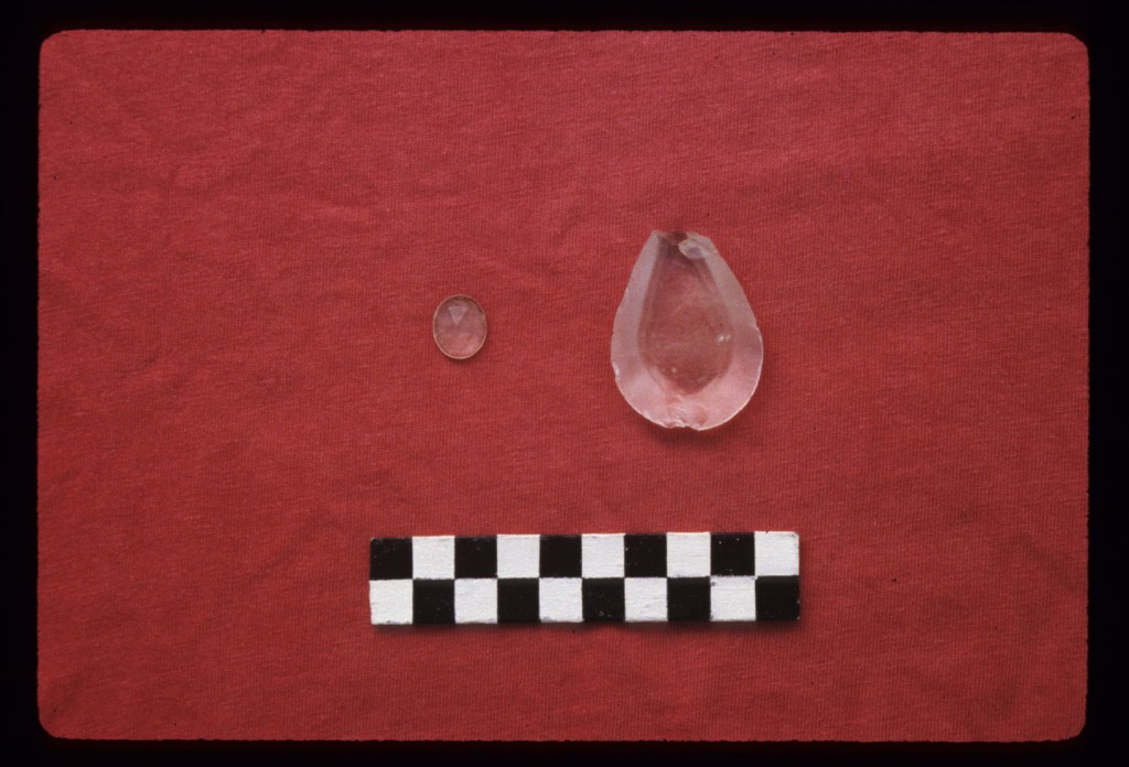
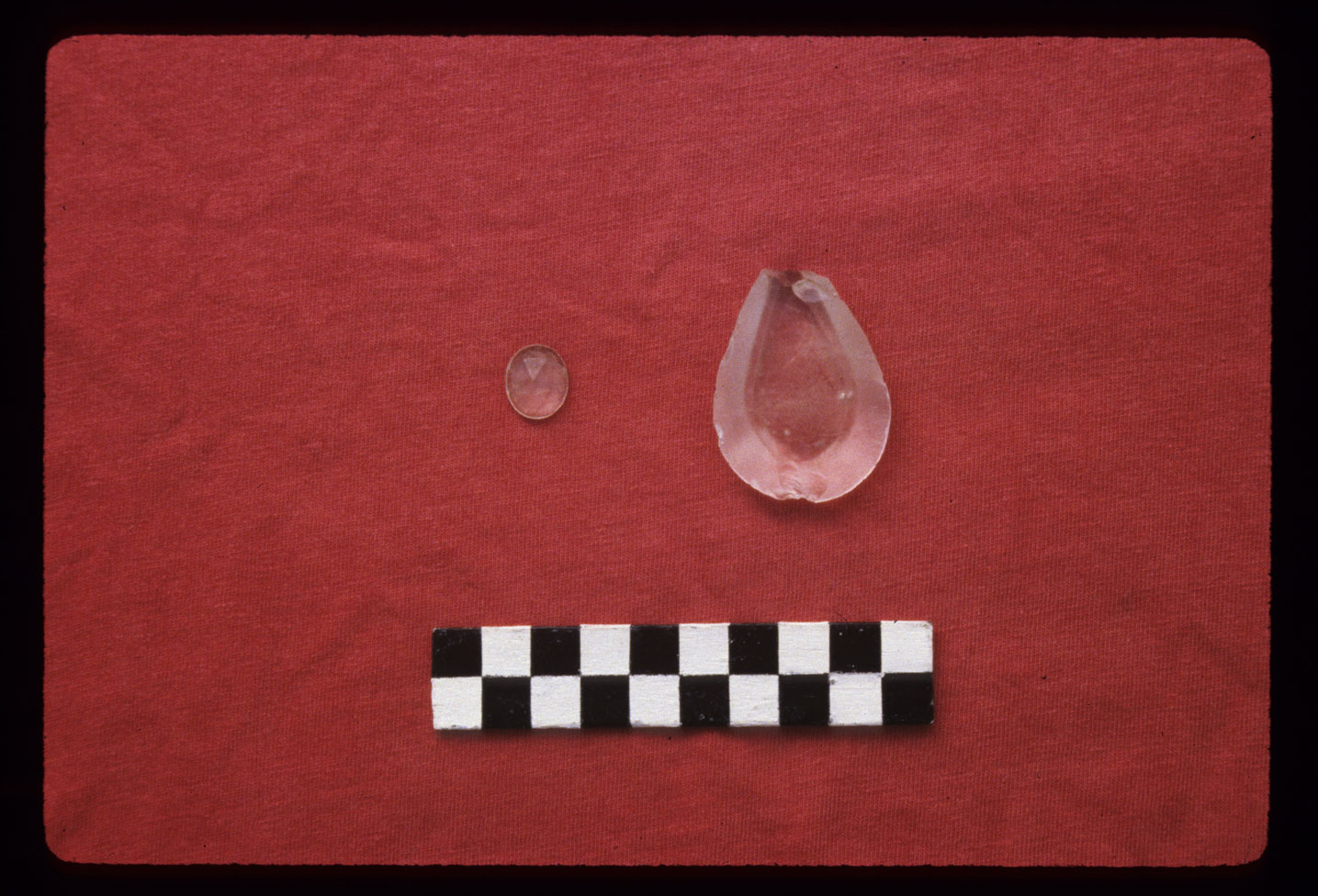
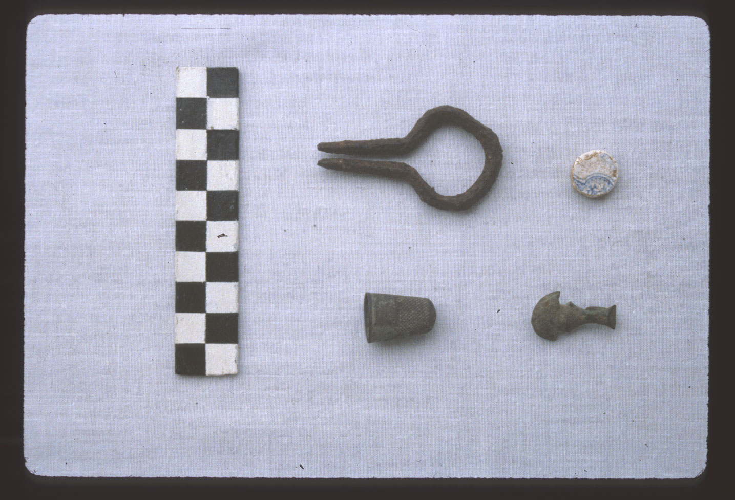
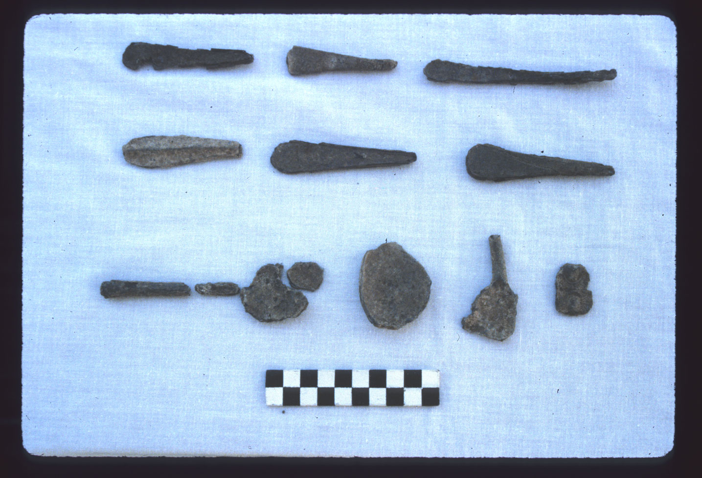
Analyses of materials from this site are included in the DAACS database. Artifact analysis has shown distinct patterns of material use including reuse of items such as gun flint and raw flint for strike-a-light fire starters and the reworking of local and imported ceramics for gaming pieces. The distributions of artifacts around the edge of the yard suggest that the yard was a place in which activities of the household and community took place. Artifacts like ground cowry shells, local earthenware, and locally made tobacco pipes provide clues as to the importance of both continuities of African traditions and the generation of goods and trades by persons of African descent in Jamaica. Patterns of material use, including imported and local wares reflect a household with limited financial means particularly when compared with materials from managerial contexts at Seville. There is greater reuse of items such as glass bottles. This house and its neighboring house sites provide a solid picture of early life within a laborer household under conditions of slavery.
The study of Seville has been published in a series of articles that have addressed thematic issues relating to the plantation. These include an overview of the cultural landscape of Seville Plantation which focuses on the African Jamaican settlements and their interpretation through time (Armstrong 1999), a comparative analysis of the processes of internally defined transformations within society (Armstrong 1998), landscapes and settlement patterns in relationship to social relations (Armstrong and Kelly 2000), house-yard burials (Armstrong 2000, Armstrong and Fleischman 2003), and comparative studies related to the material record of race, ethnicity and labor conditions (Armstrong 1998 and Armstrong and Hauser 2004). Comparative analysis of African and East Indian laborer contexts are presented in Armstrong and Hauser 2001 and 2004. In addition, details related to a refined analysis of temporal contexts using both mean and variable measures of variance from the mean using whisker plots is described in a methodological paper (Armstrong 2005). Now the DAACS database is presenting detailed analysis of selected sites on the property so that data can be compared and shared. Several recent conference papers that use Seville data are available through the DAACS website’s Research page (Galle 2007a, 2007b; Nelson, Neiman, and Galle 2007). With this renewed interest in the project related to the DAACS project, a synthetic analysis of the project is being prepared by Armstrong and Mark Hauser.
Douglas V. Armstrong and Jillian Galle
Syracuse University and The Digital Archaeological Archive of Comparative Slavery
August 2007
Things you need to know about House 16 before you use the Data
The following sections contain important information about the Seville House 16 excavations and artifact collections. They provide guidance on how to approach the the artifact and contextual data, and provide information on unprovenienced artifacts as well artifacts that were missing from the collection. It is essential that researchers review this information carefully before beginning their analysis.
- Field measurements are in meters and centimeters.
- All of the features identified at House 15 were either postholes and postmolds. None of the identified features at House 15 were excavated. As a result, there are no context records or artifacts associated with the postholes/postmolds. The features are also not represented on the site-wide Harris Matrix. Our conversations with Douglas Armstrong, and evidence from field maps, indicate that the postholes were found at subsoil. The location and size of the House 15 features are taken from Armstrong’s final measured site map drawn in the field.
- Seville House 16 site maps: DAACS attempted to include all stones drawn in the field on quadrat and sites plans. However, it is clear from the context records that differential mapping of stones by quadrat and by field season occurred. This means that the absence of stones on the digital site map is not necessarily evidence for absence of stones in the quadrats.
- Armstrong’s excavation units were labeled using an alphanumeric system with each 1-x-1 meter unit identified using a letter and number, with lettered N/S transects and numbered E/W transects. In most cases, the letters increase to the north and numbers increase to the west (i.e. C1, C2, D1, D2, and so forth). At House 16 the southern transect is the “C” line and the southeasterly most unit is C9.
- In order to generate spatial distribution data that was compatible with the DAACS database, DAACS analysts laid a numeric grid over Armstrong’s original alphanumeric system. DAACS established a datum (0/0 as opposed to A1) that was located to the south and west of the excavated area. Quadrat boundary data in DAACS for House 16 are therefore represented in the number of meters away from the DAACS datum, i.e. E9N1.
House 16 Artifact Collections
The Seville Plantation collections have been curated solely by the Jamaica National Heritage Trust since the completion of Armstrong’s excavations in 1993. The collections were initially housed at the JNHT’s Naval Hospital Facility in Port Royal. In 2004, Hurrican Ivan severly damaged the Naval Hospital and the Seville collections were moved to Headquarter’s House, the JNHT’s main offices in Kingston, for assessment and rebagging. The Seville collections are currently stored at Headquarter’s House.
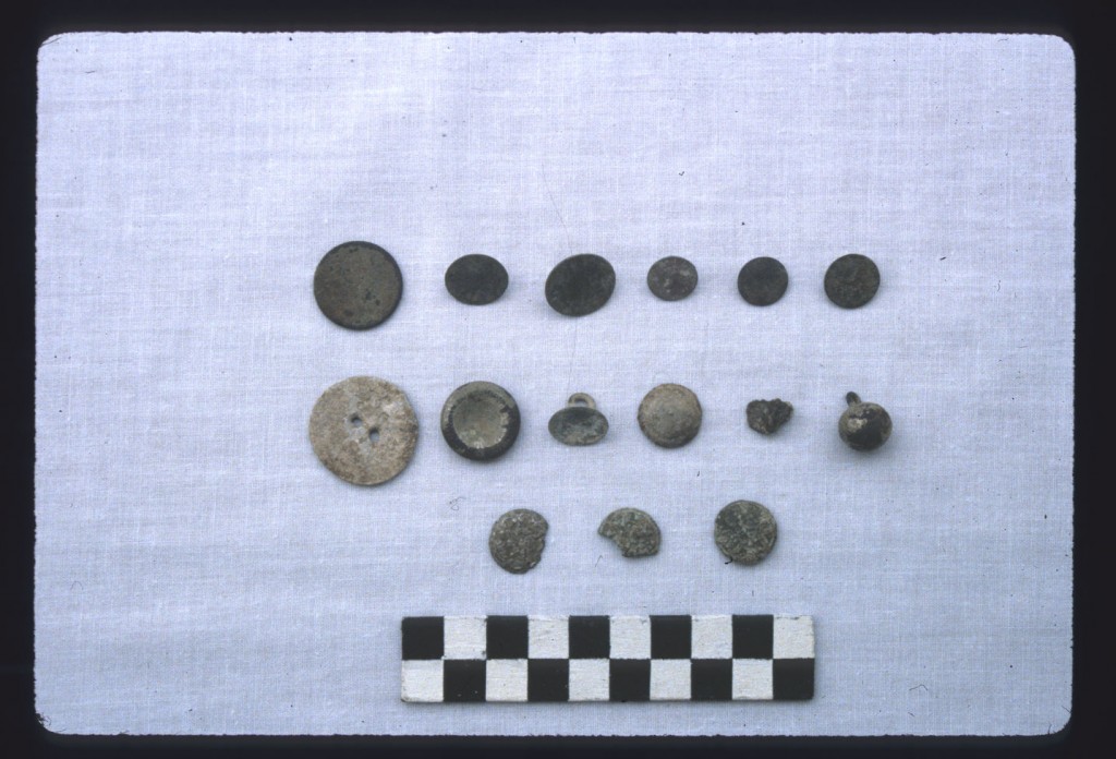
DAACS analysts cataloged to DAACS standards all of the artifacts from House 16 except for artifact types that fall into the “All Other Artifacts” category. This means that all beads, buckles, buttons, ceramic vessels, glass vessels, tobacco pipes, and utensils that were present in the collection were physically examiend and cataloged by DAACS staff. Data about objects that fell into the “All Other Artifacts” category, such as brick, nails, mortar, window glass, tools, metal pots, etc. (See All Other Artifacts for complete listing of all artifact forms.) were entered into DAACS from Armstrong’s catalog. This means that any artifacts with “DArmstrong” as the Cataloger/Editor have basic attribute information, such as form and material type, but not the complete set of DAACS attributes.
We also encountered a number of discrepancies between Armstrong’s artifact catalogs and the artifacts that we saw and cataloged while working at the JNHT. There were quite a few artifacts listed in Armstrong’s catalog could not be located at the Trust.
When we returned to the DAACS Lab at Monticello, we reconciled the artifacts DAACS cataloged at the JNHT with the artifacts listed in Armstrong’s catalogs. When we encountered an artifact in Armstrong’s catalog that we did not catalog in Jamaica, we entered that artifact into the DAACS database with the information that Armtstrong had collected in the late 1980s and early 1990s.
When using the Seville House 16 data, please note that any artifact types with “DArmstrong” as the Editor/Cataloger will have basic attribute information such as form and material type but not the complete set of DAACS attributes. If you receive data that does not contain measurements or decorative data, please use an advanced query (such as AQ5) to see who cataloged the artifact.
The downloadable files on this page provide basic information for all beads, buckles, buttons, tobacco pipes, and utensils found at House 16. All artifacts with “DArmstrong” as an editor were not cataloged by DAACS analayst.
Acknowledgements
Expansion in geographic coverage has required that DAACS staff work outside of the Chesapeake region and move beyond our laboratory at Monticello. DAACS undertook its first international project during the first five months of 2006 when it moved its lab to Kingston, Jamaica. DAACS staff analyzed the Seville archaeological collections at Headquarter’s House, the main offices of the Jamaica National Heritage Trust, located in downtown Kingston. The DAACS Jamaica team at the JNHT consisted of Ms. Leslie Cooper, DAACS Archaeological Analyst, Mr. Henry Sharp, DAACS Archaeological Analyst, Ms. Karen Hutchins, Monticello/DAACS Archaeological Analyst, Ms. Karen Smith, Monticello’s Curator of Archaeological Collections and Dr. Jillian Galle, DAACS Project Manager.
The DAACS-Jamaica project’s work at the Jamaica National Heritage Trust could not have occurred without the generous help and unstinting support of many individuals. Dr. Douglas Armstrong at Syracuse University immediately agreed to collaborate with the Archive. He has given freely of his data, time, and knowledge of the island. We could not have accomplished our work without him. Sincere appreciation also goes to Mr. Roderick Ebanks, Emeritus Director of Archaeology at the Trust, and the Board of Directors of the Jamaica National Heritage Trust for approving the DAACS permit and supporting this project.
The JNHT’s Department of Archaeology generously provided us with laboratory space as well as the assistance of several staff members. Mrs. Ann-Marie Howard-Brown, director of the Finds Department, was an invaluable coordinator of space and staff. Miss. Green and Ms. Topping helped us catalog and sort artifacts for the duration of the project. Mr. Tyndell and Mr. Murphy were always there to help us sort and move collections. Mr. Dorrick Gray, Deputy Director of Archaeology at the JNHT, and Dr. Philip Allsworth-Jones, the former Senior Lecturer in Archaeology at the University of West Indies, Mona, each gave us invaluable advice and support.
Every staff member at the Trust welcomed our daily presence at Headquarters House with warmth, especially Miss. Brooks, Mrs. Howard-Brown, Mr. Grant, Mr. Gray, Miss. Green, Mr. Murphy, Miss. Paula, Ms. Thompson, Mr. Tyndell, Ms. Topping, Mr. Walters, Mrs. Rosie Whittaker, Jasmine Whittaker, and Mrs. Williams-Simpson. Mr. Tyndell and Miss. Green provided essential guidance in downtown Kingston as well as invaluable culinary advice. We are exceptionally grateful to all Trust staff for providing us with such an enriching and successful experience.
Jillian Galle
The Digital Archaeological Archive of Comparative Slavery
August 2007
Feature Numbers
The original excavators of the House 16 site did not assign numbers to individual features. DAACS staff has assigned feature numbers using the original excavation records. Feature Numbers assigned by DAACS have a F-prefix, which precedes the number (i.e. F01 equals Feature 1).
Excavated contexts that belong to the same depositional basin (e.g. a posthole and postmold or the layers in a single pit) have been assigned a single feature number. In addition, single contexts have been given feature numbers when the original field records indicate that the excavators recognized a context’s spatial distinctiveness from surrounding contexts.
Please note that at Seville House 16 a number of quadrats and contexts are also labeled with a F-prefix (F9-F17). The majority of the features at Seville House 16 were not excavated. Features 16 (burial), 17 (marl floor) and 20 (cobble floor) were excavated, although they did not contain any contexts with a F-prefix. Please see the table below for more details.
Features at Seville House 16
The majority of the features identified at House 16 are postholes and postmolds. None of the identified House 16 posthole/mold features were excavated. As a result, there are no context records or artifacts associated with these postholes/postmolds. The features are also not represented on the site-wide Harris Matrix but the final site map and conversations with Douglas Armstrong indicate that the postholes were found at subsoil. We know the location and size of the House 16 postholes/molds since they were represented on the final site map.
Feature Groups
Feature groups are sets of features whose spatial arrangements indicate they were part of a single structure (e.g. structural postholes, subfloor pits, and hearth) or landscape element (e.g. postholes that comprise a fenceline). Feature Groups assigned by DAACS have a FG-prefix, which precedes the number (i.e. FG01 equals Feature Group 1).
| Feature | Feature Type | Contexts |
|---|---|---|
| F01 | Posthole | |
| F02 | Posthole | |
| F03 | Posthole | |
| F04 | Posthole | |
| F05 | Posthole | |
| F10 | Posthole | |
| F11 | Posthole | |
| F13 | Posthole | |
| F14 | Posthole | |
| F17 | Floor, marl | D12.4, D13.4, E11.4, E12.2, E13.2, E13.4, E14.2, G13.2 |
| F20 | Floor, stone cobble | H11.2, H12.2, H13.3, E13.3, F11.3, F13.2, G11.2, G12.2 |
| Feature | Feature Type | Contexts |
|---|---|---|
| F09 | Posthole | |
| F12 | Posthole |
| Feature | Feature Type | Contexts |
|---|---|---|
| F06 | Posthole | |
| F07 | Posthole | |
| F08 | Posthole | |
| F15 | Posthole | |
| F16 | Burial, human | D12.8, D12.12, D11.5, D11.6, D11.7, D11.8, D12.5, D12.6, D13.5, D13.6, D13.7, D12.11 |
| F18 | Post, driven | |
| F19 | Post, driven |
DAACS Seriation Method
DAACS has developed an uniform set of methods to infer intra-site chronologies for all of the sites included in the Archive. These methods, which include frequency-seriation and correspondence analysis, were developed by DAACS (see Neiman, Galle, and Wheeler 2003 for technical details). The use of common methods for all sites in the Archive is designed to increase comparability among temporal phases at different sites. The methods and the phase assignments they produced are summarized below. For some sites, the original excavators developed intra-site chronologies and where these exist, they are included on the Background page for the site. Archive users may also use the Mean Ceramic Date queries provided on the DAACS query page to calculate MCDs for individual contexts or features.
Seville House 16 Chronology
This section summarizes the frequency-seriation based chronology for House 16 at Seville Plantation. At House 16, DAACS seriated ceramic assemblages with more than 5 sherds from individual excavated contexts. Please note that at House 16, ware types, not mean-ceramic-date types, were used in the frequency seriation, correspondence analysis, and in developing the dates for each occupational phase. Please click here for more information on the differences between ware types and mean-ceramic-date types.
DAACS computed the frequency of ceramic ware types in each individual context. The seriation chronology is derived from a correspondence analysis of the ware-type frequencies. Seriated contexts were assigned to four phases. Phases are groups of assemblages that have similar correspondence-analysis scores and are therefore inferred to be broadly contemporary. Phases assigned by DAACS have a P-prefix that precedes the phase number (e.g. P01 equals Phase 1).
The stratigraphic relationships among contexts are summarized in the Harris Matrix for House 16. Phase assignments from the seriation are shown on the Harris Matrix in color, facilitating comparison of the seriation chronology and the stratigraphic chronology of the site.
Seville House 16 Phases
Based on the correspondence analysis, DAACS divided the House 16 occupation into four phases. Ware-type mean ceramic dates with start dates of 1600 were used to compute MCDS for each phase. The MCDs for the four House 16 phases are given in the table below.
The table also includes three estimates of the ceramic TPQ for each phase. The first TPQ estimate is the usual one – the maximum beginning manufacturing date among all the ware-types in the assemblage. The second estimate — TPQp90 — is the 90th percentile of the beginning manufacturing dates among all the sherds in the assemblage, based on their ware-types. The TPQp95 provides a robust estimate of the site’s TPQ based on the 95th percentile of the beginning manufacturing dates for all the artifacts comprising it. These last two TPQ estimates are more robust against excavation errors and taphonomic processes that might have introduced a few anomalously late sherds into an assemblage.
| Phase | MCD | TPQ | TPQp90 | TPQp95 | Total Ceramic Count |
|---|---|---|---|---|---|
| P01 | 1733 | 1775 | 1762 | 1775 | 395 |
| P02 | 1754.5 | 1820 | 1775 | 1775 | 1091 |
| P03 | 1769.7 | 1820 | 1775 | 1775 | 2307 |
| P04 | 1780 | 1830 | 1775 | 1775 | 1434 |
A Seriation Chronology for Seville House 16
The following table presents a seriation chronology for House 16. We use the indefinite article to signify that it is not the only chronology possible, nor even the best one possible.
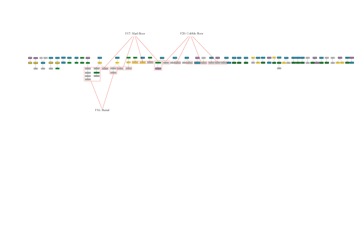
Seville House 16 Harris Matrix
The Harris Matrix summarizes stratigraphic relationships among excavated contexts and groups of contexts that DAACS staff has identified as part of the same stratigraphic group. Stratigraphic groups and contexts are represented as boxes, while lines connecting them represent temporal relationships implied by the site’s stratification, as recorded by the site’s excavators (Harris 1979).
Boxes with color fill represent contexts and stratigraphic groups with ceramic assemblages large enough to be included in the DAACS seriation of the site (see Chronology). Their seriation-based phase assignments are denoted by different colors to facilitate evaluation of the agreement between the stratigraphic and seriation chronologies. Grey boxes represent contexts that were not included in the seriation because of small ceramic samples.
See the House 16 Chronology for stratigraphic and phase information.
This Harris Matrix is based on data on stratigraphic relationships recorded among contexts in the DAACS database. It was drawn with the ArchEd application. See http://www.ads.tuwien.ac.at/arched/index.html.
For a printable version, download the Harris Matrix [776.32 KB PDF].


PDF of composite excavator’s plan, compiled by DAACS from original field drawings, with excavation units and features labeled.
PDF of composite excavator’s plan, compiled by DAACS from original field drawings, with only excavation units labeled.
PDF of composite excavator’s plan, compiled by DAACS from original field drawings, with only features labeled.
PDF of composite excavator’s plan of Houses 15, 16, and 20, compiled by DAACS from original field drawings, with excavation units and features labeled.
PDF of Seville Plantation schematic showing relationship of slave houses to sugar works and main house, compiled by DAACS.
CAD site plan in .dxf format.
CAD site plan in .dgn format.
CAD site plan of Houses 15, 16, and 20 in .dxf format.
CAD site plan of Houses 15, 16, and 20 in .dgn format.
CAD site plan of Seville Plantation showing relationship of slave houses to sugar works and main house in .dgn format.
CAD site plan of Seville Plantation showing relationship of slave houses to sugar works and main house in .dxf format.
House 16 Bead Data (TXT)
Armstrong, Douglas V., and Kenneth Kelly
1992 Spatial Transformations in African Jamaican Housing at Seville Plantation. Paper presented at the Society for Historical Archaeology Meetings, Kingston, Jamaica.
Armstrong, Douglas V., and Kenneth Kelly
2000 Settlement patterns and the Origins of African Jamaican Society: Seville plantation, St. Ann’s Bay, Jamaica. Ethnohistory 47 (2):368-397.
Armstrong, Douglas V.
2005 Refining the Temporal Dimension in Historical Archaeology: Dating Seville Plantation., In Archaeology Without Limits: Papers in Honor of Clement W. Meighan, edited by Brian D. Dillon and Matthew A. Boxt. Labyrinthos Press, Lancaster, California. Pp. 213-232.
Armstrong, Douglas V.
1991 Recovering an early 18th century Afro-Jamaican Community: Archaeology of the Slave Village at Seville, Jamaica., Proceedings of the Thirteenth International Congress for Caribbean Archaeology, , edited by E.N. Ayubi and J.B. Haviser. Proceedings of the Thirteenth International Congress for Caribbean Archaeology, , edited by E.N. Ayubi and J.B. Haviser. Reports of the Archaeological-Anthropological Institue of the Netherlands Antilles, No. 9, Curacao, Netherlands.
Armstrong, Douglas V.
1991 The Afro-Jamaican House-Yard: An Archaeological and Ethnohistorical Perspective. Florida Journal of Anthropology. Special Publication 7: 51-63.
Armstrong, Douglas V.
1990 The Old Village and the Great House: An Archaeological and Historical Examination of Drax Hall Plantation, St. Ann’s Bay, Jamaica. University of Illinois Press.
Armstrong, Douglas V.
1999 Archaeology and Ethnohistory of the Caribbean Plantation., I, Too, Am America: Archaeological Studies of African American Life. In I, Too, Am America: Archaeological Studies of African American Life, edited byTheresa Singleton. University of Virginia Press. Pp. 173-192.
Armstrong, Douglas V.
1998 Cultural transformation within Enslaved Laborer Communities in the Caribbean., Studies in Culture Contact: Interaction, Culture Change, and Archaeology. In Studies in Culture Contact: Interaction, Culture Change, and Archaeology, edited by James G. Cusick. Center for Archaeological Investigations, Occasional Paper No. 25., Southern Illinios University.
Armstrong, Douglas V., and Mark Fleischman
2003 House-Yard Burials of Enslaved Laborers in Eighteenth-Century Jamaica., International Journal of Historical Archaeology. International Journal of Historical Archaeology, 7(1):33-65.
Armstrong, Douglas V.
2003 Creole Transformation from Slavery to Freedom: Historical Archaeology of the East End Community, St. John, Virgin Islands. University Press of Florida, Gainesville.
Armstrong, Douglas V., and Mark W. Hauser
2004 An East Indian Laborer’s Household in Nineteenth-century Jamaica: A Case for Understanding Cultural Diversity through Space, Chronology, and Material Analysis. Historical Archaeology, 38(2) 9-21.
Galle, Jillian E.
2007a Conspicuous consumption and gendered social strategies among slaves in 18th-century Jamaica and Virginia. Paper presented in the session: Approaching Darwin’s Bicentennial. The State of the Art in Evolutionary Archaeology at the Annual Meeting of the Society for American Archaeology, Austin, Texas.
Galle, Jillian E.
2007b Consumption and gendered social strategies among slaves in Jamaica and the Chesapeake: an archaeological perspective. Paper presented at the World Archaeological Congress Intersession, Kingston, Jamaica, May 2007.
Harris, Edward C.
1979 Principles of Archaeological Stratigraphy. Academic Press, London, England.
Hauser, Mark W., and Douglas V. Armstrong
2003 An East Indian Laborer’s Household in 19th Century Jamaica., Proceedings of the XIX International Congress for Caribbean Archaeology. Proceedings of the XIX International Congress for Caribbean Archaeology. Edited by Luc Alofs and Raymundo A.C.F. Dijkhoff. Museo Arqueologico Aruba Volume 9 (2): 195-210.
Nelson, Louis , Fraser D. Neiman , and Jillian E. Galle
2007 Archaeological Counterpoint: Jamaica and the Chesapeake in the 18th century. Paper presented at the annual meeting of the Society for Historical Archaeology,Williamsburg, Virginia.