
| Location: | The Hermitage, Hermitage, TN, United States |
|---|---|
| Occupation Dates: | First quarter 19th century |
| Excavator(s): | Kevin Smith and Larry McKee |
| Dates excavated: | 1989 |

Overview
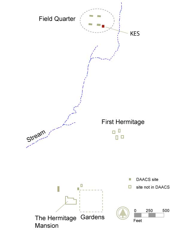
KES location at Hermitage Plantation.
The Field Quarter site KES is located approximately 75 feet east of a grove of Alianthus trees surrounding Cabin 4. This site was named for its primary excavator, Kevin E. Smith. Initial interpretation of the site as remnants of a domestic structure was supported by the heavy scatter of ceramic, glass, bone and rubble fragments found throughout the excavated layers in most of the quadrats. The lack of any cut limestone foundation suggests that the structure was built either of logs placed directly on the ground surface, or by post-in-ground construction. The highly disturbed nature of possible postholes obscures identification. Dating of this site to an occupation period prior to the construction of the four brick duplex cabins is supported by the difference in structural remains recovered.
Documentary evidence
The area known as the Field Quarter at the Hermitage is located one-third mile north of the mansion. It was home to as many as eighty enslaved individuals between the 1820s and the 1850s, who worked in the outlying fields (Galle 2006). It would have been a crowded and lively place, and perhaps one of the centers of the plantation community, though the documentary record provides little information on life there. The number of slaves and some slaves’ names are gleaned from lists in account books and various references in letters penned by Jackson family members over the years.
Early structures at the Field Quarter were constructed of wood, possibly log cabins. After 1821, when the Hermitage mansion was completed, brick duplex cabins were then constructed. Any extant log structures, which had stood at least two decades by the time Jackson acquired the land outright, were likely in a state of extreme disrepair. In addition, Jackson sought to steadily increase the number of slaves at the Hermitage. While the 1820 U.S. census listed 44 enslaved persons on the property, this number rose to nearly 100 by 1830. It is likely that additional housing was required to accommodate the growing population.
In the 1970s, longtime Hermitage employees who were interviewed about their recollections of the “North Field” or Field Quarter remembered only one or two brick buildings still standing in the 1920s located near a deep and still very active spring. Archaeological investigation in the Field Quarter began with a survey conducted in 1976 by Samuel D. Smith of the Tennessee Division of Archaeology. The survey confirmed the locations of two of the 20 by 40 foot limestone block foundations in the Field Quarter and Smith hoped that “more thorough investigation of these sites can be undertaken at a future date” (Smith 1976).
Excavation history, procedure, and methods

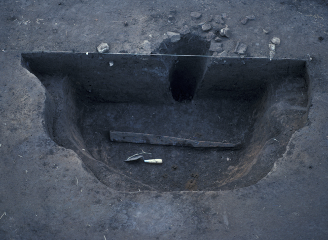
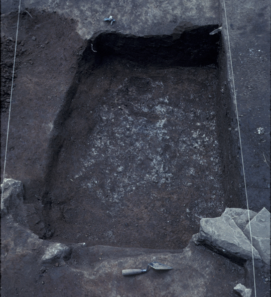
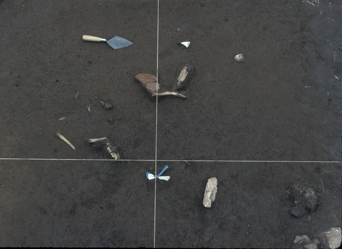
Top exposure of Feature 289, from the south.
Though Smith conducted a Field Quarter survey and some unit excavations at Cabins 1 and 2, the area comprising KES remained largely uninvestigated until Larry McKee became director of Archaeology at the Hermitage in 1990. At the beginning of his tenure, McKee established a partnership program with the organization Earthwatch which proved to be a successful involvement lasting several years. Earthwatch volunteers supervised by experienced excavators carried out fieldwork at KES and other Field Quarters during his time.
McKee established a grid system with an 1150 foot baseline, oriented to magnetic north, which served as the system used in both the shovel testing program and the later cabin excavations at the Field Quarter. Shovel tests were then dug over the entire fifteen acres at the Field Quarter in 1990, in order to build on Smith’s work and acquire data on the specific distribution of subsurface remains.
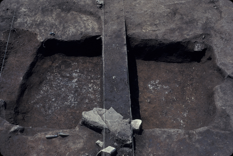
Based on shovel test pit data, including intrusion into feature fill containing animal bone, brick and ash, the area designated KES was excavated beginning in 1990 (McKee 1990, 1991). Research goals driving KES unit excavations included defining the boundaries of the ephemeral structure and yard area, and determining the chronological sequence of the site in relation to the four brick and limestone cabins to the west. Exposure of multiple subsurface features including a large cellar (F289) and possible limestone hearth base (F281), as well as the lack of limestone foundations, suggest that KES was occupied prior to the formal construction of the duplex Field Quarter cabins. Further excavation conducted in 1993 sought to complete excavation of F275, which was bisected in 1990. Six contexts excavated in May of 1993 comprise these excavations.
McKee and primary excavator Kevin Smith employed standard excavation units of ten by ten foot quadrats aligned to the same grid system and baseline used in McKee’s shovel test survey. All quadrats excavated for this site were designated by the Northeast corner northing and easting, since they were located east of the datum line for the Field Quarter excavations. Five by five foot quadrant subdivisions of the units were often used during the project in situations where a fine-grained exploration of artifact distribution was deemed necessary. These quadrants were designated beginning in the northwest and running clockwise from A to D. Given the extent of plowing and rodent burrowing present at this site, the excavators primarily excavated the quadrats in all four quadrants to achieve greater control over artifact placement due to numerous apparent but poorly defined features.
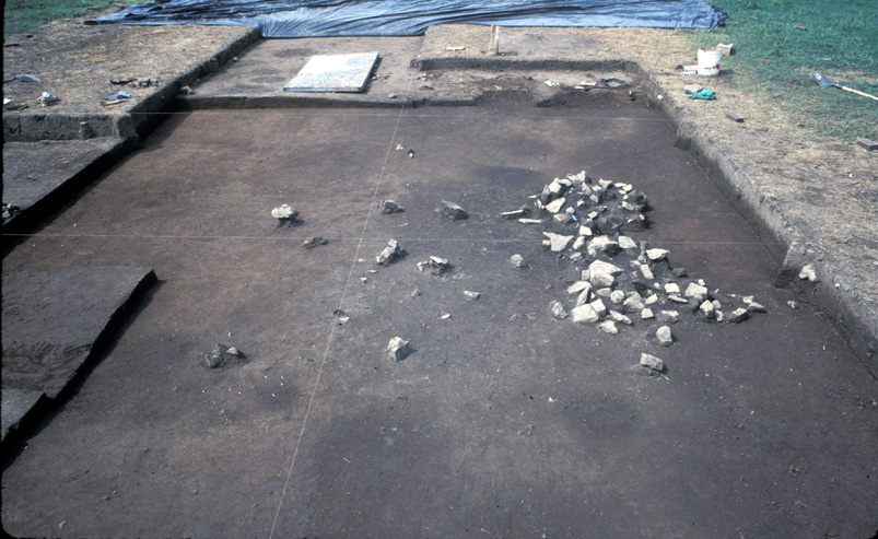
Aerial View of KES after 1990 excavations, north at top.
Most stratigraphic sequences uncovered in KES included the following strata: a well-developed sod layer (referred to by excavators as Level 1); a plowzone/other disturbance stratum, characterized by rubble scatter and scattered artifacts (Level 2A); a layer formed during primary occupation (Level 2C) wherein artifacts frequency was nearly zero except immediately around/in features and in rodent tunnels/burrows. It should be noted that, unlike the four duplex cabins, Level 2B was not identified at KES. Kevin Smith noted during excavation that “Level 2B is skipped in all units, as we appear to be excavating primary deposits.”
Soil and structural features were defined and excavated as separate entities from the level designations within quadrats. All deposits below the first sod layer were screened through quarter inch mesh. Samples from deposits of particular interest were waterscreened through eighth-inch window screen. In addition, soil samples were collected from these deposits for flotation analysis in an effort to recover any surviving micro-examples of floral remains, such as charred seeds. Photographs were taken and drawings were made whenever warranted by exposures of artifacts or features of note.
Notable Features in the KES Yard Area
During the preliminary survey of the site, a shovel test pit at grid point N150E060 intruded feature fill that included bone, brick, ash and other artifacts. The initial full-scale excavation of the feature suggested it was an oval cut measuring roughly four feet by eight feet. Designated F275, this pit was covered by brick, rubble and animal bone. This feature was bisected from north to south, with the west half excavated in 1990 and the east half in 1993. Up to a depth of 0.75 feet, the fill of the feature was dark, midden-like soil containing ash and charcoal. The lack of any adjacent structural remains suggests this feature may have been an exterior storage pit or root cellar in the yard of a nearby dwelling. This interpretation is complicated by the feature’s sloping sides, irregular shape and uneven floor, which argue against any purposeful design in its construction. It may have originated as a ‘borrow pit’ dug to obtain clay to be used in mortar, daub and chinking of the structure. This feature also yielded several notable artifacts including a fork with carved bone handle, fragments of a Chinese porcelain ‘Canton’ pattern platter and a wrought iron strap hinge. Given the location of F275 and shovel test pit data, a majority of fieldwork for this site was focused on the area south and west of this feature. Results from the excavation of the east half in 1993 yielded few artifacts, though no formal report is extant at this time.
Notable Features within the Presumed Structure of KES
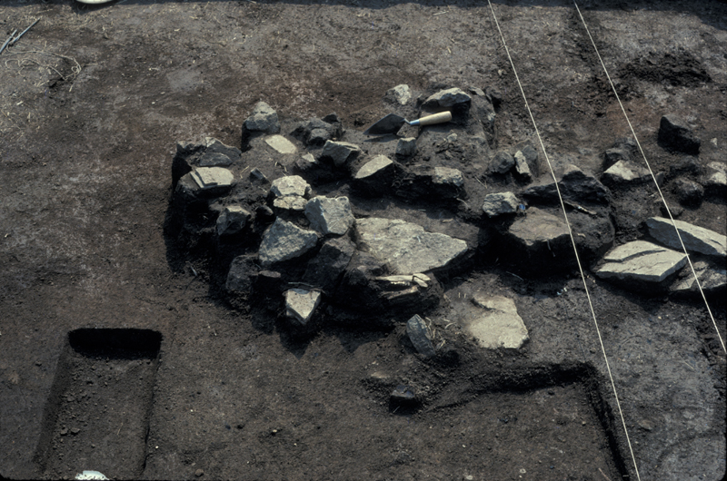
Two other features strongly define the domestic usage of this space. First, F281 was a concentration of limestone rubble that was likely the disturbed remains of a hearth.
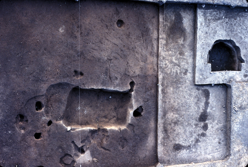
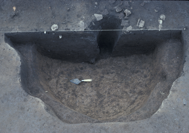
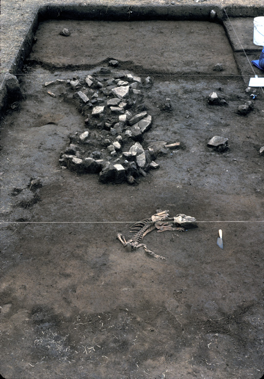
Aerial view detailing Features 275 and 289, north at left.
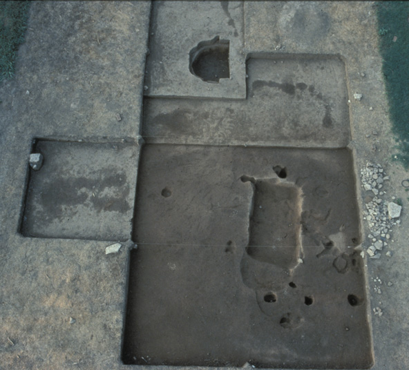
Partially below this feature, a large rectangular cut roughly 10 feet by 5 feet was uncovered. Designated F289, this feature was divided into four adjacent sections, with dividing lines running east-west, based on an apparent outline in Level 2C. The four sections from south to north, were as follows: section X (two by four feet); balk (one by four feet); section Y (four by four feet); and section Z (3 feet by unknown). Only one level excavated in these sections: Level A. This feature had two ‘levels with floors at different elevations. The upper several inches of the entire feature appear to have been scattered by later plowing. The shallower section, filled with a 1.8 inch layer of dark soil, was interpreted as a possible ‘step,’ or shelf. The second section was a relatively straight-walled pit four feet by eight feet. Bone and charcoal were present to the bottom of the feature. Overall this feature was interpreted as a pit cellar.
According to McKee’s final report, fragments of burned clay with several wood impressions from F289 provide strong evidence that the structure had a catted chimney, made from woven sticks daubed with mud. An inconsistent pattern of postholes present around F289 and F281 suggests this was a post-in-ground building. However, heavy rodent burrowing activity greatly disturbed these features complicating their interpretation as postholes. It is possible that this structure was a log dwelling, a type common to middle Tennessee during the early 19th century.
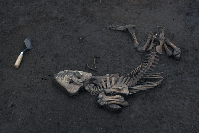
Finally, the excavations at KES also uncovered a complete, articulated skeleton of a young pig (sus scrofa), designated F285. Given its location north of the cellar and at the same stratigraphic level as the top of the cellar, this evidence suggests the pig may have been disposed of, or died within, the abandoned structure. Another articulated skeleton of a juvenile pig was uncovered in the 1995 excavations of Cabin 3 (F618). It is likely that, given the amount of meat these individuals represented, they were diseased or unusable for some reason and thus discarded in toto.
Summary of research and analysis
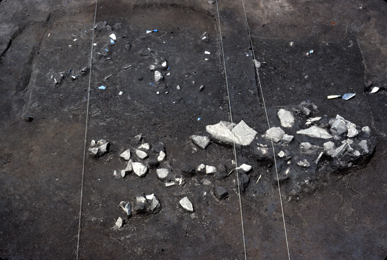
Features 289, 281 and 282, from the east.
Interpretation of the site as remnants of a domestic structure was supported by the heavy scatter of ceramic, glass, animal bone and rubble fragments found throughout the excavated layers in most of the quadrats. Three primary features provide insight into the construction and use of this structure. Feature 275 as a potential barrow pit and trash deposit suggests the usage of clay as an architectural material in the construction of the structure. Feature 281 as a potential limestone hearth echoes similar features found in other Field Quarter sites. The large unlined cellar F289 indicates the utility of these features though it lacks the formality of the brick-lined, rectangular cellars in Cabins 2 and 3. Significant rodent burrowing obscured interpretation of possible postholes and other small features in many cases within the excavation boundaries of this site. The lack of any cut limestone foundation suggests that the structure was built either of logs placed directly on the ground surface, or by post-in-ground construction. The highly disturbed nature of possible postholes obscures identification. Interpretation of the dating of this site suggested that it was occupied prior to construction of the four brick duplex cabins given the difference in structural remains and the artifacts recovered.
Larry McKee and Lynsey Bates
TRC Solutions and Digital Archaeological Archive of Comparative Slavery
November 2013
Things you need to know about Field Quarter KES before you use the data:
- The DAACS Project ID for KES is “1403.” All KES contexts and artifact IDs begin with this prefix. A two-digit year representing the field season in which it was excavated, followed by a two-digit project number assigned to work at KES for 1990, follows the Project ID for all Contexts and Artifact IDs. KES was excavated in 1990, with several additional excavations in 1991 and 1993. All contexts for KES have Contexts beginning with “1403-90-” Although additional contexts were excavated in subsequent years, these contexts were given a “90” context register number. Feature numbers followed the single, non-duplicating list of feature numbers initiated in 1976.
- The Hermitage employed the “CRN” or “Context Register Number” system for artifact and context management, which DAACS has retained. CRNs were assigned in the field as consecutive three-digit numbers to contexts and their respective artifacts in the order they were dug, and were independent of provenience information. Context/provenience information is found in the DAACS Context Record.
- The site grid for KES is based on the Field Quarter datum established by Larry McKee in the 1990s. Quadrats and all contexts excavated within them are identified with a Quadrat ID based on the coordinates for the northeast corner of that unit: a Northing followed by an Easting, e.g. N240E010. This convention was defined since the units were east of the datum line, and to avoid naming the units with a zero easting/westing. All measurements are in feet and tenths-of-feet.
- Contexts were excavated by natural layer. Based on stratigraphy seen elsewhere at the Field Quarter, identified natural layers/strata were interpreted and referred to in corresponding paperwork as Levels 1, 2A, and 2C. Chief excavator Kevin E. Smith noted during excavations of KES that Level 2B was skipped in all units, since primary deposits were recovered below Level 2A. Level 1 is interpreted as Topsoil, 2A is interpreted as a plowzone layer, and 2C as an occupation layer.
- Features were often bisected, though not in all cases. Significant rodent burrowing obscured interpretation of features in many cases. Refer to “Excavator Descriptions” for individual feature clarification.
KES Artifact Data
DAACS analysts cataloged to DAACS standards all of the artifacts from KES except for artifact types that fall into the “All Other Artifacts” category. This means that all beads, buckles, buttons, ceramic vessels, glass vessels, tobacco pipes, and utensils that were present in the collection were physically examined and cataloged by DAACS staff. Data about objects that fell into the “All Other Artifacts” category, such as brick, nails, mortar, window glass, tools, metal pots, etc. (See All Other Artifacts for complete listing of all artifact forms) were entered into DAACS from previous artifact catalogs produced by the Hermitage Archaeology Lab. This means that any artifacts with “Hermitage” as the Cataloger/Editor will have basic attribute data, such as form and material type, but not the complete set of DAACS attributes. If you receive data that does not contain measurements or decorative data, please use an advanced query (such as AQ5) to see who cataloged the artifact.
Feature Numbers
The original excavators of the KES site assigned numbers to individual features. Between 1987 and 2003, all archaeological features identified at The Hermitage were assigned consecutive feature numbers, regardless of excavation year and location on the property. For example, the first feature identified at the beginning of Larry McKee’s field work in 1987 was Feature 1. By the end of the excavation season in 2003 over 900 features had been identified and excavated at The Hermitage since 1987.
Feature numbers at the KES site range, non consecutively, between 275 and 310. Since KES feature numbers were assigned by the excavators, they do not have a F-prefix in the database as DAACS-assigned feature numbers do.
Feature Groups
Feature groups are sets of features whose spatial arrangements indicate they were part of a single structure (e.g. structural postholes, subfloor pits, and hearth) or landscape element (e.g. postholes that comprise a fenceline). Feature Groups at The Hermitage were assigned by DAACS and they have a FG-prefix, which precedes the number (i.e. FG01 equals Feature Group 1).
| Feature | Feature Type | Contexts |
|---|---|---|
| 275 | Pit, unidentified | 90-01-065, 90-01-160, 90-01-076, 90-01-085, 90-01-086, 90-01-267, 90-01-263, 90-01-264, 90-01-265, 90-01-266 |
| 281 | Hearth, possible | 90-01-116, 90-01-131, 90-01-170, 90-01-189, 90-01-109 |
| 282 | Unidentified | 90-01-124, 90-01-180, 90-01-190 |
| 283 | Unidentified | 90-01-247 |
| 285 | Pit, unidentified | 90-01-137 |
| 287 | Unidentified | 90-01-149 |
| 289 | Cellar | 90-01-167, 90-01-176, 90-01-177, 90-01-208, 90-01-222, 90-01-223, 90-01-203, 90-01-196, 90-01-193, 90-01-202, 90-01-204, 90-01-216, 90-01-209, 90-01-230, 90-01-231 |
| 292 | Posthole, possible | |
| 293 | Posthole, possible | |
| 294 | Posthole, possible | |
| 295 | Posthole, possible | |
| 296 | Unidentified | 90-01-171 |
| 303 | Unidentified | |
| 305 | Unidentified | |
| 306 | Unidentified | |
| 307 | Posthole | |
| 308 | Posthole, possible | |
| 309 | Posthole, possible | |
| 310 | Animal Hole |
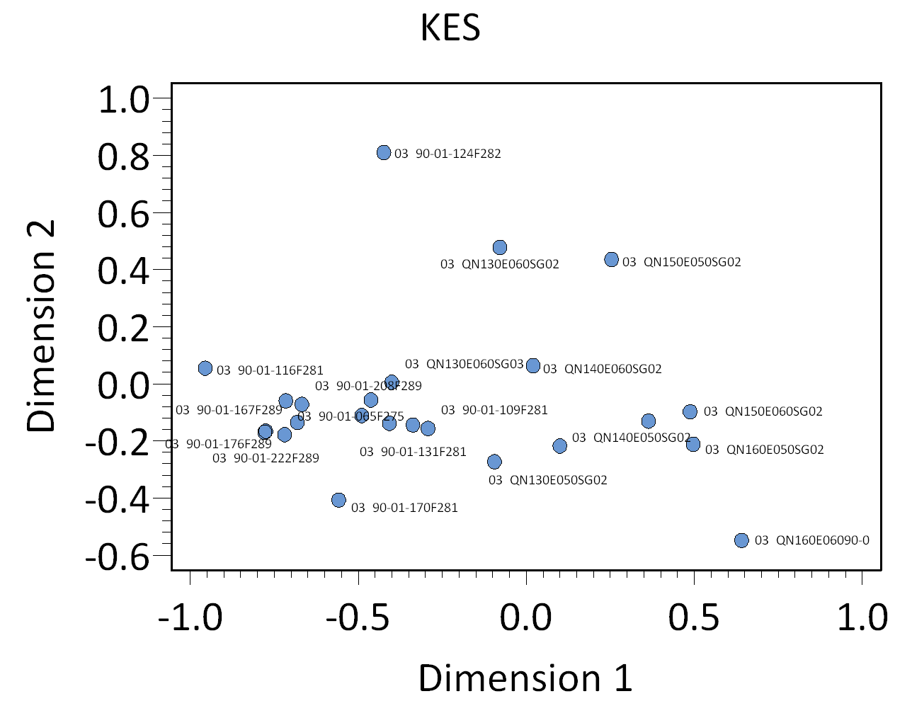
Figure 1. Plot of contexts along CA Dimensions 1 (Inertia 44.8%) and 2 (Inertia 22%). Time runs left (early) to right (late).
Intra-Site Chronologies
DAACS staff performs a standard set of analyses to produce a seriation-based intra-site chronology for each site included in the Archive. We aspire to use the same analytical methods for each site, specifically correspondence analysis and ware-type manufacturing dates, to develop and assign ceramic assemblages from excavated contexts to site-specific occupation phases (see Neiman, Galle, and Wheeler 2003 for technical details). We provide a mean ceramic dates (MCD, BLUE MCD) and terminus post quem (TPQ, TPQp90, TPQp95) for each intra-site phase. The phases are recorded in the DAACS Phase field of the database.
The use of common analytical methods is designed to increase comparability among phases at different sites. The methods, any changes we made to those methods that are specific to the site and the phase assignments our methods produce are summarized below. DAACS encourages users of Archive data to help explore improvements to our methods.
For some sites, the original excavators developed intra-site chronologies and, where these exist, they are described on the Background page for the site. In the case of The Hermitage’s KES site, the principal investigators did not develop a chronology for the site. The DAACS chronology presented here is the only current chronology for the site.
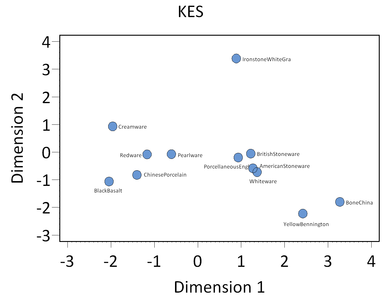
Figure 2. Plot of Ware Types along CA Dimensions 1 (Inertia 44.8%) and 2 (Inertia 22%).
DAACS Seriation Method
As with other sites in the Archive, the seriation chronology for the KES site was derived from ceramic assemblages aggregated at the level of stratigraphic groups and individual contexts not assigned to stratigraphic groups. To reduce the noise introduced by sampling error, only ceramic assemblages with more than 5 sherds and more than two ceramic types were included. The seriation chronology presented here is the result of a correspondence analysis (CA) of ware-type frequencies from contexts that meet these requirements (Figures 1 and 2).
The CA results produced a strong correlation between Dimension 1 scores and MCDs (Figure 3), suggesting that Dimension 1 represents time from left (early) to right (late). The KES site represents the earliest pre-brick structure occupation at The Field Quarter and the CA chronology and resulting occupational phases confirms this. Based on the dips in ceramic counts observed in a histogram of Dimension 1 scores, where the vertical axis measures ceramic assemblage size, we divided the site into four occupational phases (Figure 4).
KES Site Phases
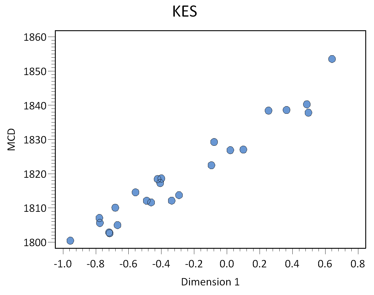
Figure 3. CA Dimension 1 scores plotted against Mean Ceramic Dates.
DAACS Phases are groups of assemblages that have similar correspondence-analysis scores, similar MCDs, or both, and are therefore inferred to be broadly contemporary. Phases have a P-prefix that precedes the phase number (e.g. P01 equals Phase 1).
Mean ceramic dates for the site-specific phases are given in the table below. The table also includes three estimates of the ceramic TPQ for each phase. The first TPQ estimate is the usual one – the maximum beginning manufacturing date among all the Ware types in the assemblage. The second and third estimates — TPQp90 and TPQp95-are less sensitive to excavation errors and taphonomic processes that might introduce a small amount of anomalously late material into an assemblage were used. A TPQp90 is the 90th percentile of the beginning manufacturing dates among all the sherds in the assemblage, based on their ware types. A TPQp95 provides a robust estimate of a phase’s or site’s TPQ based on the 95th percentile of the beginning manufacturing dates for all the ceramic ware types comprising it.
| Phase | MCD | BLUE MCD | TPQ | TPQp90 | TPQp95 | Total Count |
|---|---|---|---|---|---|---|
| P01 | 1807 | 1803 | 1820 | 1775 | 1775 | 230 |
| P02 | 1815 | 1807 | 1840 | 1820 | 1820 | 283 |
| P03 | 1827 | 1814 | 1840 | 1820 | 1840 | 941 |
| P04 | 1839 | 1823 | 1840 | 1820 | 1840 | 72 |
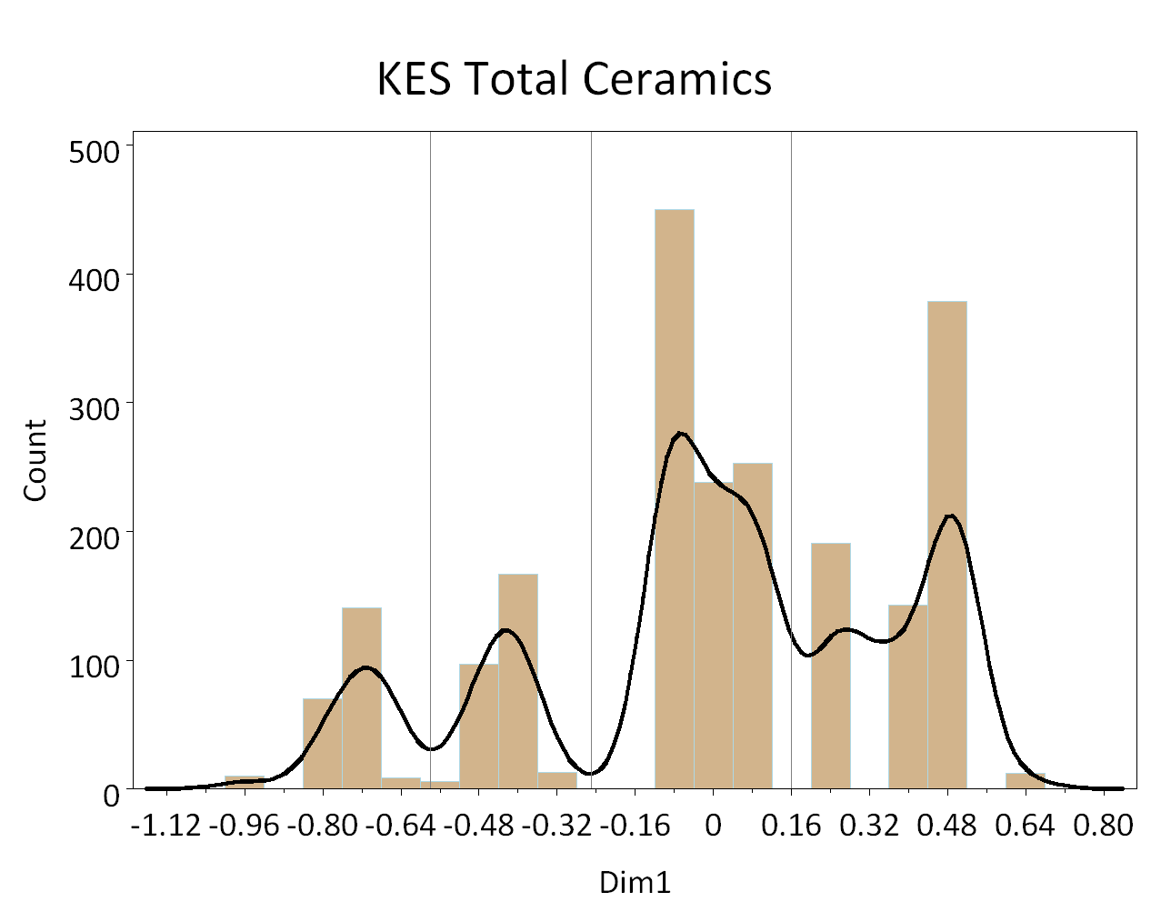
Figure 4. Historgram of ceramic counts plotted along CA Dimension 1. The lines indicate DAACs phase divisions, with phase 1 on left, phase 4 on right.
Phase 1 is comprised of ceramic assemblages from stratigraphic groups located within the pit features, 289, an unlined subfloor pit, and 275, a likely borrow pit. McKee argues that these pit features, along with the lack of brick and limestone architecture, indicate that the KES site represents a central component of the earliest settlement at the Field Quarter. The KES phasing supports this argument; the seriation of its ceramic assemblages indicate it is the earliest dated domestic site identified at The Hermitage to date.
Phase 2 is comprised of assemblages from Feature 281, a likely hearth feature adjacent to, and east of, the subfloor pit (289) and Feature 282, an amorphous feature with limestone fragments, that was combined, post excavation, with Feature 281. Both features were discovered at the base of Level 2C intruding into subsoil. Assemblages from Stratigraphic Group 3 from quadrats N130E50, N130E60 and N140E60, the sediment directly above and around Features 281 and 282, also make up Phase 2.
Phases 3 and 4 are comprised of assemblages derived primarily from Stratigraphic Group 2, which likely represents yard refuse and discard from the post-1820 occupation of The Field Quarter by slaves who lived in the four brick duplexes (Cabins 1 through 4).
KES Site-wide Mean Ceramic Date and Terminus Post Quem

Figure 5: Plot of contexts along CA dimensions 1 and 2, color coded by DAACS Phase to highlight synchronic variation.
The site-wide Mean Ceramic Date points to the occupation’s temporal placement in the 1820s. However the site’s Blue MCD, a date which gives less influence to ceramics types with long manufacturing spans, places the occupation’s mid-point at 1813. We also provide three site-wide ceramic ware-type TPQs.
| Site | MCD | BLUE MCD | TPQ | TPQp90 | TPQp95 | Total Count |
|---|---|---|---|---|---|---|
| KES | 1826 | 1813 | 1840 | 1820 | 1840 | 3003 |
A Seriation Chronology for The Hermitage’s KES site
The following table presents a seriation chronology for the KES site. We use the indefinite article to signify that it is not the only chronology possible, nor the best. We encourage users of Archive data to help explore improvements.
The stratigraphic relationships among stratigraphic groups and unassigned contexts are summarized in the Harris Matrix for the site. DAACS phase assignments from the seriation are shown on the Harris Matrix in color, facilitating comparison of the seriation chronology and the stratigraphic chronology of the site.

Figure 6. Plot of contexts along CA dimensions 1 and 2, color-coded by DAACS phase and labeled with assemblage name.
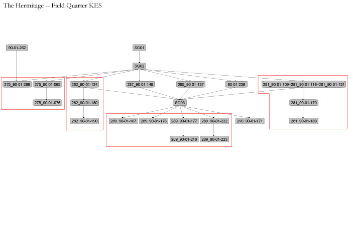
KES Harris Matrix
The Harris Matrix summarizes stratigraphic relationships among excavated contexts and groups of contexts that DAACS staff has identified as part of the same stratigraphic group. Stratigraphic groups and contexts are represented as boxes, while lines connecting them represent temporal relationships implied by the site’s stratification, as recorded by the site’s excavators (Harris 1979).
Stratigraphic groups, which represent multiple contexts, are identified on the diagram by their numeric designations (e.g. SG01). Contexts that could not be assigned to stratigraphic groups are identified by their individual context numbers (e.g. 90-01-239).
Boxes with color fill represent contexts and stratigraphic groups with ceramic assemblages large enough to be included in the DAACS seriation of the site (see Chronology). Their seriation-based phase assignments are denoted by different colors to facilitate evaluation of the agreement between the stratigraphic and seriation chronologies. Grey boxes represent contexts that were not included in the seriation because of small ceramic samples.
See KES Chronology for stratigraphic and phase information.
This Harris Matrix is based on data on stratigraphic relationships recorded among contexts in the DAACS database. It was drawn with the ArchEd application. Seehttp://www.ads.tuwien.ac.at/arched/index.html.
For a printable version, download the Harris Matrix [469.22 KB PDF].

PDF of composite excavator’s plan, compiled by DAACS from original field drawings, with excavation units and features labeled.
PDF of composite excavator’s plan, compiled by DAACS from original field drawings, with only excavation units labeled.
PDF of composite excavator’s plan, compiled by DAACS from original field drawings, with only features labeled.
Battle, Whitney
2010 Sweepin’ Spirits: Power and Transformation on the Plantation Landscape, In Archaeology and the Preservation of Gendered Landscapes, S. Baugher and S.M. Spencer-Wood, editors. Springer
Battle, Whitney
2004 A Space of Our Own: Redefining the Enslaved Household at Andrew Jackson’s Hermitage Plantation, In Household Chores and Household choices: Theorizing the domestic Sphere in Historical Archaeology, edited by K. Barile and J. C. Brandon. University of Alabama Press, Mobile.
Battle, Whitney
2011 Black Feminist Archaeology, Routledge, New York.
Galle, Jillian E.
2006 Strategic Consumption: Archaeological Evidence for Costly Signaling among Enslaved Men and Women in the 18th-Century Chesapeake. Unpublished Ph.D. dissertation, Department of Anthropology, University of Virginia, Charlottesville, Virginia.
Harris, Edward C.
1979 Principles of Archaeological Stratigraphy. Academic Press, London, England.
McKee, Larry
1991 Summary Report of the 1990 Hermitage Field Quarter Excavation. Tennessee Anthropological Association Newsletter 16(1):1-17.
McKee, Larry
1995 The Earth Is Their Witness, The Sciences. March/April.
Russell, Aaron E.
1997 Material Culture and African-American Spirituality at the Hermitage Historical Archaeology, Vol. 31, No. 2 (1997), pp. 63-80.
Smith, Samuel D.
1976 An Archaeological and Historical Assessment of the First Hermitage. Tennesse Division of Archaeology Research Series No. 2. Published by the Tennesse Division of Conservation, Nashville, Tennesse.
Thomas, Brian W., and Larissa Thomas
2004 Gender and Presentation of Self: An Example from The Hermitage, In Engendering African American Archaeology: A Southern Perspective. University of Tennessee Press, Knoxville.