
| Location: | Montpelier, St. James Parish, Jamaica |
|---|---|
| Occupation Dates: | Last-quarter 18th through second-quarter 19th century. Phasing and mean ceramic dates can be found on the Chronology Page. |
| Excavator(s): | Barry Higman with the collaboration of Tony Aarons and Robert Riordan |
| Dates excavated: | 1973-1980 |

Overview

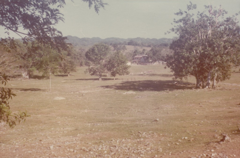
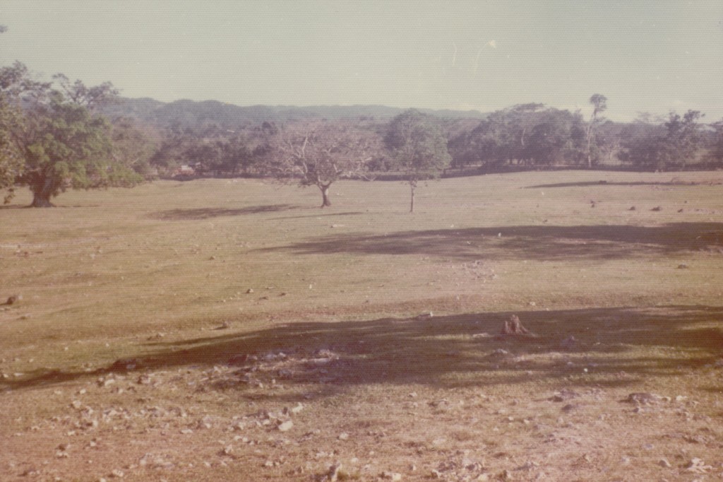
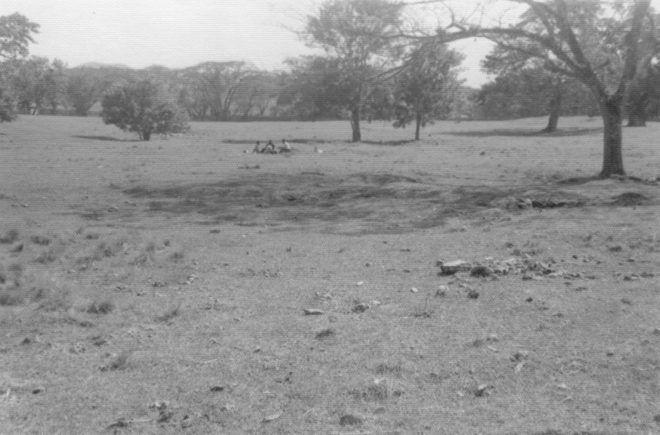
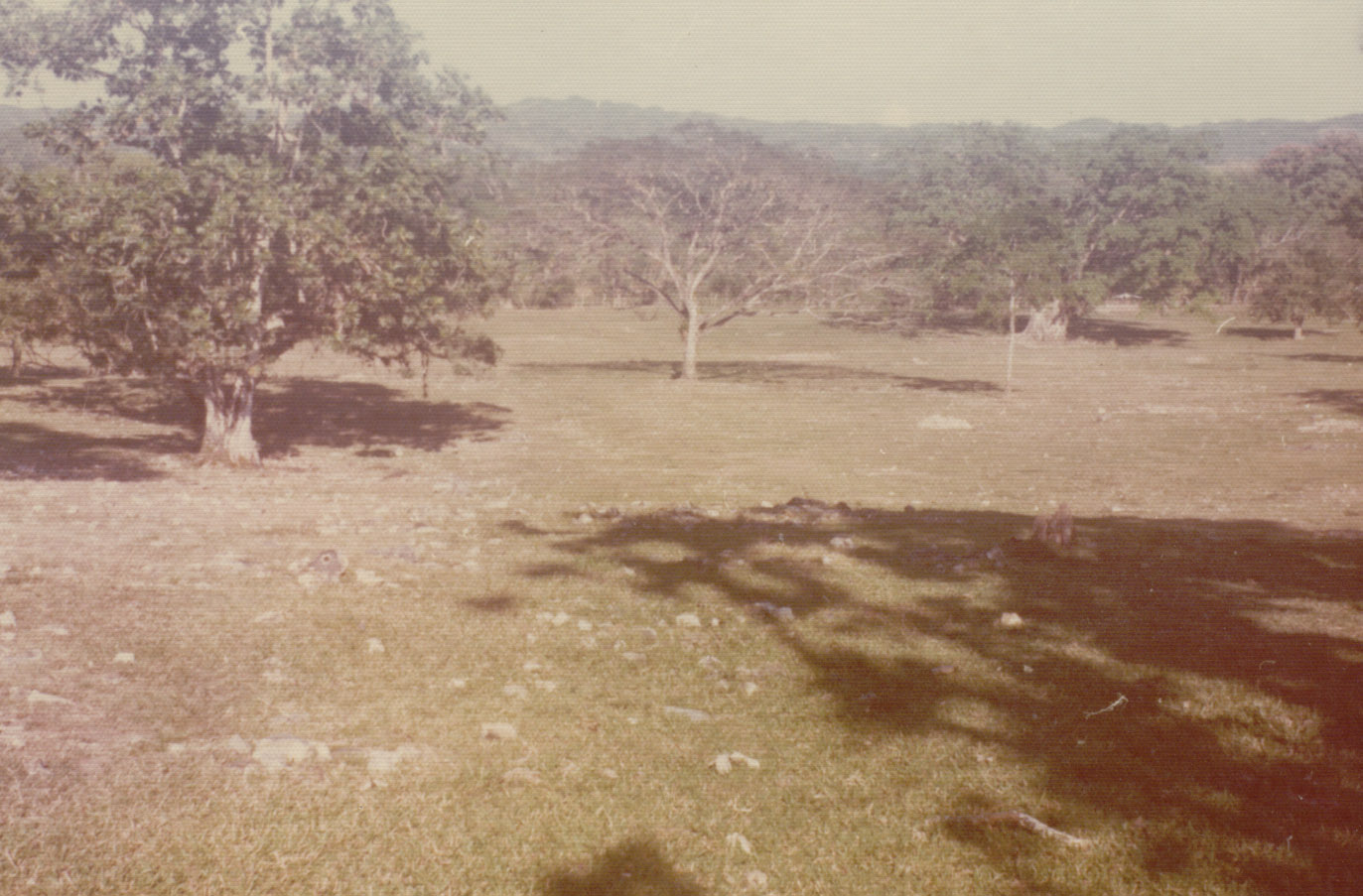
View of the New Montpelier Village looking over the “hilltop” area from the north. Photograph taken January 1976.
During the 1970s, eight quadrats were excavated by Higman in order to investigate landscape features and yard spaces at the New Montpelier Slave Village. These quadrats can be broken into two spatially distinct groups. The first group is comprised of five trenches located in the northern half of the slave village. Initially these trenches were associated with House 26. The second group consists of three quadrats located in the southern half of the village. The southern yard quadrats were initially associated with House 37.
In most cases these units were several hundred feet away from the house with which they were associated. DAACS wanted to capture the data in these units but also wanted to separate them from this often distant house designation. In 2006, DAACS staff, in consultation with Higman, designated both groups of quadrats as contexts separate from the excavated houses. A separate project number was given to these yard contexts (1204). The Before You Begin page for the Montpelier Yard Contexts describes this separation in greater detail.
Documentary Evidence
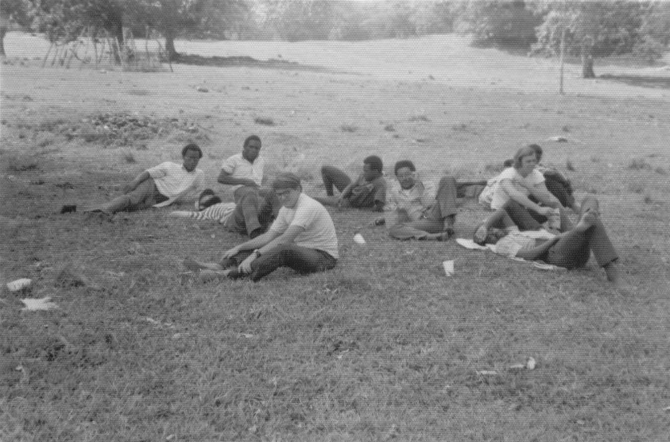
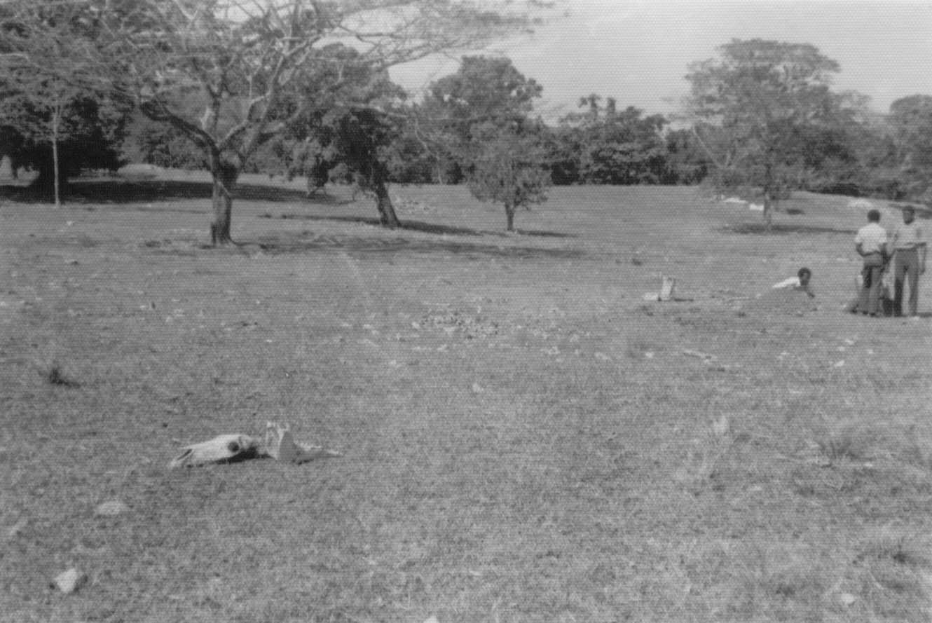
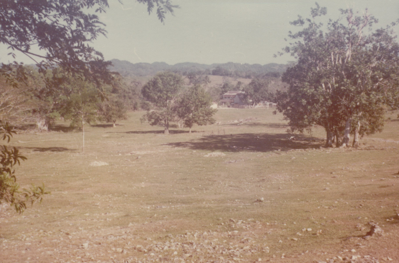
View of New Montpelier Village, with students from the University of West Indies and Johns Hopkins University in the foreground. Photograph taken February 1973.
Very little documentary evidence exists that mentions explicitly the use of yard space within the New Montpelier Slave Village. An 1825 report on Montpelier indicates that gardens at New Montpelier covered over 20 acres. This report was published in the British Parliamentary Papers in 1832 and conflicts with the 1821 plan of the site which suggests that gardens covered 16 acres at the slave village (Higman 1998:341). No other documentary data exists that describe how the slave village yard areas were used.
The entire village, as defined by its exterior walls, measured around 16 acres and it can be broken into three topographical areas. Higman notes that “the northern quarter located closest to the works, was relatively level and partially waterlogged during the wet season. The second section sloped steeply, rising 30 feet over a distance of just 40 yards. The third section, covering the southern half of the site, formed an elevated plateau from which it was possible to look down on the great house and works and to take in part of the vista across the valley” (1998:143).Some of the garden acreage mentioned in the 1825 report was most likely located in the slave village.
Excavation history, procedure and methods

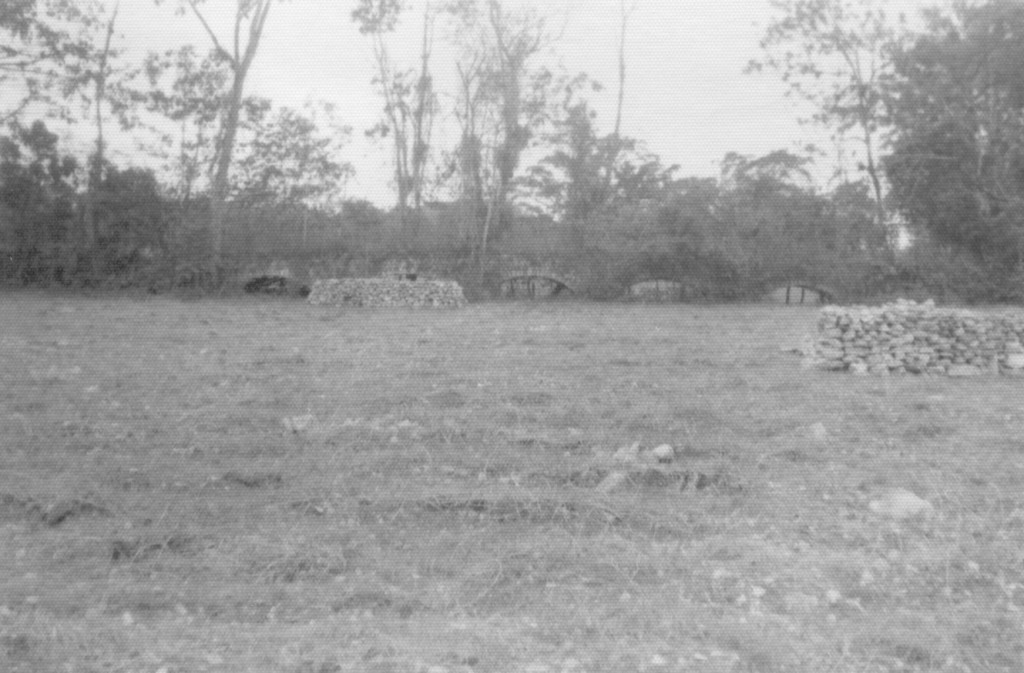
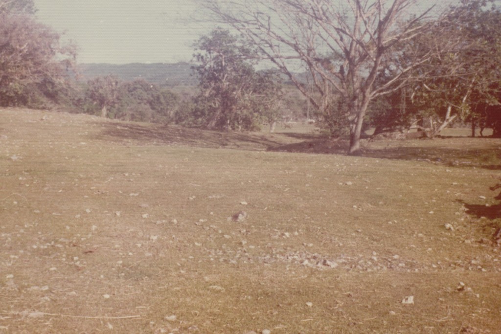
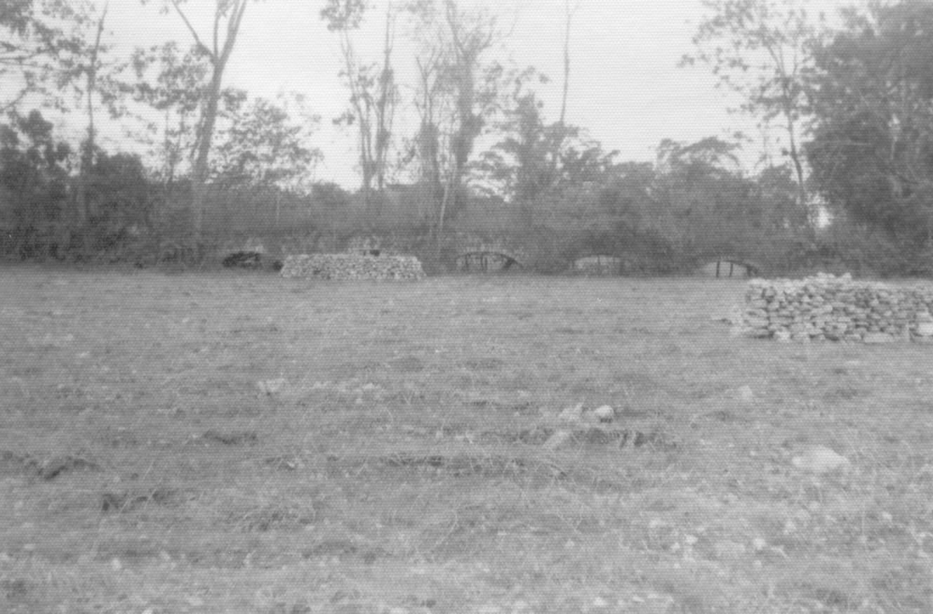
View of the New Montpelier Village looking northeast across the “pathway” toward the area labeled on 1821 map as “Guinea Grass” and “Pen”. Photograph taken January 1976.
Surface survey and excavation of the New Montpelier Slave Village commenced in 1973 and continued until 1980. These projects were led by Barry Higman and Tony Aarons and included students from the University of the West Indies, staff from the Port Royal Archaeological Project, and volunteers. Elevations were taken using the plane table and tied to a local datum, and a north-south grid established, for the entire village site.
Excavation was principally by levels of varied depth and excavation units or quadrats linked to the site grid, though construction trenches and other special features were treated separately. Most of the excavation was achieved using hand tools, generally trowels and brushes. Screening was used throughout most of the yard contexts, using a 1/8 inch screen, but no flotation.
The first yard quadrat, E52/N4, was excavated during the 1973 season. This 12 x 4 foot exploratory trench was placed across the sunken pathway that is represented on the village site map. Four 20 x 2 foot trenches were subsequently placed along the datum’s baseline (W40/N2, W80/N2, W120/N2, W160/N2) in 1975. These quadrats, along with E52/N2, comprise the northern group of yard contexts excavated by Higman.
The second group of yard contexts, located in the southern half of the village, is comprised of three 10 x 10 foot quadrats (N160/S450, N160/S500, W60/S450). Only these southern quadrats contained ceramics. A mean ceramic date and TPQs for these quadrats are located on the Chronology Page.
Summary of research and analysis
Although little analysis of the archaeological data from the yard contexts has occurred, Higman conducted extensive historical research of the yard and village landscape, which is discussed in detail in his 1998 book, Montpelier Jamaica: A Plantation Community in Slavery and Freedom, 1739-1912.
The New Montpelier village measured around 16 acres and was bounded on three sides by stone walls, with its northern boundary formed by the masonry aqueduct that powered the sugar mill. The substantial stone wall along the eastern edge of the village was four feet wide at its base and ran for over 300 yards. Higman notes that it separated the slave village from the adjoining “pasture planted in Guinea grass, as shown on the plan of 1821” (1998:143). Stone walls located within the village suggested to Higman the presence of yards created by multiple-household families to demarcate space. He writes that “The obviously important role of permanent, stone walls within the village, however, demonstrated equally the political significance of space and the worker’s desire to establish boundaries internal to the village, defining the individuals (generally kin) with rights to use the resources of that space” (1998:144).
The village also contained a system of pathways not recorded on historic maps or plats. A number of these paths were visible during surface survey in the 1970s but are now completely obscured by the bush. One pathway, which ran along the eastern boundary of the village, appears to have served as the main route connecting the village to the sugar works to the north and the Great River to the south (1998:144).
The eight excavated yard quadrats contain few artifacts. Only the southern group of quadrats (N160/S450, N160/S500, W60/S450) contained ceramics. The mean ceramic date for these quadrats is 1818 with a TPQp95 of 1830. Please see the Chronology page for more details on dating the yard contexts.
Jillian Galle and Barry Higman
The Digital Archaeological Archive of Comparative Slavery and Australian National University
January 2007
Things you need to know about the Montpelier Yard Contexts before you use the data
- During the 1970s, Higman excavated a number of trenches and test units in yards and other open areas throughout the New Montpelier slave village. At the time of excavation, these units were associated with the nearest excavated slave house. In many cases these units are several hundred feet away from their associated house. DAACS wanted to capture the data in these units but also wanted to separate them from their often distant house designation. We therefore created a separate project number (1204) for Montpelier Yard Contexts.
- There are two numbering systems for houses at the Montpelier slave village. Both systems were implemented by Barry Higman. Higman numbered the New Montpelier slave houses while in the field in the 1970s and renumbered the houses for his 1998 book on Montpelier Plantation (Higman 1998). The DAACS analysis has adopted the numbering system used by Higman in his published work. We provide the old numbering and new numbering information here as anyone returning to the original field notes will need to convert the old field numbers to the new numbering system.
Old house numbers used in 1970s field notes and artifact logs. New house numbers used in Higman 1998 and by DAACS. Contexts assigned to houses by Higman but designated as yard contexts by DAACS DAACS Project ID House 1 House 26 008, 034, 035, 036, 037 1204 House 14 House 37 255, 256, 257, 258, 259, 260, 261, 262 1204 - The New Montpelier Slave Village and Sugar Works maps available on the Site Images Page are compiled from different sources. The sugar works section of the map is an optimal estimate of the c. 1834 layout, based on documentary references of building locations as well as a field survey conducted by Higman of existing structures in the mid 1970s. The complete slave village area was mapped in 1976 during which all architectural elements still visible on the landscape were plotted. The Slave Village and Sugar Works maps were then aligned using GPS points acquired during a 2006 visit to the New Montpelier site by DAACS crew and Higman. Additionally, two foot contours are available for the slave village area based on a comprehensive landscape survey carried out during the mid to late 1970s Higman.
- Field measurements are in feet and tenths-of-feet.
- Expansion in geographic coverage has required that DAACS staff work outside of the Chesapeake region and move beyond their main laboratory at Monticello. DAACS undertook its first international project during the first five months of 2006 when it moved its lab to Kingston, Jamaica. The DAACS Jamaica team consisted of Ms. Leslie Cooper, DAACS Archaeological Analyst, Mr. Henry Sharp, DAACS Archaeological Analyst, and Dr. Jillian Galle, DAACS Project Manager. DAACS staff spent 2.5 months analyzing archaeological collections curated by the University of West Indies Department of History and Archaeology and 2.5 months working with collections curated by the Jamaica National Heritage Trust.
Important information about the Montpelier Collections
The following sections include information about the Montpelier collections in general as well as specific details about the Montpelier yard contexts. They contain important information about unprovenienced artifacts and artifacts that were missing from the collection. It is essential that researchers review these sections carefully before beginning their analysis.
The New Montpelier collections are over 30 years old and have been curated by a number of different archaeolgists and Jamaican institutions. As a result, DAACS uncovered two major problems with the collections: missing artifacts and missing or incomplete contextual information for existing artifacts. These problems, and our solutions to these problems, are described below. A general discussion of the difficulties is first provided, followed by detailed discussion of site by site concerns. We hope this document will serve as our best understanding of the history of the New Montpelier collections and will guide future researchers’ work with these materials. Please do not hesitate to contact daacs@monticello.org with any additional questions about the Montpelier collections.
Missing Artifacts
New Montpelier was excavated between 1973 and 1980. A memo on file at the Univesity of West Indies, Mona archaeology laboratory that dates from the late 1980s as well as personal communication with Higman indicate that all artifacts from the New Montpelier excavations were processed in the early 1980s at the Jamaica National Heritage Trust’s archaeological facility located in the Naval Hospital in Port Royal, Jamaica. Once processed, the artifacts were curated by the JNHT until the late 1980s. In 1987, U.W.I.’s Department of History hired Kofi Agorsah as its first full-time archaeologist. Shortly after his hire, the New Montpelier collections were moved from the Naval Hospital to the University of West Indies campus. Higman indicates that some New Montpelier artifacts remained on exhibit at the Trust. Hurricane Ivan (2004) caused significant damage to the Naval Hospital and the facility has remained closed due to structural damage since the storm, although it continues to house archaeological collections curated by the JNHT.
As is discussed in greater detail below, DAACS staff discovered that all ceramics for Montpelier House 14 were missing from the collections housed at U.W.I. Smaller percentages of ceramics from other houses were missing and we could not find a number of significant, non-ceramic objects described by Higman in his artifact logs. It is likely that some of these objects were on exhibit at the JNHT prior to Hurricane Gilbert, which struck Jamaica in 1988 and which hit Port Royal and the Naval Hospital particularly hard. During our work at the Trust, Dr. Galle (DAACS Project Manager) had several discussions with Mrs. Anne-Marie Howard Brown, curator for the JNHT, about the Montpelier collections. Mrs. Howard-Brown indicated that she had recently seen one or two boxes of Montpelier artifacts at either the Naval Hospital or Headquarters House, the current location for the JNHT’s Department of Archaeology. Unfortunately, JNHT staff was unable to locate these artifacts during DAACS’s time in Jamaica. We conclude that most, if not all, of the missing New Montpelier collections remain at the Jamaica National Heritage Trust or were lost in the damage incurred by Hurricanes Gilbert and Ivan.
Missing Contextual Information for Artifacts
When the New Montpelier artifacts were initially processed, Higman and his staff used ink and nail polish to label all of the ceramic and tobacco pipe sherds from New Montpelier with their appropriate contextual information. Personal communication with Higman indicates that these labeled artifacts were bagged by context with other artifacts from the same contexts. These artifacts were subsequently stored at the Naval Hospital in Port Royal.
After the Montpelier artifacts were transferred to U.W.I., they appear to have been used as part of a teaching collection. A number of class projects completed in the late 1980s and early 1990s have survived. They indicate that subsets of the New Montpelier collection were given to students to inventory. At some point during this inventory process a decision was made to ignore horizontal context designations and to group all of the New Montpelier artifacts by stratigraphic level. When we arrived at U.W.I., we therefore discovered that all artifacts had been bagged by stratigraphic level within each House and that most artifacts had been removed from their context or unit designations. The only artifacts that retained contextual information were those ceramic and tobacco pipe sherds labeled by Higman in the early 1980s. This meant that we encountered boxes full of artifacts labeled “House 1, Level 1,” “House 1, Level 2,” etc., however no context information within levels was retained. Vertical control had been retained for the New Montpelier artifacts but horizontal control had been eliminated. All artifacts except for ceramics and tobacco pipes have no horizontal contextual data and the physical reanalysis of these artifacts can now only be conducted on the most general site-wide level.
Since the majority of ceramic and tobacco pipe sherds had context labels, DAACS staff was able to physically reanalyze these ceramic and tobacco pipes sherds to DAACS standards. We were also able to place most beads and buttons in their correct contexts based on photographs that Higman had labeled with context numbers. Beads and buttons that could be reliably provenienced were cataloged to DAACS standards. Any ceramic, tobacco pipe, bead or button that could not be placed with certainty into a context was cataloged as an unprovenienced artifact within its correct house number (i.e. House 37-UNPROV). Examples of unprovenienced artifacts include ceramics whose ink labels were illegible or were partially missing with enough data to indicate the sherd was from a specific house. In other cases we might have known that an artifact was from a specific house due to its bag or box label but we could not assign it to a context. An “UNPROV” context was created by DAACS for each of the four houses analyzed. House 37 has a context known as “1203-UNPROV,” House 26 has “1202-UNPROV,” House 14 has “1200-UNPROV,” and House 24 has “1201-UNPROV.”
The remainder of the artifacts (glass, nails, brick, tools, utensils, etc.) had no context information associated with them. Fortunately, Higman’s artifact logs were exceptionally detailed and basic information for these artifact classes were entered into their appropriate context within the DAACS database. The artifacts entered into the DAACS database using Higman’s paper artifact catalog have general descriptions but no measurements, color descriptions, manufacturing technique information, and so forth.
Details on the Analysis of All Artifact Classes
As noted above, the majority of ceramic and tobacco pipe sherds had context labels. DAACS staff was able to physically reanalyze these ceramic and tobacco pipes sherds to DAACS’s standards using our cataloging protocols. We were also able to place most beads and buttons in their correct contexts based on photographs that Higman had labeled with context numbers. Beads and buttons that could be reliably provenienced were cataloged to DAACS standards. Any ceramic, tobacco pipe, bead or button that could not be placed with certainty into a context was cataloged as an unprovenienced artifact within its correct house number (i.e. House 37-UNPROV). Examples of unprovenienced artifacts include ceramics whose ink labels were illegible or were partially missing with enough data to indicate the sherd was from a specific house. In other cases we might have known that an artifact was from a specific house due to its bag or box label but we could not assign it to a context.
All other artifact classes (glass vessels and objects, nails, brick, tools, utensils, etc.) in the Montpelier collections had no context information associated with them. Fortunately, Higman’s artifact logs were exceptionally detailed and basic information for these artifact classes were entered into their appropriate context within the DAACS database. The artifacts entered into the DAACS database using Higman’s paper artifact catalog have general descriptions but no measurements, color descriptions, manufacturing technique information, or other DAACS cataloging protocols completed.
Montpelier Yard Collections
Although the preceding discussion applies to the entire Montpelier collection, we also encountered peculiarities specific to each area analyzed. This section summarizes our work with the collections from the quadrats placed in yard spaces throughout the Montpelier slave village and provides artifacts counts, information on missing artifacts and estimates of the percentage of artifacts missing.
The following table provides a summary of the artifacts from yard contexts. All ceramics, tobacco pipes, beads, and buttons were analyzed by DAACS analysts to DAACS standards. Basic information for the remaining artifacts was entered into the database from the paper finds list. Researchers doing spatial analyses should be aware that 25% of the beads from yard contexts were unprovenienced.
| Montpelier Yard Contexts | Total Cataloged Artifacts | Unprovenienced Cataloged Artifacts (percentage of artifact class that is unprov) ¹ | Missing Artifacts (Percentage of Artifacts Missing)² |
|---|---|---|---|
| Beads | 4 | 1 (25%) | N/A |
| Buckles | 0 | 0 (0%) | N/A |
| Buttons | 21 | 0 (0%) | N/A |
| Ceramics | 122 | 0 (0%) | N/A |
| All Other Artifacts | 599 | 0 (0%) | N/A |
| Glass | 464 | 0 (0%) | N/A |
| Tobacco Pipes | 15 | 0 (0%) | N/A |
| Utensils | 0 | 0 (0%) | N/A |
| Total Artifacts | 1203 | 1 (0%) | N/A |
| Contexts (Field Records) | 16 | N/A | N/A |
| ¹ “Unprov Artifacts” refers to the number of artifacts analyzed by DAACS that have no identifiable provenience. “Percentage unprov” refers to the percentage of the total artifact count that is unprovenienced. | |||
| ² “Missing Artifacts” indicates the number of artifacts missing from each category. “Percentage of Artifacts Missing” records the percentage of artifacts missing from the category of artifact. Both numbers are calculated by comparing the counts in Higman’s paper finds list with the actual number of ceramic sherds that we found in the collection. | |||
Barry Higman’s Montpelier Archives
Higman spent over a week with DAACS staff at Mona between mid-February and mid-March 2006. During this time, Higman transferred all of his excavation and artifact photographs to the DAACS team for processing. These photographs were scanned and labeled at the DAACS lab at Monticello. The photographs were filed in acid-free photo-sleeves and placed in three-ring binders. These binders were presented to Mrs. Karen Spence in the archaeology lab at the University of West Indies Mona.
Higman also gave all of his paper field maps, notes and artifact logs to DAACS. These journals and maps were scanned at Monticello. These documents are in the process of being tranmitted to the West Indies Collection at the University of West Indies, Mona Library.
Access to a subset of the photographs, field notes, and maps are provided on this website. The DAACS laboratory at Monticello will maintain the complete digital archive of field and artifact photographs, field notes, and scanned maps from New Montpelier.
Use of Montpelier Images
DAACS will provide digital copies of all of these documents to researchers for free as long as they are used for non-profit activities such as research, teaching, and private study.
If a researcher plans to use artifact or site images for profit, written approval from the chair of the U.W.I., Mona Department of History and Archaeology must be received prior to the distribution of the digital files.
Acknowledgements
The DAACS-Montpelier project would not have occurred without the unstinting support provided by a number of individuals and academic departments at the University of West Indies, Mona. Barry Higman has been exceptionally generous with his data, time, and knowledge of the island. We could not have accomplished our work without him. The support and friendship of Dr. Swithin Wilmot, Chair, Department of History and Archaeology, Dr. Philip Allsworth-Jones, Senior Lecturer in Archaeology, and Mrs. Karen Spence, Archaeology Technologist made our experience at U.W.I. a positive and successful one. Dr. James Robertson, Ms. Thera Edwards, and Mr. Ivor Connolly also provided valuable advice. All of these individuals gave us the warmest of welcomes, as did the general faculty in the Departments of History and Archaeology and Geography and Geology.
Jillian Galle
The Digital Archaeological Archive of Comparative Slavery
December 2006
Feature Information
There were no features in the Montpelier Yard quadrats. No feature numbers or feature groups were assigned.
DAACS Seriation Method
DAACS staff did not produce a seriation chronology for the Montpelier Yard Contexts. The eight quadrats that make up the Montpelier Yard Contexts comprise two spatially distinct groups that are not associated with the four excavated houses. No ceramics were excavated from the five quadrats that make up the group of northern yard contexts (Quadrats E52/N4, W40/N2, W80/N2, W120/N2, W160/N2). The following Mean Ceramic Date and TPQs are for the three quadrats that comprise the southern group of yard contexts (Quadrats N160/S450, N160/S500, W60/S450) excavated at the Montpelier Slave Village
| Site | MCD | TPQ | TPQp90 | TPQp95 | Total Count |
|---|---|---|---|---|---|
| Montpelier Yard Quadrats, southern group | 1818 | 1840 | 1830 | 1830 | 74 |
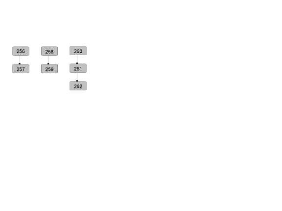
Montpelier Yard Harris Matrix
The Harris Matrix summarizes stratigraphic relationships among excavated contexts and groups of contexts that DAACS staff has identified as part of the same stratigraphic group. Stratigraphic groups and contexts are represented as boxes, while lines connecting them represent temporal relationships implied by the site’s stratification, as recorded by the site’s excavators (Harris 1979).
Stratigraphic groups, which represent multiple contexts, are identified on the diagram by their numeric designations (e.g. SG10) followed by the original excavator’s descriptions of them (e.g. “occupation zone”). Contexts that could not be assigned to stratigraphic groups are identified by their individual context numbers (e.g. 622A).
Boxes with color fill represent contexts and stratigraphic groups with ceramic assemblages large enough to be included in the DAACS seriation of the site (see Chronology). Their seriation-based phase assignments are denoted by different colors to facilitate evaluation of the agreement between the stratigraphic and seriation chronologies. Grey boxes represent contexts that were not included in the seriation because of small ceramic samples.
This Harris Matrix is based on data on stratigraphic relationships recorded among contexts in the DAACS database. It was drawn with the ArchEd application. See http://www.ads.tuwien.ac.at/arched/index.html.
For a printable version, download the Harris Matrix [76.33 KB PDF].


PDF of large scale plan of New Montpelier yard excavation units locations within the village.
PDF of New Montpelier slave village.
PDF of New Montpelier slave village and works.
PDF of New Montpelier slave village and works featuring landscape and architectural details as well as hillshading and contours.
PDF of New Montpelier village featuring village architectural details as well as hillshading and two foot contours based on Dr. Higman's detailed village survey.
CAD site plan of the New Montpelier slave village in .dxf format.
CAD site plan of the New Montpelier slave village in .dgn format.
CAD site plan of the New Montpelier slave village and works in .dxf format.
CAD site plan of the New Montpelier slave village and works in .dgn format.
Harris, Edward C.
1979 Principles of Archaeological Stratigraphy. Academic Press, London, England.
Higman, B. W.
1998 Montpelier, Jamaica: A Plantation Community in Slavery and Freedom, 1739-1912. University of the West Indies Press, Mona, Jamaica.
Higman, B. W.
1973 Household Structure and Fertility on Jamaican Slave Plantations: A Nineteenth-Century Example., Population Studies (27) 527-50 In Population Studies (27) 527-50.
Higman, B. W.
2003 The Letterbooks of Isaac Jackson, Jamaican Planting Attorney, 1839-1843., Journal of Caribbean History (37) 317-29. In Journal of Caribbean History (37) 317-29.
Higman, B. W.
2005 Plantation Jamaica, 1750-1850: Capital and Control in a Colonial Economy. University of the West Indies Press, Mona, Jamaica.
Neiman, Fraser D., Jillian E. Galle , and Derek Wheeler
2003 Chronological Inference and DAACS. Unpublished paper presented at the annual meeting of the Society for Historical Archaeology, Providence, Rhode Island. On file at the Department of Archaeology, Thomas Jefferson Foundation, Charlottesville, Virginia.