| Location: | Papine Estate, Kingston, Jamaica |
|---|---|
| Occupation Dates: | Late-18th through mid-19th centuries. Phasing and mean ceramic dates can be found on the Chronology Page. |
| Excavator(s): | Jillian Galle, Sabrina Rampersad, Ivor Conolley, and Fraser Neiman. Archaeological field crew from The Digital Archaeological Archive of Comparative Slavery and the University of the West Indies, Mona. |
| Dates excavated: | January 2008, 2009, and 2010. |

Overview

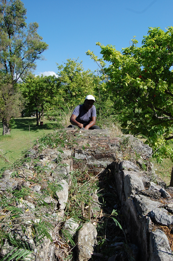
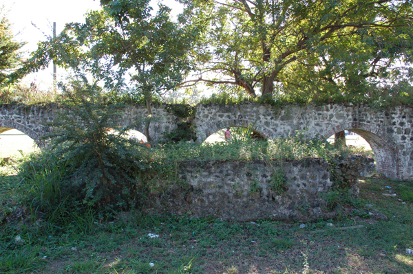
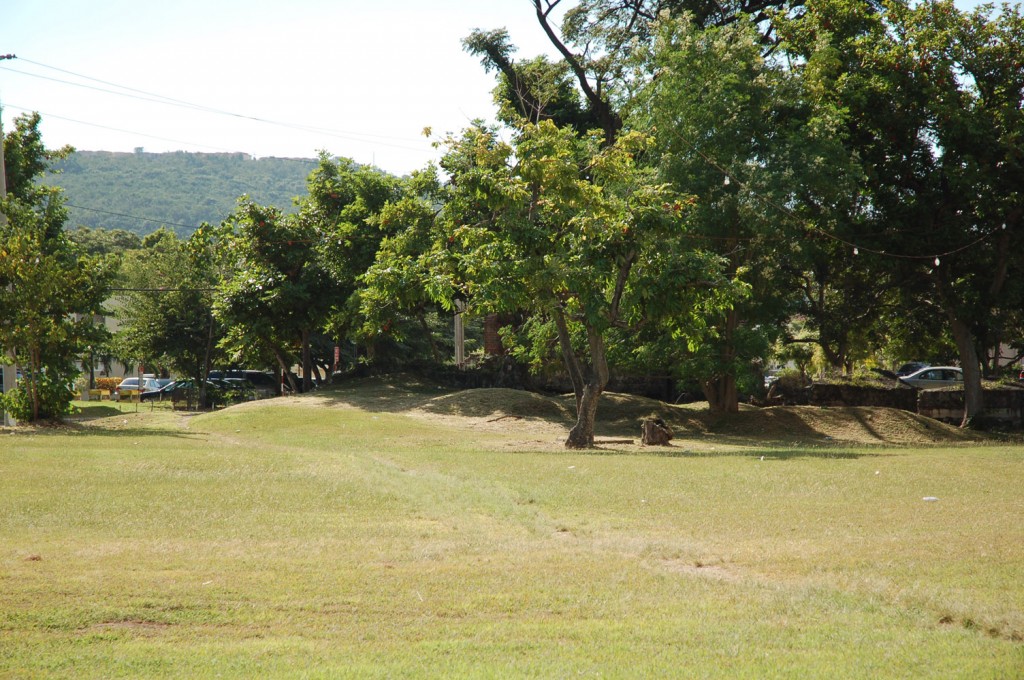
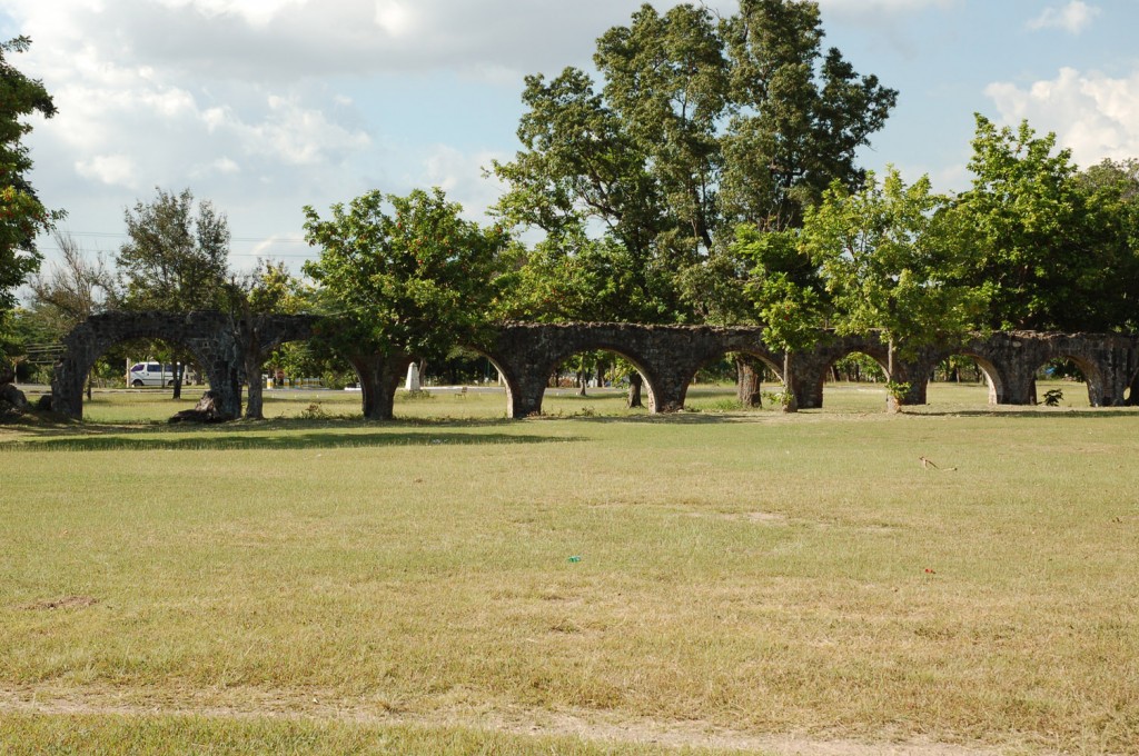
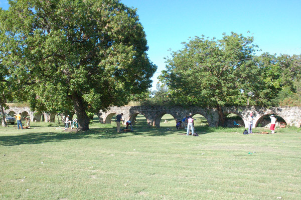
View of aqueduct section that runs through Papine Village.
In the mid-18th century, Papine, Mona, and Hope, three large sugar estates in St. Andrew Parish, Jamaica, shared boundaries and an impressive cut limestone and brick aqueduct that carried water to sugar mills and cisterns on each estate. In the 19th century, these estates continued to share a common water source and prospered. By the mid-20th century, ruins of the Papine, Mona, and Hope Estates lay beneath the Gibraltar Refugee Camp and the University College of the West Indies. In 1962 the University College of the West Indies received an independent Charter from Queen Elizabeth to become the University of the West Indies, Mona (Francis-Brown 2004).
Today, the remains of the Papine Village, once home to nearly 200 enslaved laborers in the 18th and 19th centuries, lie under an informal soccer field and running track on the northern edge of the University of the West Indies, Mona campus. The now defunct aqueduct, likely constructed around 1758, still runs through the center of the Papine Village and the substantial ruins of the sugar mill, boiling house, and distillery lie to the south of the site.
Excavations at the Papine Village were first initiated by Dr. Karl Watson, then lecturer at UWI, Mona, in the late 1980s. Several test units were excavated at the Papine Village as part of the UWI archaeological field school. Excavations were limited. Surviving field notes and maps provide only a partial picture of the work completed and recovered artifacts were used in the years after field work as a teaching collection. Over the years the artifacts were grouped by site-wide stratigraphy, resulting in an extant assemblage with no association with the contexts from which they came.
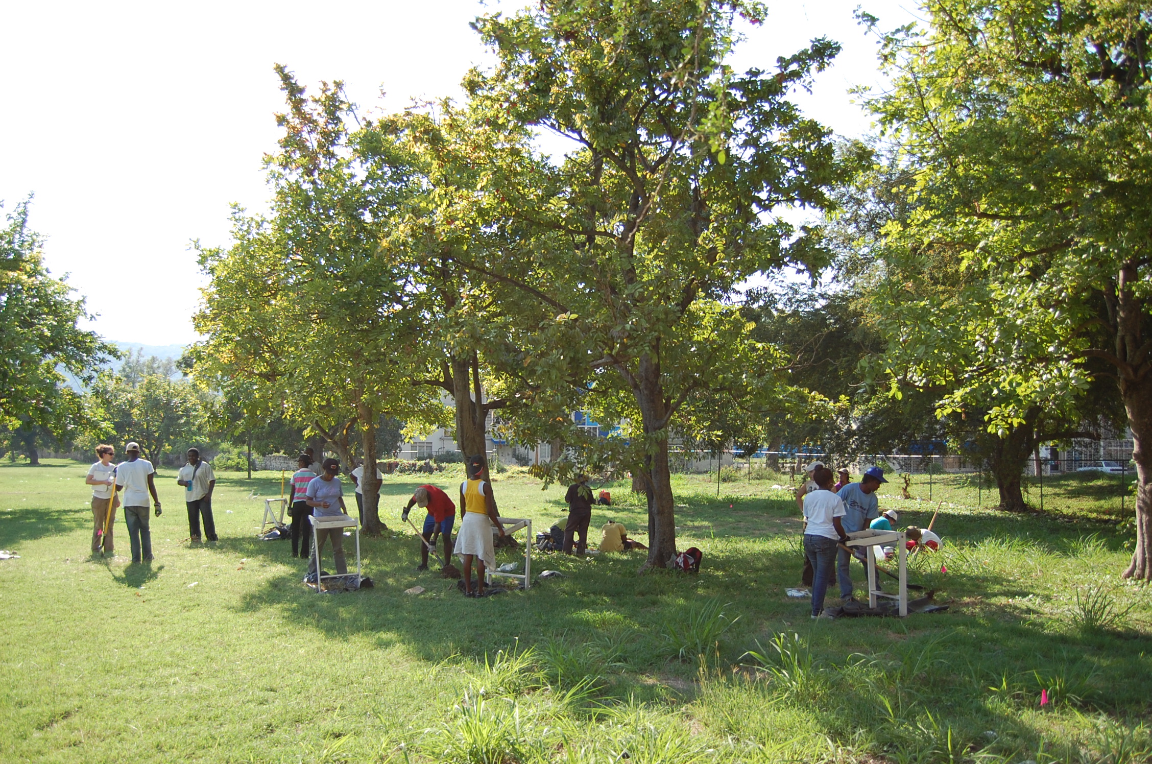
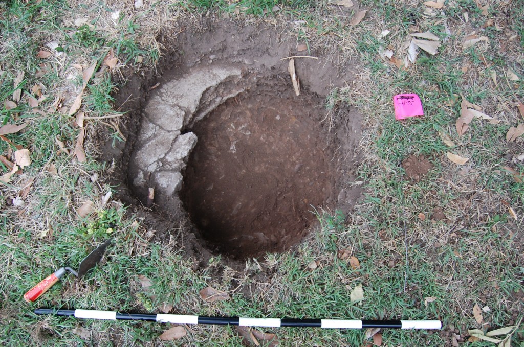
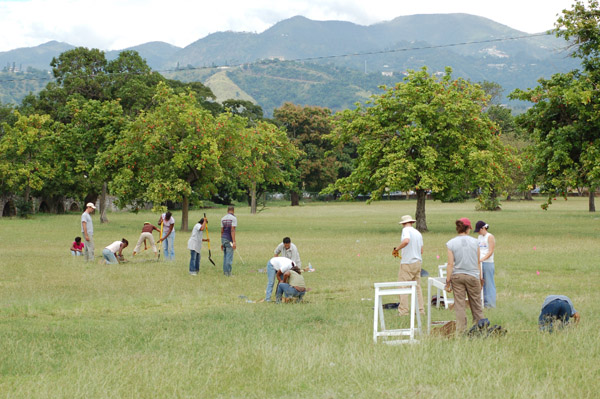
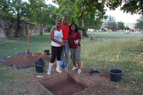
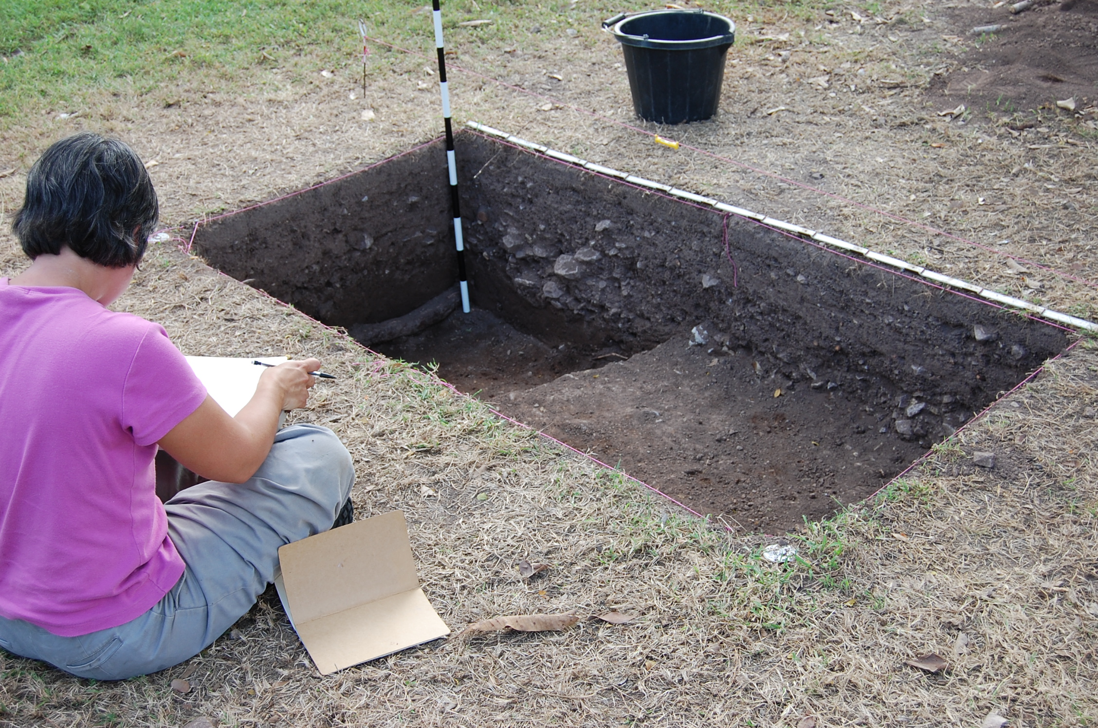
STP digging at Papine Village during 2010 field school.
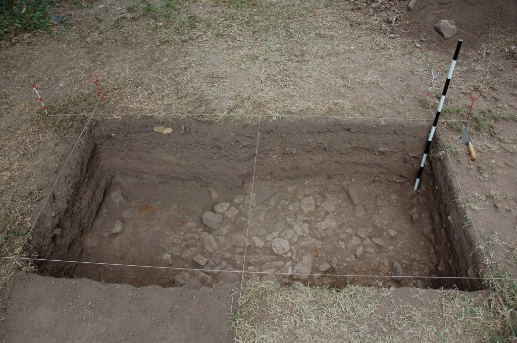
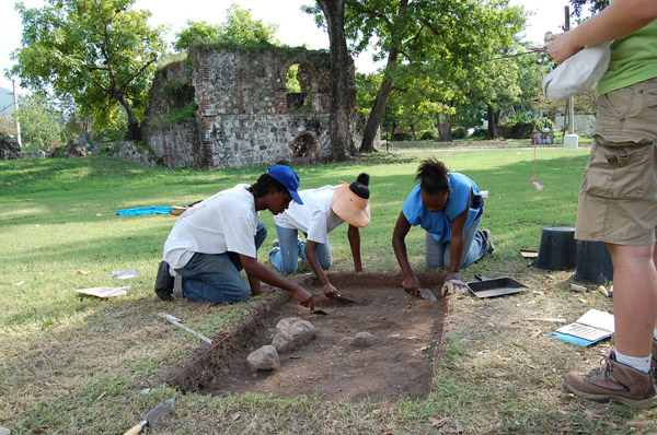
In 2008, the University of the West Indies, Mona Archaeological Field School returned to the Papine Village, this time with the aim of understanding how occupation of the village changed throughout the 18th and 19th centuries. In collaboration with the Digital Archaeological Archive of Comparative Slavery, students and DAACS staff undertook a large-scale shovel-test-pit survey. In January 2008, 2009, and 2010, amounting to over 7 weeks of field work, students and DAACS staff excavated 1207 STPs, with the perimeter of the area excavated across 55,100 square meters. Four 1-x-1 meter units were excavated to subsoil and two other 1-x-1 meter units are currently in process. These units were strategically placed to date stratigraphy and architecture.
Documentary evidence
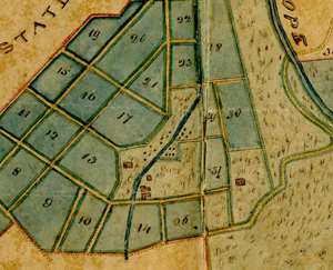
1834 survey map showing Papine Village. Jamaica National Library.
Few primary sources exist that mention slavery at the Papine Estate. Of those that do, they fall into two main categories, plats and slave returns. Eighteenth- and nineteenth-century plats showing the location of the village for enslaved laborers at Papine exist for various times during the Estate’s occupation. A 1774 plat shows the Papine Estate in relationship to the Mona Estate but does not show the location of the slave village. A drawing likely dating from the late-18th or early-19th century details the water system that carried water from the Hope River through the Hope, Papine, and Mona Estates. In this detail of water works at Papine, “Negro Houses” and “Gardens” are represented in relationship to the aqueduct. An 1834 survey map provides details of all of the estate’s fields, including crops grown, as well as a detail of the slave village, aqueduct, and mill.
Dr. Suzanne Francis-Brown has worked extensively with the 19th-century slave returns. Her research was published in the Caribbean Quarterly in 2005. A single document from 1783 “List of Negroes on St Andrew Estates” indicates that 187 enslaved people lived at the Papine Estate in that year. Slave returns, taken every three years between 1817 and 1832, also provide information on the lifecycle of the estate population. The 1817 list for Papine shows a total of 189 persons. There were 83 men and boys; 106 women and girls. Most of them were Creole or local-born, but the list included 45 persons born in Africa, the youngest being an 11-year old girl. In 1820 there were two returns – one of 182 persons for estate owner James Wildman; the other of nine persons for Mrs. Joanna Wildman: a total of 191 enslaved persons. In 1823, the numbers rose to 227, mainly due to the purchase of 45 persons under a Writ of Vendition; however by 1829, many of these persons and others in the estate community had been moved to estates in the south-central parishes of Clarendon or Vere.
The estate workers were provided with some basic supplies, which they supplemented with provision grounds which were allocated on marginal estate land. The undated drawing of the water supply shows the Papine “Negroe Grounds” along the higher reaches of the aqueduct. Ground provisions such as coco and arrowroot, vine-borne produce such as pumpkin, sweet potato and melon; as well as plantain, banana, corn and other crops, would have been grown in the provision grounds. Home gardens may also have produced vegetables and fruit, while groves of fruitful trees such as ackee, mango, citrus and breadfruit would also have been encouraged near to the village. Indeed, groves of these trees are considered as botanical markers for such villages, and ackee trees are common across the area close to the old Papine Village.
The use of some part of the estate village continued after slavery finally came to an end in 1838, though a 1915 map of the Kingston area shows a “Nigger House Corner” to the south-west of the original village. The same map also shows the location of a “Coolie Village” in the vicinity. Many East Indians, former indentured workers, had settled in the Papine area by the early years of the 20th century, making it one of the longest-standing East Indian communities in the city at the time. Over 100 “free” East Indians worked on the Mona Estate in the early 1900s and many more lived in the Mona Commons area, part of the old Papine Estate. One tomb has endured which helps to mark that population, that of Jaghai or Jaghi, a tenant dairy farmer on the old Papine Estate lands, who died in 1929. Other East Indian residents had market gardens and farmed tobacco and other crops in the area between the aqueduct and the village of Papine, which also carries the estate’s name.
Excavation history, procedure, and methods

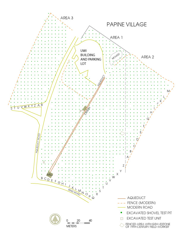
Archaeological site map showing Papine Village excavations 2008-2010.
Archaeological field research was first undertaken at the Papine Village in 1981 and again between 1987 and 1989 by Dr. Karl Watson, then lecturer in History and Archaeology at UWI, Mona, now currently retired Senior Lecturer at the University of the West Indies, Cave Hill. Only a handful of incomplete field records, two undated maps, and a few student journals, survive from the 1988 and 1989 field seasons. As a result, understanding the exact extent of the work conducted is nearly impossible. Vitalyn Latty’s Master’s thesis went far in unraveling the threads of evidence (2006). However, it is still unclear exactly how many units were excavated. It appears that at least four areas of excavation units were opened during the 1988 season, with possibly another nine units of undetermined size opened during the 1989 season. Nearly 6,000 artifacts were recovered from these units. These artifacts were housed at the University of the West Indies, Mona, and used as teaching collections in the late 1980s and early 1990s. As a result, the finds were grouped stratigraphically, not by individual excavation unit. Therefore Latty’s reassessment of the artifacts resulted in a detailed finds list by site-wide stratigraphic layers, not by individual contexts within individual units.
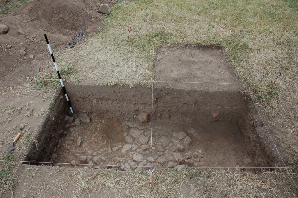
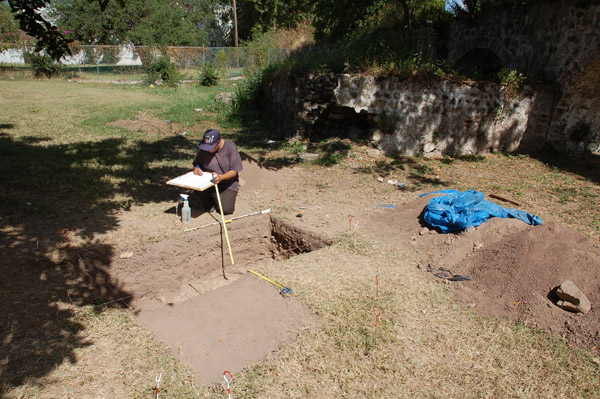
Beginning in January 2008, UWI, Mona and The Digital Archaeological Archive of Comparative Slavery began a systematic shovel-test-pit survey of the Papine Village. Led by Dr. Sabrina Rampersad (UWI) and Dr. Jillian Galle (DAACS), UWI students and DAACS staff worked together to excavate 50 centimeter in diameter shovel-test pits every six meters across the entire village area, including the fields east and west of the aqueduct, north of Aqueduct Flats and west of Aqueduct Road, prior to the construction of the new UWI Basic Medical Sciences Complex. Field work was conducted for approximately 15 days every January in 2008, 2009, and 2010. During this time 1207 STPs and four 1-x-1 meter units were excavated. Another two units adjacent to the cistern were begun but not completed due to time constraints. Completion of these units is planned for upcoming field seasons.
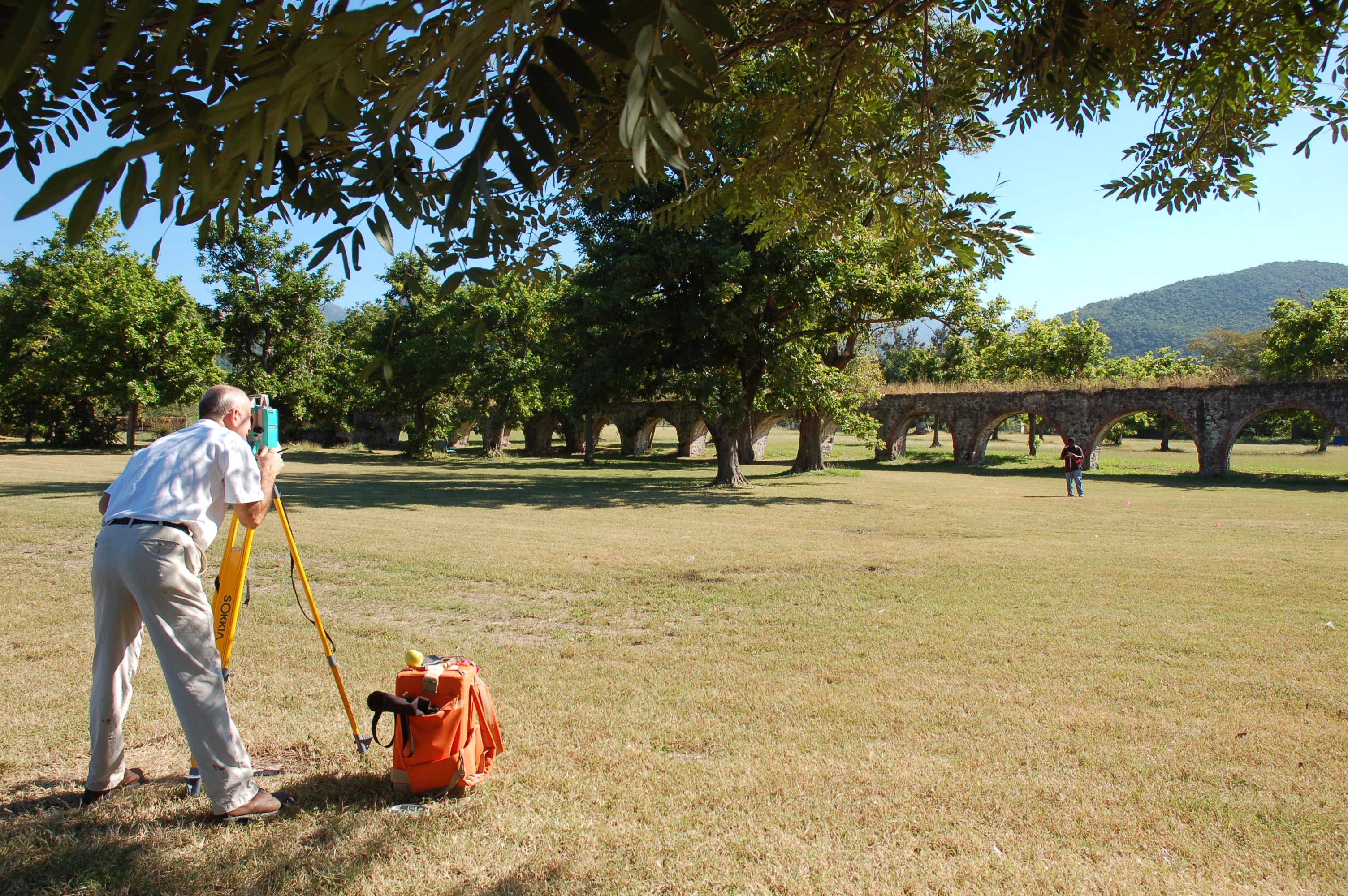
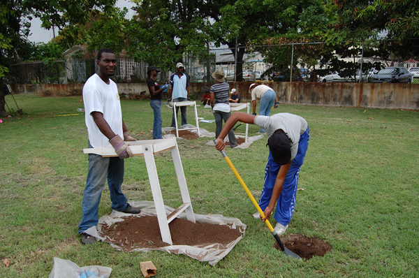
Archaeologists establishing a grid across Papine Village site.
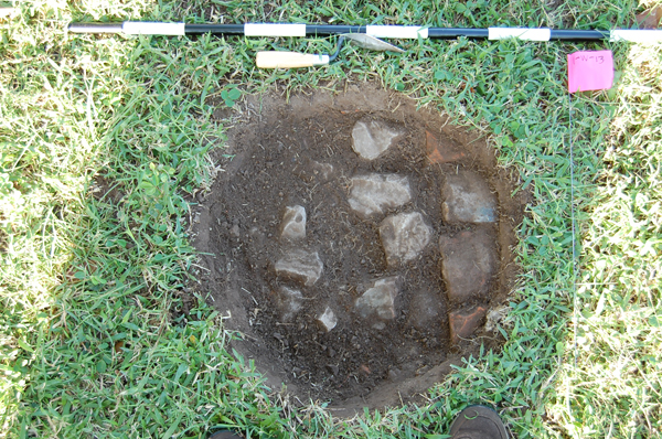
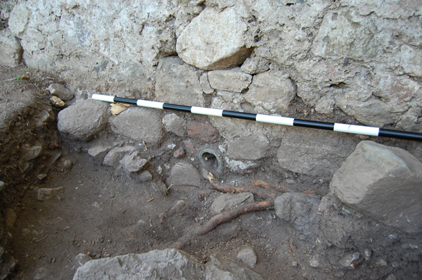
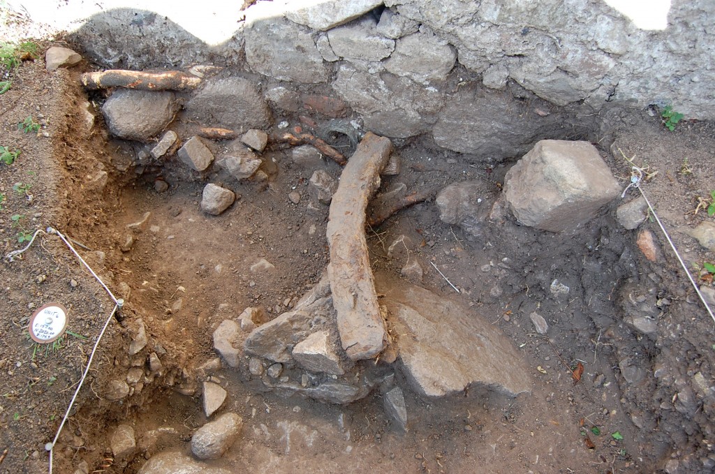
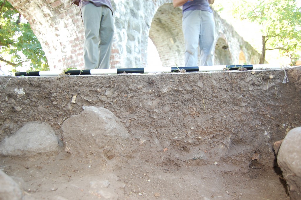
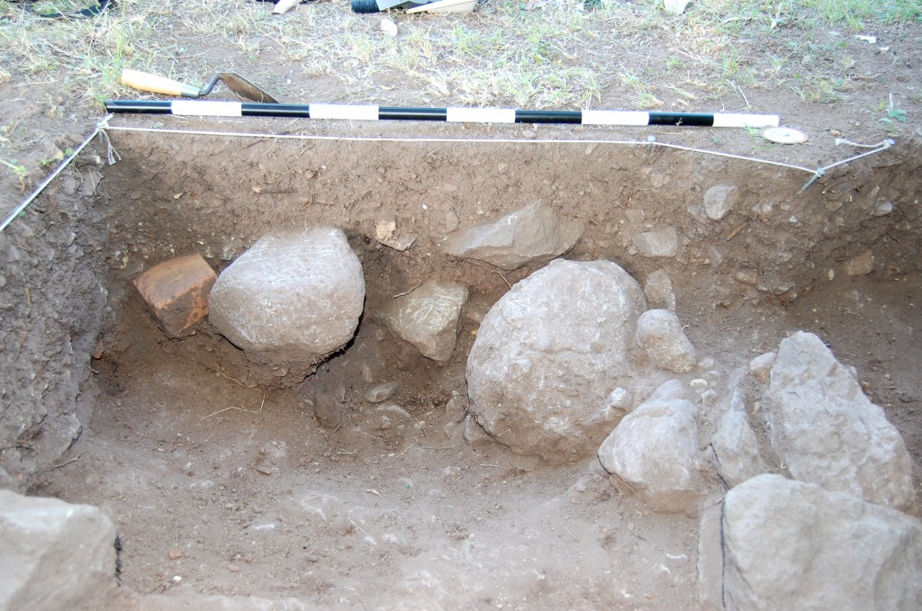
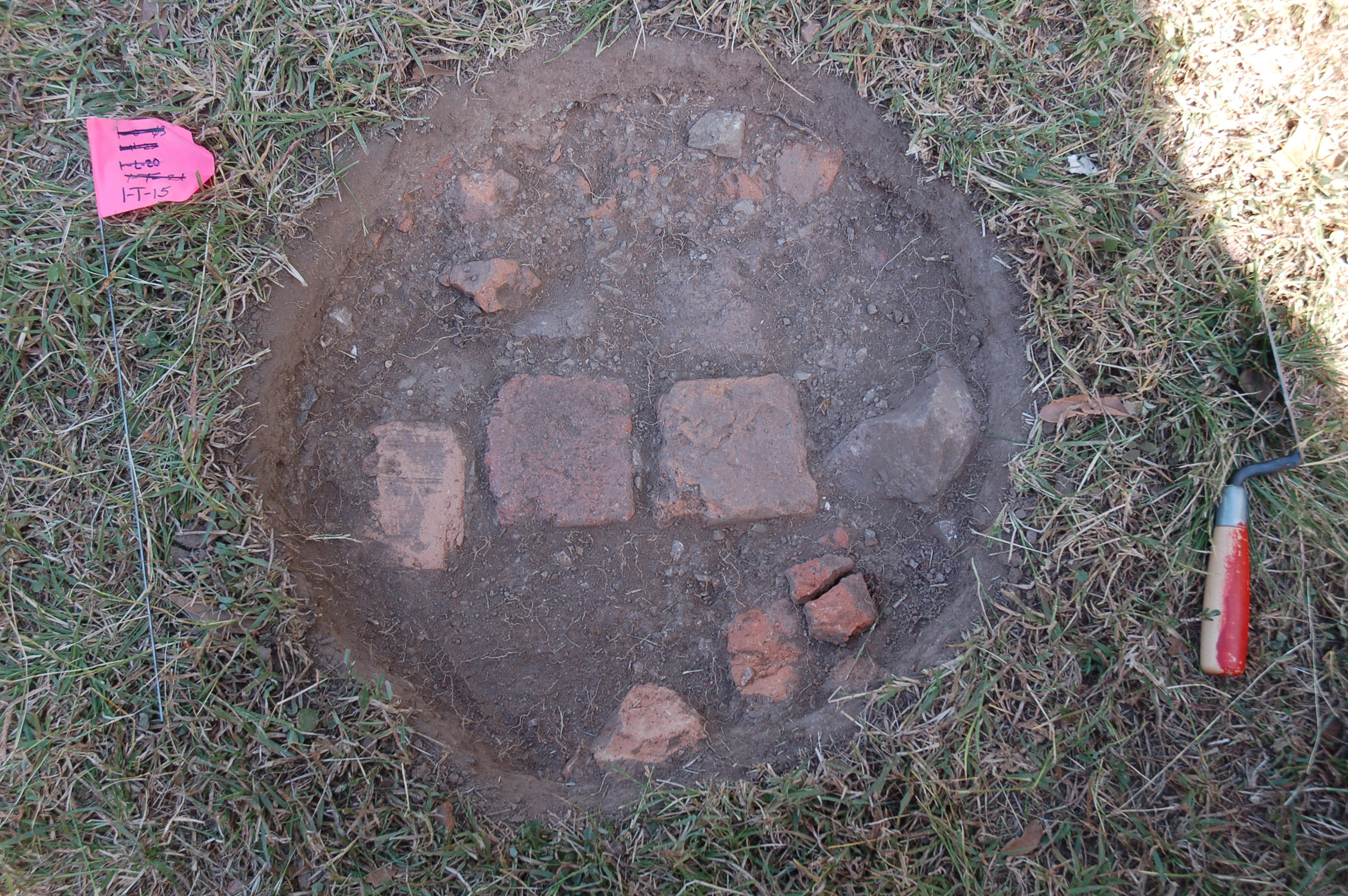
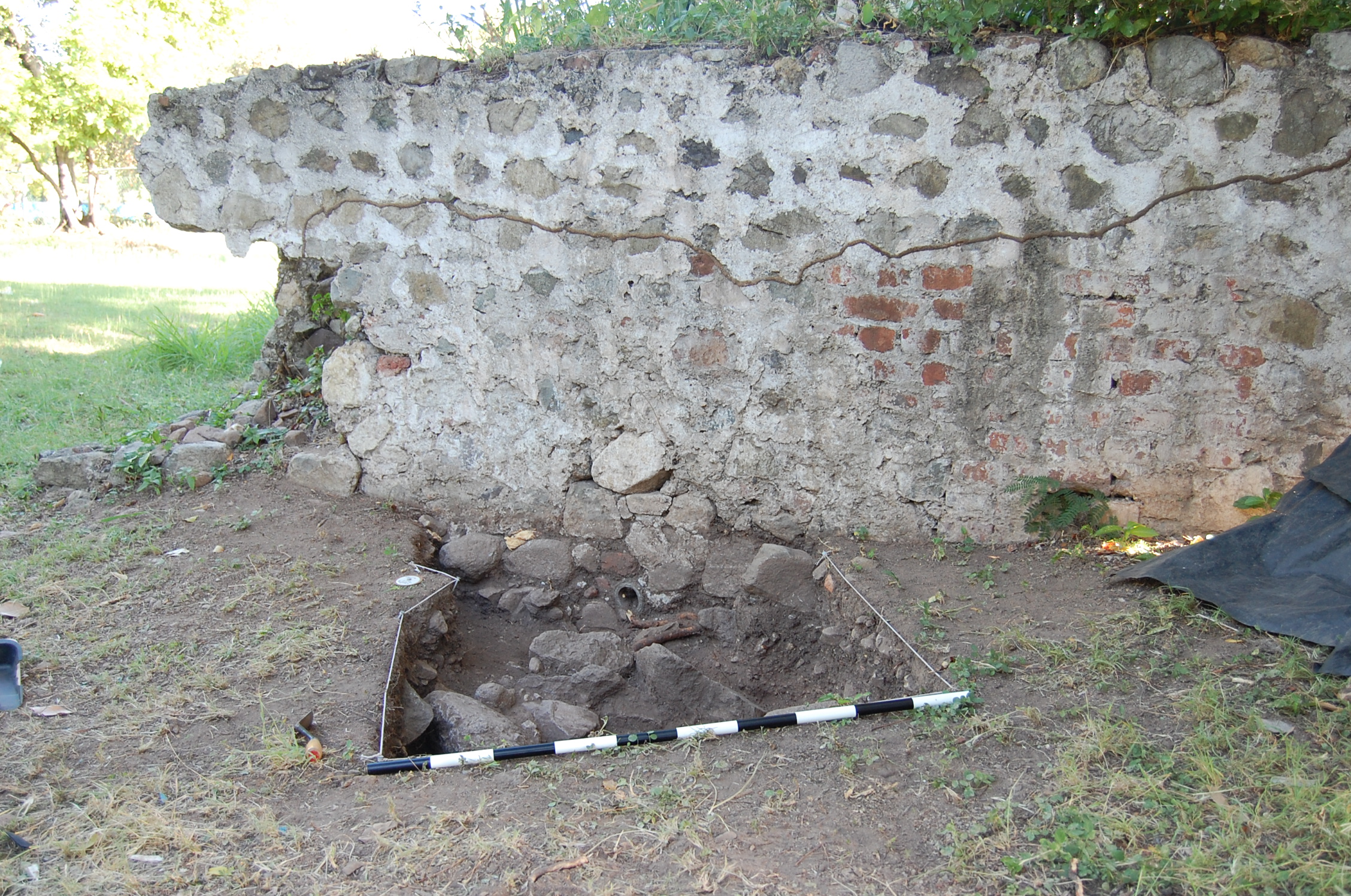
Work began in 2008 by establishing a UTM grid across the entire area of the village. During the 2008 season 398 STPs were excavated in transects running north/south and east/west through the center of the village area, as identified by historic plats and Dr. Karl Watson’s 1988 excavations. This cross-shaped test area was created to help us begin to establish boundaries of the village. During this season, Dr. Ramersad oversaw the excavation of Unit 1, a single 1-x-1 meter unit southwest of the aqueduct’s cistern. A cobble paving (Feature 1, originally interpreted as a cobble floor to a domestic structure) was discovered at a little over a meter deep. We interpret this feature as a cobble paving constructed around the cistern to control erosion and muddy conditions around the outlet for the cistern. This explains the mix of early- and late-19th century artifacts found together at this level. The feature consists of a hard-packed surface without stone in the southwest area of the unit and a stone-packed surface that appears to overlie it in the east and northwest corner. The feature was not excavated, as it was felt that the entire feature should be exposed before removing the cobbles.
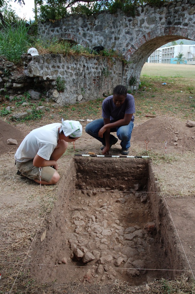
UWI and DAACS returned to the Papine Village in 2009. Field work focused on the expansion of the survey, with an emphasis on completing work on the western side of the aqueduct and to the north, around Aqueduct Flats, an apartment building northeast of the extant aqueduct. During this field season it was discovered that construction would soon begin for UWI’s new Basic Medical Sciences Complex in an area west of Aqueduct Road. The presence of a stand of ackee trees, as well as oral histories, suggested that the village may have extended into this area. In order to ensure this area was tested prior to construction, DAACS retained a crew of Jamaican archaeologists supervised by Mr. Ivor Conolley, a PhD. candidate in Archaeology at UWI, Mona to completely survey the area. As a result, a total of 589 STPs were excavated during the 2009 season. A second unit (Unit 3) was opened adjacent to Unit 1 and was excavated to the cobble layer.
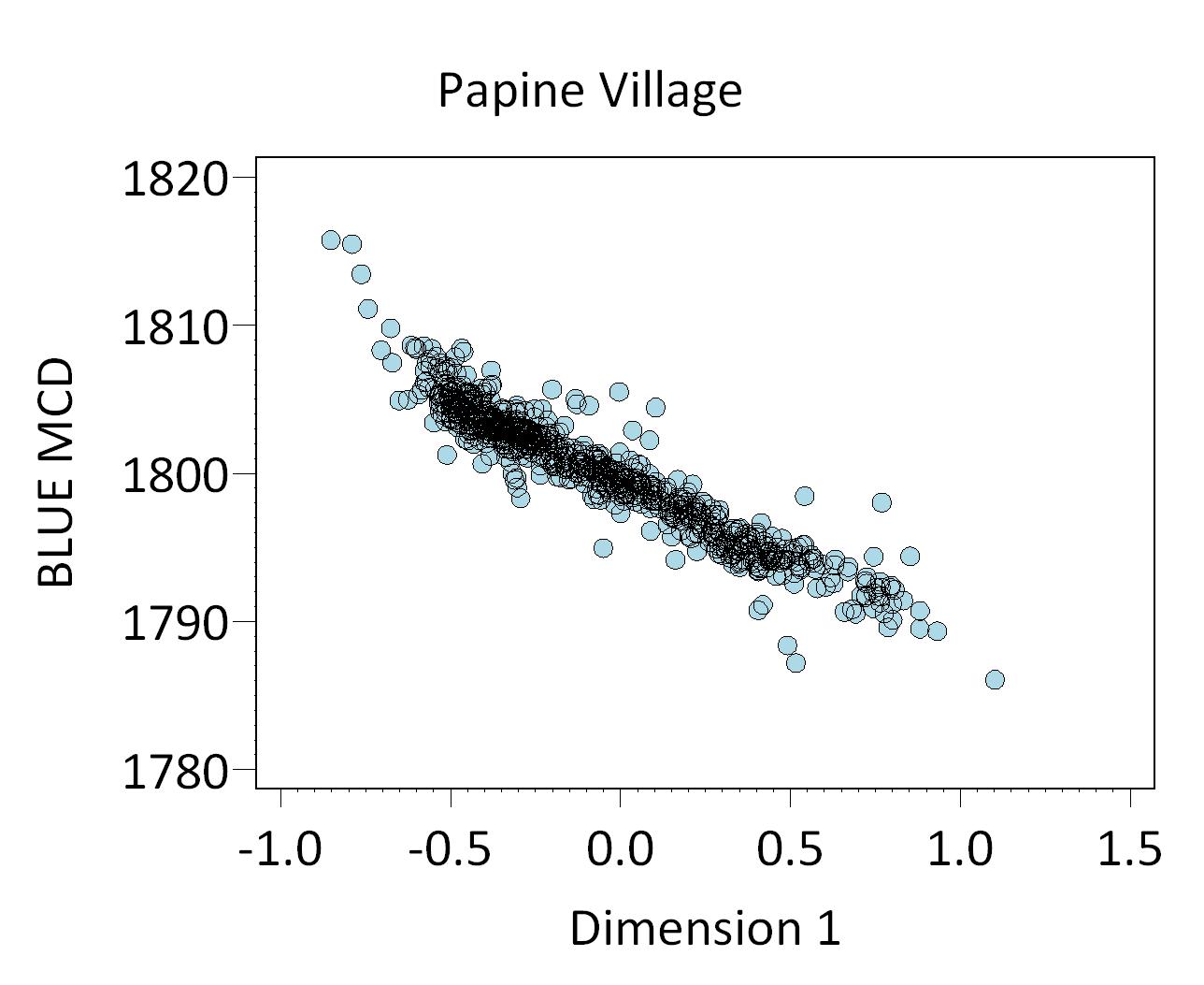
Figure 1. Plot of Blue MCDs by Dimension 1 scores for shovel-test-pit assemblages from the Papine Village.
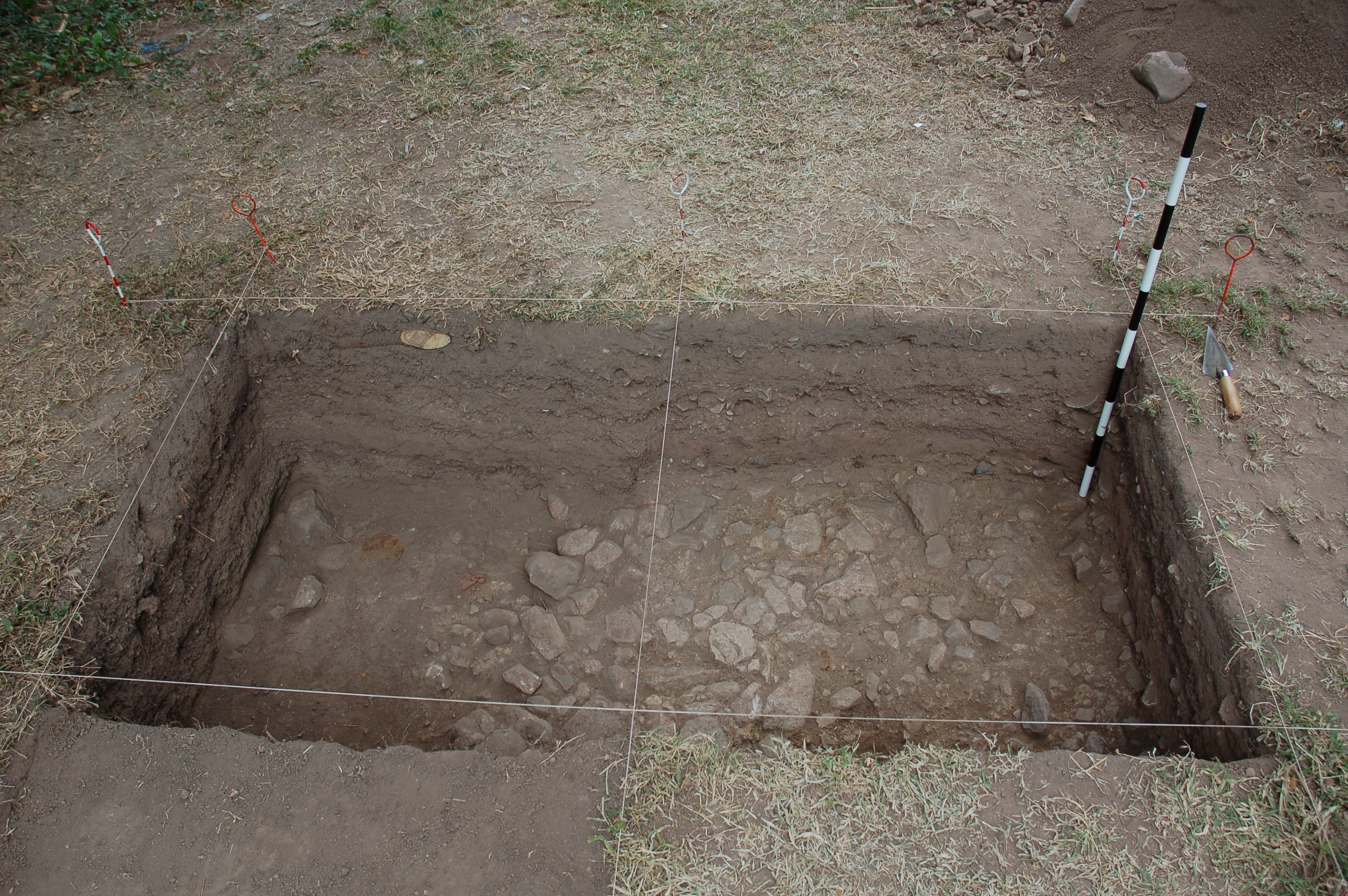
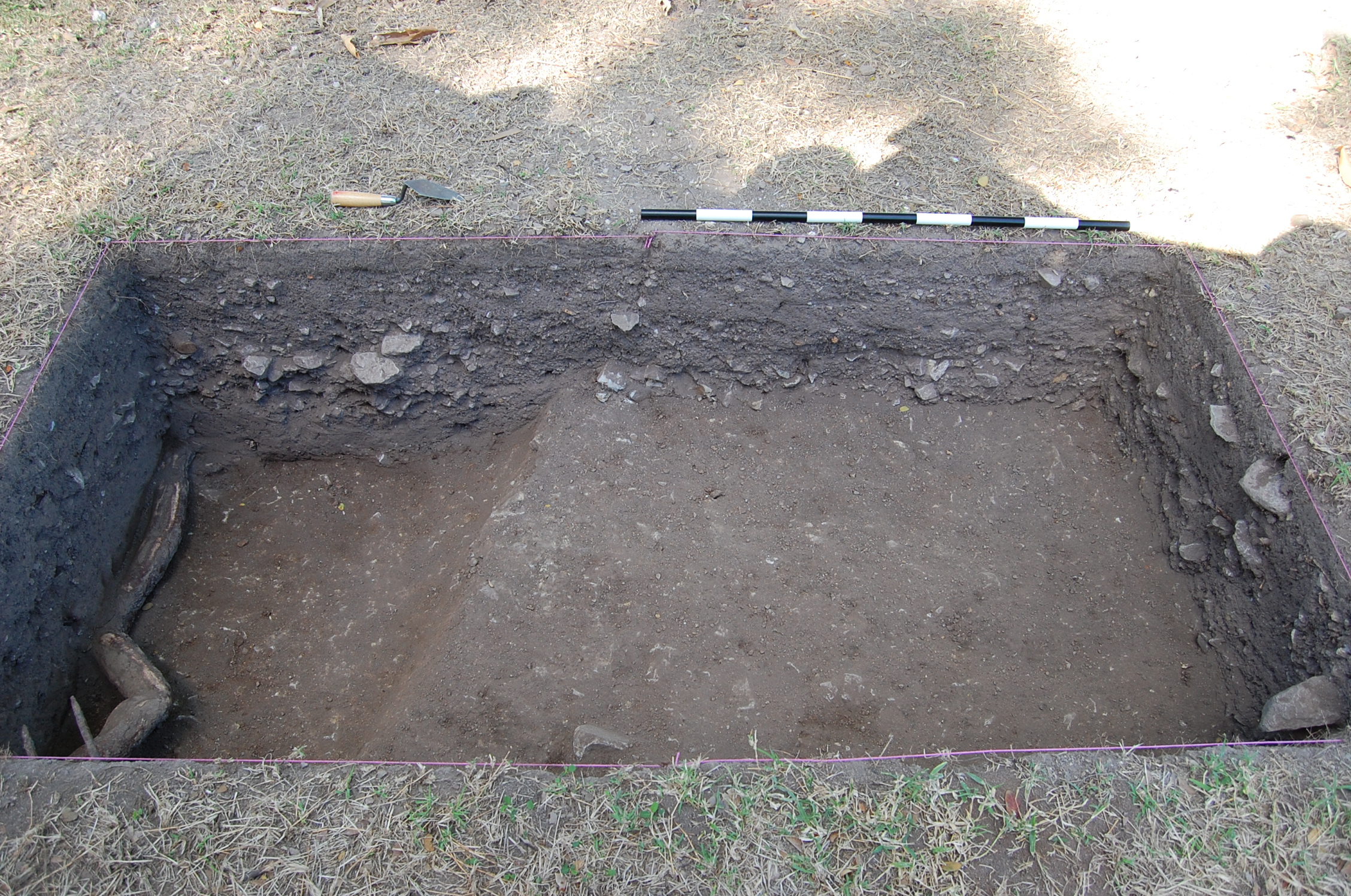
DAACS and the UWI field school completed the Papine Village survey during the 2010 season. Work focused on filling in gaps in the northeastern and southeastern sections of the village. As teams of excavators headed south along Area 1 Transects X, Y, and Z and Area 2, Transect A they encountered multiple pits with no artifacts. Consequently, this area, which was in the southeasterly-most section of the village, remained unexcavated. Once STPs were completed at Papine, the students and crew began work at the Mona Village. A small crew stayed to open two 1-x-1 meter units (004 and 005) just northwest of the Papine Mill. These pits were opened to explore the stratigraphy of the area and the presence of the mid-18th-century material culture found in STPs surrounding these units. As the same time, two units, 006 and 007, were opened adjacent to the cistern, with the hope of dating the cistern. These units produced a massive quantity of artifacts ranging in age from late-18th century through 20th century material culture. The top layers were densely packed, artifact rich fill. Given the time constraints of the field season, and the expectation that multiple layers of fill would continue for at least a meter, we stopped excavation and hope to return to complete the units in future field seasons.
Summary of research and analysis

Figure 2. Plot of ware types from Papine Village along CA Dimension 1 and 2. Note early types on the right, late ones of the left.
Preliminary research on the Papine Village dataset has focused on three main areas: determining the temporal and spatial boundaries of the site, understanding the distribution of artifacts across the village, and placing locally-produced coarse earthenwares found at Papine in the context of other locally-produced wares found at other sites in Jamaica. We provide a general overview of the material recovered and then briefly describe research in these three areas.
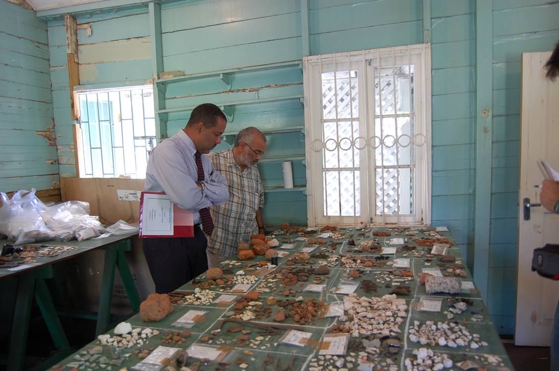
Over 58,000 artifacts (excluding faunal elements that are currently being analyzed by the Colonial Williamsburg Zooarchaeological Laboratory) were recovered from the 1207 STPs and units excavated at the Papine Village. The overwhelming majority of artifacts consisted of brick daub and stone fragments. Eight thousand three hundred sixty-eight ceramic sherds were recovered, ranging from locally-produced coarse earthenwares to high-style, costly imported ceramic tablewares. Seven thousand four hundred twenty-nine fragments of glass vessels were recovered, along with 28 buttons, 12 buckles, 11 glass beads, 19 utensil fragments and 510 tobacco pipe fragments. All artifact data can be accessed through http://www.daacs.org/querydatabase/.
Chronology:
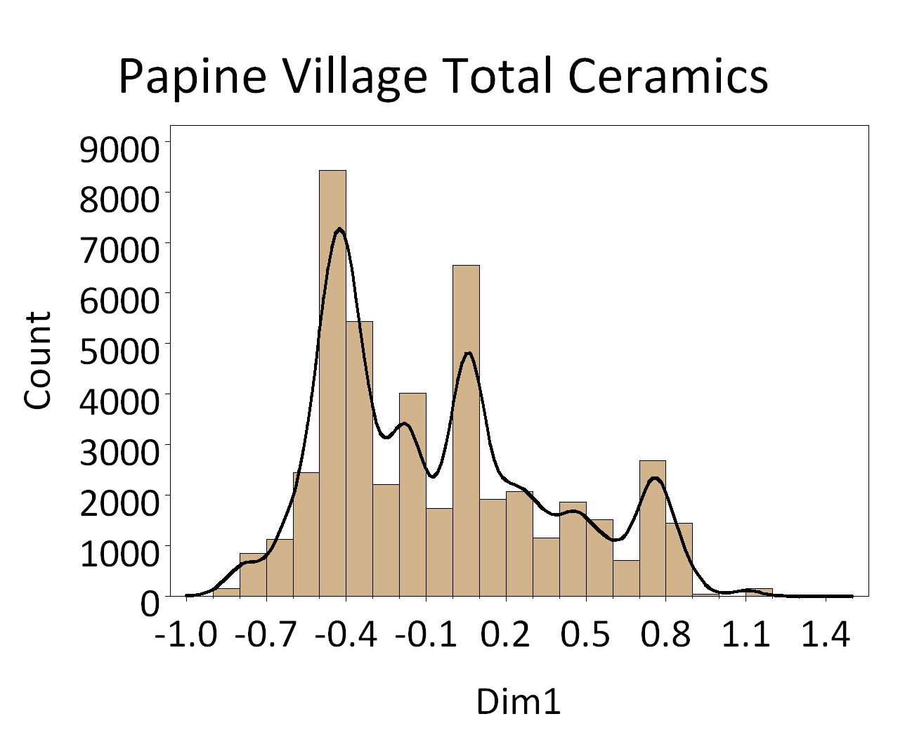
Figure 3. Histogram of ceramics from Papine Village plotted along CA Dimension 1. Note dips in counts at .5 and 0 on the Dimension 1 axis indicate phase divisions.
The DAACS Caribbean Initiative focuses on exploring large-scale change on slave villages, or areas where enslaved individuals lived and labored, such as great house compounds, in the Caribbean through the use of shovel-test-pit surveys. For sites with extensive and standardized STP coverage, including the Papine Village site, a variation on our site-based seriation method is employed. This is because each STP is small (50 cm. in diameter) and provides a small artifact sample. As a result, STP assemblages are rife with sampling error. The samples from individual STPs are so small that variation among STPs is almost entirely statistical noise.
Successfully analyzing STP data, without first aggregating those pits into counting units called sites, requires methods to suppress sampling error. Here we use empirical-Bayesian methods. They offer a smart way to smooth both artifact density surfaces and relative frequencies of artifact types. To understand how these methods work, consider an STP – let’s call it STP 12. The number of artifacts found in STP 12 is likely to be similar to the number of artifacts in the STPs within a certain distance of it. The information contained in the neighborhood of pits is combined with the actual number of artifacts from STP 12 to arrive at an estimate of artifact counts that are less influenced by sampling error (Neiman et al. 2008).
We use two forms of Bayesian smoothing in succession. First, to smooth counts of ceramic ware types in individual STPs, we use a gamma-Poisson model. The gamma-Poisson algorithm smoothes counts of individual artifact types in each STP, based on the counts for that type in nearby STPs. We then use a beta-binomial model to estimate relative frequencies (percentages or proportions) of ceramic ware types in individual STPs. Together two forms of Bayesian smoothing provide smoothed, stable estimates of artifact-type frequency variation in individual STPs, allowing us to see overall site patterning that may otherwise be distorted using raw data (Neiman et al. 2008).
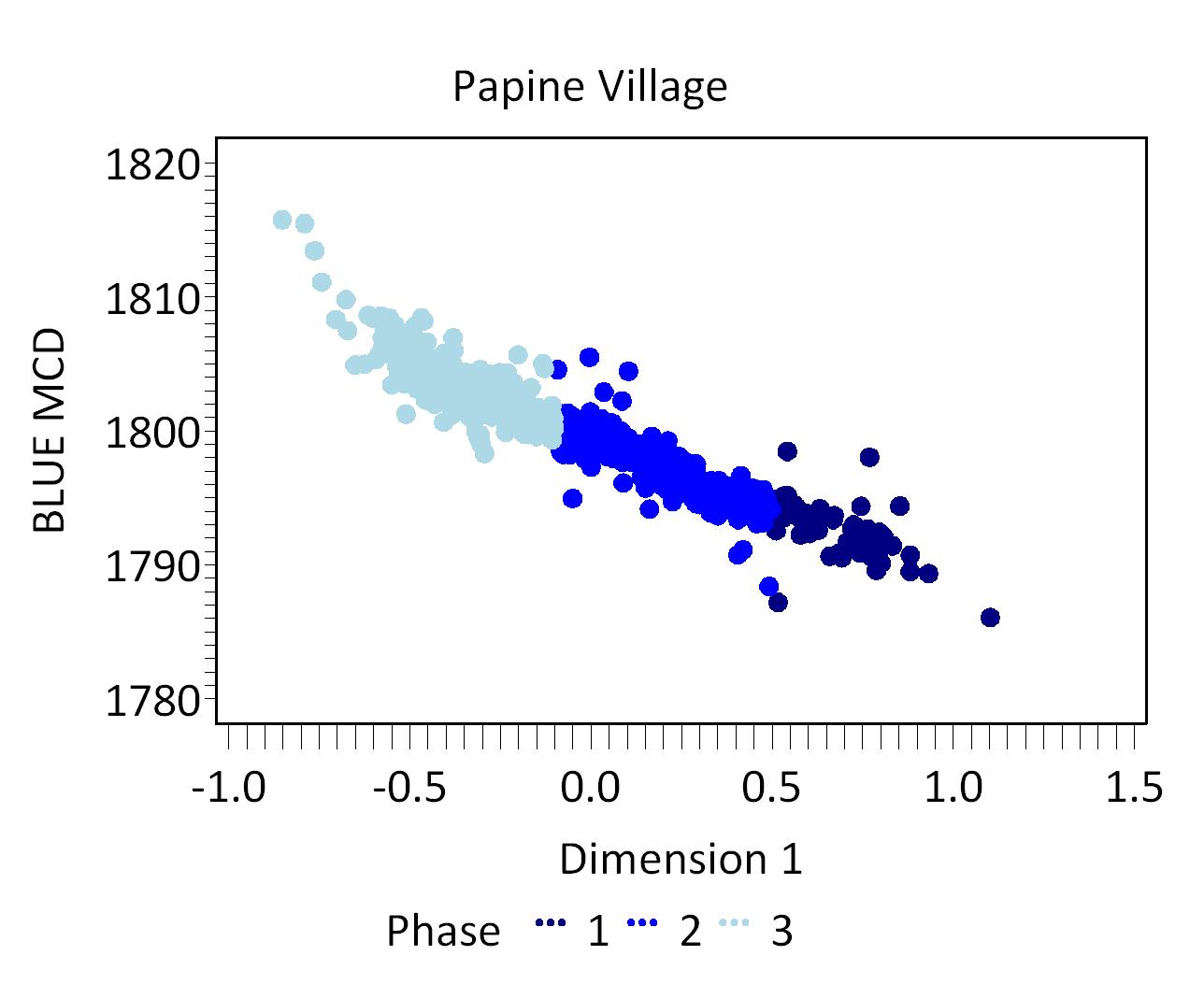
Figure 4. Plot of Blue MCDs by Dimension 1 scores for phased shovel-test-pit assemblages from the Papine Village.
To infer a chronology from the STPs we used correspondence analysis (CA) of ware-type frequencies. We employ CA because with the numbers of STP assemblages in the hundreds, a traditional manual frequency seriation is completely impractical. CA converts a data matrix of ware-type frequencies into a set of scores which estimate the positions of the assemblages on underlying axes or dimension of variation. MCDs are weighted averages of the historically documented manufacturing date for each ware type found in an assemblage, where the weights are the relative frequencies of the types. Measuring the correlation between CA axis scores and MCDs offer an indication of whether the CA scores capture time (Ramenofsky, Neiman, and Pierce 2009).
Bayesian smoothing and CA analysis can be used on STP data from the Papine Village site. The CA for the Papine Village resulted in three occupational phases for the survey area. The Papine Village dates from the 1770s through the mid-19th century with materials dating from the post-emancipation East Indian laborer settlement. The mean ceramic dates and TPQs for each of the three phases are provided below.
The table also includes three estimates of the ceramic TPQ for each phase. The first TPQ estimate is the usual one – the maximum beginning manufacturing date among all the ware-types in the assemblage. The second estimate — TPQp90 — is the 90th percentile of the beginning manufacturing dates among all the sherds in the assemblage, based on their ware-types. The TPQp95 provides a robust estimate of the site’s TPQ based on the 95th percentile of the beginning manufacturing dates for all the artifacts comprising it. These last two TPQ estimates are more robust against excavation errors and taphonomic processes that might have introduced a few anomalously late sherds into an assemblage.
| Phase | MCD | TPQ | TPQp90 | TPQp95 | Total Count |
|---|---|---|---|---|---|
| P01 | 1791.6 | 1830 | 1775 | 1775 | 940 |
| P02 | 1801 | 1870 | 1775 | 1820 | 1881 |
| P03 | 1822.4 | 1840 | 1820 | 1820 | 2324 |
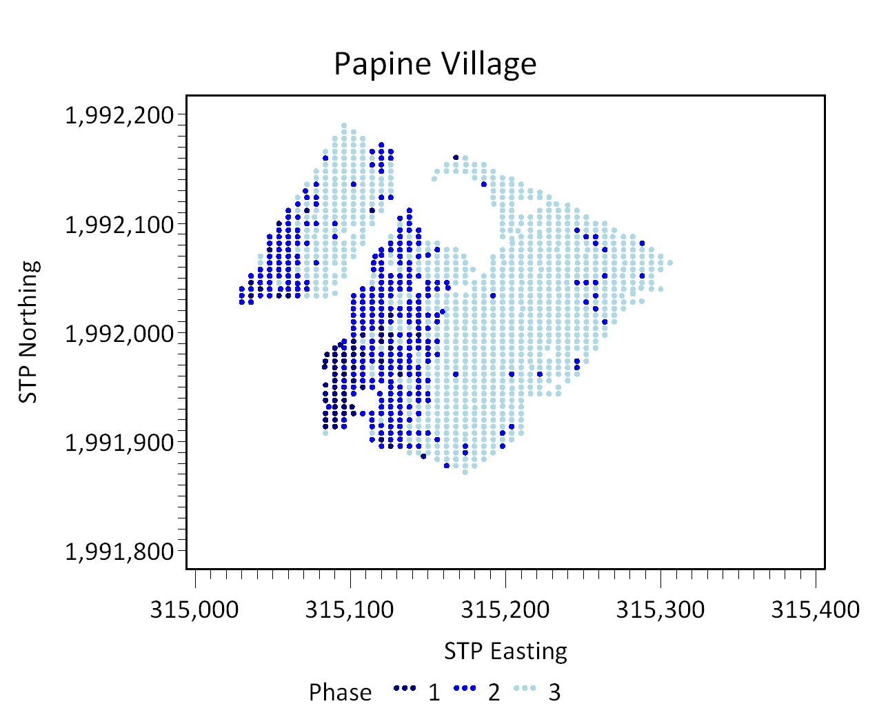
Figure 5. Plot of phased STPs from the Papine Village by STP northing and easting.
The smoothed ceramic ware-type frequencies for the village fit the expectations of the seriation model well, witness the point configuration in the plot of STP assemblages on the first two CA dimensions (Figure 1). The corresponding plot of ware types reveals that CA axis 1 (Dimension 1) reflects a temporal trend, with early ware types on the right and later ware types on the left (Figure 2). A histogram of ceramic sherds from the Papine Village by Dimension 1 help us determine the three phases (Figure 3). The plot of the Dimension 1 scores against BLUE MCDs demonstrates the strong temporal association, especially visible when the STPs are coded with their phase assignment (Figure 4). When the Phase assignments were mapped onto the shovel-test-pits, the earliest, Phase 1 occupation is seen along the western side of the site, just southwest of the mill. Phase 2 is primarily on the western side of the aqueduct with Phase 3, representing the latest occupation, spreading far across the eastern half of the village (Figure 5). In 2010, Galle, Cooper, and Neiman included the Papine Village seriation in an island-wide seriation using data from 16 slave site assemblages (Galle, Cooper, Neiman 2010).
Artifact Distribution across the Village:
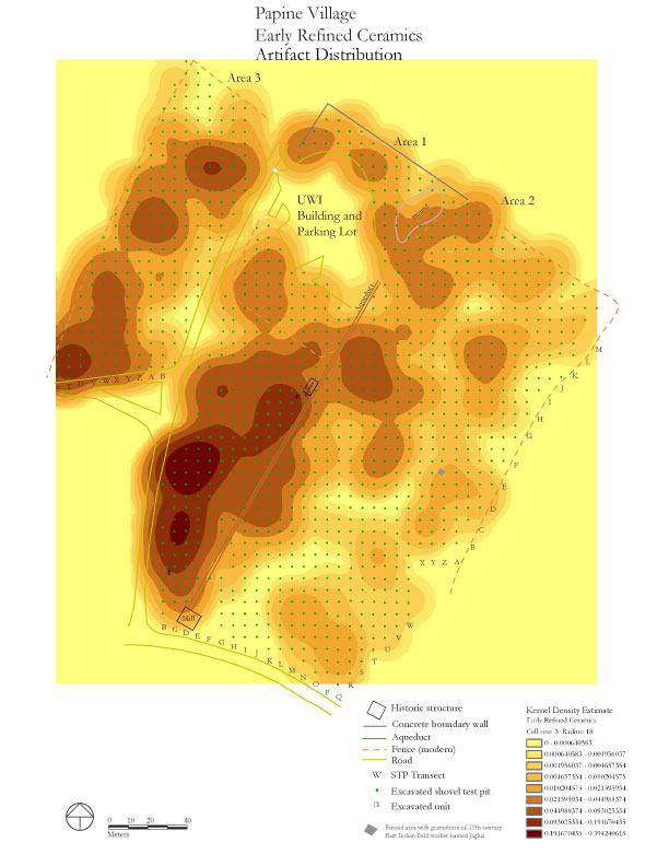
Figure 6. Distribution map of early refined ceramics at Papine Village, produced using Kernel Density Estimates.
Time-space relationships can also be inferred using artifact distribution maps. Artifact distribution maps are created using two pieces of information: STP map locations and counts of artifact types recovered at those locations. We use Kernel Density Estimates to extrapolate the counts of artifacts over the entire site area, resulting in an interpolated surface.
The distribution of diagnostic artifacts such as ceramics reveals spatial-time patterning at the site. We see that “early refined ceramics”, defined as refined stonewwares, earthenwares, and porcelains dating through the end of the third-quarter 18th century, spread west of the cistern and south near the mill while later ware types such as Pearlware and Whiteware spread east and north across the village site. The mapping of less time-sensitive artifacts like window glass and brick, that were probably utilized throughout the entire time period of occupation at the village, produces distribution maps with little or no time-spatial patterning.
Locally-Produced Coarse Earthenware:
Ongoing research by Galle, Cooper, and Neiman on locally-produced coarse earthenware ceramics in Jamaica has focused on developing an island-wide chronology for domestic sites of slavery across Jamaica and using that chronology to track change in coarse earthenware types through time. To date, scholars have argued that locally-produced wares–both those that are hand-built on a small, local scale and those that are produced by specialist workshops across the island–varied little throughout the 17th, 18th, and 19th centuries (Hauser 2007, 2008) or that their manufacture and use were clear indicators of African ceramic and culinary traditions (Armstrong 1999, Ebanks 2003).
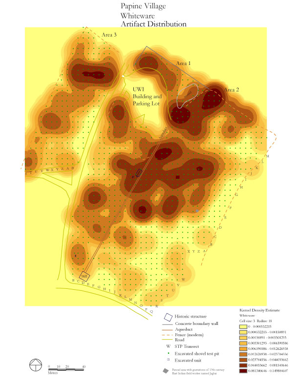
Figure 7. Distribution map of Whiteware at Papine Village, produced using Kernel Density Estimates.
Our preliminary analysis using data from 19 domestic slave sites in Jamaica suggests that locally-produced coarse earthenwares change significantly through time, with a dramatic decrease in the frequency of coarse earthenwares through the 18th and early 19th centuries, especially in relationship to the high, sustained consumption rates of costly ceramics imported from the UK and China. Seriation of coarse earthenware vessel attributes suggests that locally-produced vessels that imitated European wares in regards to glazing and decoration decrease during the fourth quarter of the 18th century while large, thick-bodied, unglazed vessels suitable for food storage and bulk processing remained popular throughout the 19th century. These trends are seen clearly at the Papine Village, with thin-walled, handbuilt Afro-Caribbean ceramics prominent in Phase 1 and thick-walled, unglazed, red paste coarse earthenwares dominate in Phases 2 and 3. For greater detail, click here.
Jillian E. Galle, with contributions from Suzanne Francis-Brown on the documentary record.
The Digital Archaeological Archive of Comparative Slavery and the University of West Indies, Mona
September 2011
Things you need to know about the Papine Village before you begin using the data
- Field measurements are in meters and centimeters.
- All excavated sediment was passed through 1/4 inch mesh.
- Shovel-test-pits are on the UTM grid system.
- 1207 shovel-test-pits were excavated at the Papine Village between January 2008 and January 2010.
- Four 1-x-1 meter excavation units were opened and completed west of the aqueduct and two more 1-x-1 meter units were begun adjacent to the cistern.
- An alphanumeric system was established for naming STPs that combine the Area, the Transect Letter, and the STP number. The Papine Village site was divided into three areas, Area 1, Area 2 and Area 3. Transects were labeled alphabetically across the site. STPs were numbered consecutively within each transect. As a result, STP context numbers follow this format: 3-J-01, which translates into Pit 1, on Transect J, in Area 3.
- In the DAACS database, the Papine Village site is designated as Project “1212”. Artifact ID numbers for artifacts associated with the village therefore begin with the 1212 prefix.
- Architectural and landscape features including terraces, roads, and cisterns, were selectively mapped with a total station.
The University of the West Indies Mona and The DAACS Caribbean Initiative
The UWI, Mona Department of History and Archaeology has facilitated DAACS’s research in Jamaica since 2005, when DAACS staff began work analyzing Barry Higman’s Montpelier Plantation Archaeological Collections, which are curated by the UWI Archaeology Laboratory. Dr. SwithinWilmot, then Chair of the Department of History and Archaeology, welcomed the DAACS project and helped us find on-campus housing for our five months of work in Kingston. Dr. Philip Allsworth Jones, then Lecturer in Archaeology, welcomed DAACS archaeologists and included us in the laboratory’s events. Galle taught H28A for Dr. Jones in Spring 2006, while conducting analysis on the Montpelier collections with Leslie Cooper and Henry Sharp.
In May 2007, Galle taught a Field School in Historical Archaeology at Stewart Castle, on the north coast of Jamaica, for The University of Virginia. Although not directly affiliated with UWI Mona, DAACS offered paid internships and scholarships for UWI, Mona History and Archaeology undergraduates. Four students attended the field school as UVA students and received academic credit for their participation. Another four UWI students received internships with the project. The Reed Foundation generously provided funds for these students and interns through a grant made to DAACS.
A similar model was followed in 2008, when Galle and Neiman ran an eight-week field project on Nevis and St. Kitts. They once again received funding from The Reed Foundation to bring UWI Mona graduate and undergraduate students to Nevis for a three-week internship. Seven UWI Mona interns, three graduate students and four undergraduate students, participated in the program.
In 2008 DAACS began a more directly collaborative program with UWI Mona by helping run the annual UWI Mona Archaeological Field School. Dr. Sabrina Rampersad had recently been hired as lecturer in Archaeology upon Allsworth-Jone’s retirement. Dr. Rampersad welcomed DAACS’sinterest in working at Papine and Mona Villages and generously agreed to work with DAACS to design an archaeological field school program that offered experience in survey and unit excavation, as well as laboratory methods and digital technology such as the use of total stations and GPS in the field. DAACS and Dr. Rampersad worked together in 2008, 2009 and 2010.
In 2011, Galle and Ivor Conolley, a PhD. candidate in the UWI Mona Department of History and Archaeology, co-directed the 2011 H28A Archaeological Field School. Dr. Rampersad left UWI Mona in May 2010 to take a position at UWI Cave Hill and Mr. Conolley served as lecturer for the 2010/2011 field school. Galle and Conolley currently hold a three-year permit for work at the Mona and Papine Estates.
DAACS staff is deeply grateful for the help and support of UWI Mona’s Department of History and Archaeology and the Principal’s Office. We look forward to continuing the UWI Mona/DAACS collaboration in future years.
Acknowledgments
The work at the Papine Village was supported by the DAACS Endowment and the University of the West Indies, Mona Department of History and Archaeology (http://myspot.mona.uwi.edu/history/).
None of this field work would have been possible without the consistent, engaged support of the University of the West Indies, Mona Principal’s Office and the Department of History and Archaeology. Special thanks goes to Professor Gordon Shirley, Pro Vice Chancellor and Principal of the Mona Campus, for granting permission to the UWI-DAACS archaeological excavations at the Papine and Mona Villages and the Mona Great House. Professor Swithin Wilmot, Dean of the Faculty of Humanities and Education, Professor Kathleen Monteith, Chair, Department of History and Archaeology, Professor Waibinte Wariboko, Acting Dean of the Faculty of Humanities and Education, Dr. James Robertson and many others in the Department of History and Archaeology have demonstrated a sustained interest in, and support, of the fieldwork since the beginning. We are ever grateful for their support and friendship.
The Jamaica National Heritage Trust (JNHT) supported the fieldwork through excavation and export permits. Mr. Dorrick Gray and his staff were enthusiastic volunteers and engaged visitors throughout the field seasons.
Jillian Galle and Sabrina Rampersad co-directed excavations at the Papine Village in 2008, 2009, and 2010. Ivor Conolley played a significant role in organizing and supervising fieldwork during these seasons and Conolley led the team in late January 2009 that conducted all of the STP field work in Area 3 of the Papine Village.
The short but intensely productive field seasons would not have been possible without our invaluable DAACS crew: Lynsey Bates (2008-2011), Suzanne Francis Brown (2009-2011), Ivor Conolley (2008-2011), Leslie Cooper (2008-2011), Sarah Corker (2008), Krystle Edwards (2009-2011), Christopher Graham (2011), Clive Grey (2009-2011), Karen Hutchins (2008-2010), Brian McCray (2008-2010), Chris Mundy (2008), Fraser Neiman (2009-2010), Rim Patterson (2009-2011), Karen Spence (2008-2011) and Derek Wheeler (2008).
Leslie Cooper, Ivor Conolley, Lynsey Bates, and Karen Hutchins played particularly significant roles on insuring each field school ran smoothly on all fronts.
Dr. Suzanne Francis-Brown has provided invaluable historical research and advice on all manner of UWI-related concerns.
Leslie Cooper digitized all of the site maps (.dgns, .pdfs, and .gifs) and artifact distribution maps.
Karen Hutchins and Karen Spence supervised all laboratory work between 2008-2010.
Derek Wheeler established the UTM grid system at the Papine Village during the first season of fieldwork in 2008
Leslie Cooper, Lynsey Bates, Jesse Sawyer, and Sarah Payton analyzed the contexts and artifacts at the DAACS lab at Monticello.
This research would not have been possible with the energy and commitment of the students in H28A: Methods in Archaeology. These students remained upbeat and engaged in the face of hundreds of pits to dig.
2008 H28A Archaeological Field School Students: Terry Black, Shawna Brown, Annalys DeLandro, Kareen Dixon, Krystle Edwards, Fayona Forsythe, Melbourne James, Laura Jones, and Sherrion Robinson.
2009 H28A Archaeological Field School Students: Delmore Byfield,Rochelle Denniseur, Eulalee Duncan, Dedre Dunn, Rozanne Gayle, Casmar James, Shanique McFarlane, Kacey-Ann Nelson, Ruschell Russell, Jermaine Smith, and Noni Stephenson.
2010 H28A Archaeological Field School Students: John-Marc Evans, Cornelia Francis, St. Marie Gibbs, Keri Goulbourne, Christopher Graham, Danielle Green, Jermaine Lambert, Krystina Laurence, Janice Malcolm, Ka-Sheena Minott, Mavis Morris, Machela Osagboro, Tanel Panton, Latoya Senior, Roslyn Smith, and Winston Watson.
Feature Numbers
Feature numbers were assigned in the field by DAACS have a F-prefix, which precedes the number (i.e. F01 equals Feature 1, F02 represents Feature 2, etc.). Excavated contexts that belong to the same depositional basin (e.g. the layers in a single pit) have been assigned a single feature number.
Features at Papine Village
Two archaeological features at the Papine Village were identified and given feature numbers. These features were found in 1-x-1 meter units. Feature 1 is a likely cobble paving found in Unit 1 near the cistern. Feature 2 is an unidentifiable pit or trench feature in Unit 4, northwest of the sugar mill. In the case of both features, additional unit excavation in adjacent units is required to fully define the features.
Whenever a possible feature was encountered during the excavation of a 50-centimeter diameter shovel test pit, work in the pit was halted and the presence of a likely feature was noted in the STP field form. These features were not given numbers as they were not slated for excavation but the field notes and drawings for these STPs usually include a drawing of the possible feature and notes regarding its characteristics.
| Feature | Feature Type | Contexts |
|---|---|---|
| F01 | Paving, cobble | 001G |
| F02 | Pit, unidentified | 005E, 005G |
Papine Village Chronology
DAACS staff aims to produce a seriation-based chronology for each site using the same methods (see Neiman, Galle, and Wheeler 2003 for technical details). The majority of sites in the archive are comprised of data derived from deposits within quadrats. On these sites, only assemblages from features or stratigraphic groups with more than five ceramic sherds are included in these ceramic-based seriations. Plowzone contexts do not contribute to a DAACS seriation-based chronology.
The DAACS Caribbean Initiative focuses on exploring large-scale change on slave villages, or areas where enslaved individuals lived and labored, such as great house compounds, in the Caribbean through the use of shovel-test-pit surveys. For sites with extensive and standardized STP coverage, including the Papine Village site, a variation on our site-based seriation method is employed. This is because each STP is small (50 cm. in diameter) and provides a small artifact sample. As a result, STP assemblages are rife with sampling error. The samples from individual STPs are so small that variation among STPs is almost entirely statistical noise.
Successfully analyzing STP data, without first aggregating those pits into counting units called sites, requires methods to suppress sampling error. Here we use empirical-Bayesian methods. They offer a smart way to smooth both artifact density surfaces and relative frequencies of artifact types. To understand how these methods work, consider an STP – let’s call it STP 12. The number of artifacts found in STP 12 is likely to be similar to the number of artifacts in the STPs within a certain distance of it. The information contained in the neighborhood of pits is combined with the actual number of artifacts from STP 12 to arrive at an estimate of artifact counts that are less influenced by sampling error (Neiman et al. 2008).
We use two forms of Bayesian smoothing in succession. First, to smooth counts of ceramic ware types in individual STPs, we use a gamma-Poisson model. The gamma-Poisson algorithm smooths counts of individual artifact types in each STP, based on the counts for that type in nearby STPs. We then use a beta-binomial model to estimate relative frequencies (percentages or proportions) of ceramic ware types in individual STPs. Together two forms of Bayesian smoothing provide smoothed, stable estimates of artifact-type frequency variation in individual STPs, allowing us to see overall site patterning that may otherwise be distorted using raw data (Neiman et al. 2008).
To infer a chronology from the STPs we used correspondence analysis (CA) of ware-type frequencies. We employ CA because with the numbers of STP assemblages in the hundreds, a traditional manual frequency seriation is completely impractical. CA converts a data matrix of ware-type frequencies into a set of scores which estimate the positions of the assemblages on underlying axes or dimensions of variation. MCDs are weighted averages of the historically documented manufacturing date for each ware type found in an assemblage, where the weights are the relative frequencies of the types. Measuring the correlation between CA axis scores and MCDs offer an indication of whether the CA scores capture time (Ramenofsky, Neiman and Pierce 2009).
Dating the Papine Village Site
Bayseian smoothing and CA analysis can be used on STP data from the Papine Village site. The CA for the Papine Village resulted in three occupational phases for the survey area. The Papine Village dates from the 1770s through the mid-19th century with materials dating from the post-emancipation East Indian laborer settlement. The mean ceramic dates and TPQs for each of the three phases are provided below.
The table also includes three estimates of the ceramic TPQ for each phase. The first TPQ estimate is the usual one – the maximum beginning manufacturing date among all the ware-types in the assemblage. The second estimate — TPQp90 — is the 90th percentile of the beginning manufacturing dates among all the sherds in the assemblage, based on their ware-types. The TPQp95 provides a robust estimate of the site’s TPQ based on the 95th percentile of the beginning manufacturing dates for all the artifacts comprising it. These last two TPQ estimates are more robust against excavation errors and taphonomic processes that might have introduced a few anomalously late sherds into an assemblage.
| Phase | MCD | TPQ | TPQp90 | TPQp95 | Total Count |
|---|---|---|---|---|---|
| P01 | 1791.6 | 1830 | 1775 | 1775 | 940 |
| P02 | 1801 | 1870 | 1775 | 1820 | 1881 |
| P03 | 1822.4 | 1840 | 1820 | 1820 | 2324 |
The smoothed ceramic ware-type frequencies for the village fit the expectations of the seriation model well, witness the point configuration in the plot of STP assemblages on the first two CA dimensions (Figure 1). The corresponding plot of ware types reveals that CA axis 1 (Dimension 1) reflects a temporal trend, with early ware types on the right and later ware types on the left. A histrogram of ceramic sherds from Papine by Dimension 1 shows the three phases. The plot of the Dimension 1 scores against BLUE MCDs demonstrates the strongly temporal association, especially visible when the STPs are coded with their Phase assigment. When the Phase assignments were mapped onto the shovel-test-pits, the earliest, Phase 1 occupation is seen along the western side of the site, just southwest of the mill. Phase 2 is primarily on the western side of the aqueduct with Phase 3, representing the latest occupation, spreading far across the eastern half of the village.
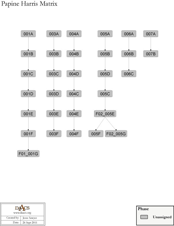
Papine Village Harris Matrix
The Harris Matrix summarizes stratigraphic relationships among excavated contexts and groups of contexts that DAACS staff has identified as part of the same stratigraphic group. Stratigraphic groups and contexts are represented as boxes, while lines connecting them represent temporal relationships implied by the site’s stratification, as recorded by the site’s excavators (Harris 1979).
For a printable version, download the Harris Matrix [195.73 KB PDF].


PDF of Unit 1, north, east, south, and west profiles.
PDF of composite excavator’s plan, compiled by DAACS from original field drawings.
Conolley, Ivor C., Leslie Cooper , Fraser D. Neiman , and Jillian E. Galle
2010 Identifying Change in household- and specialist-produced coarse earthenware from 18th and 19th century Jamaican villages. Scientific Poster Presented at the Annual Meeting of the Society of American Archaeology, April 2010. St. Louis, MO.
Ebanks, Roderick
2003 The History of Jamaica Ceramics, 1655-1840. Master's of Philosophy thesis, Department of History and Archaeology, University of West Indies, Mona.
Francis-Brown, Suzanne
2005 Finding Families within the Communities Enslaved on the Mona and Papine Estates, 1817-1832. In Caribbean Quarterly. Vol 51 (3-4) pp. 94-108.
Francis-Brown, Suzanne
2004 Mona Past and Present: The History and Heritage of the Mona Campus, University of the West Indies. University of the West Indies Press, Kingston, Jamaica.
Harris, Edward C.
1979 Principles of Archaeological Stratigraphy. Academic Press, London, England.
Hauser, Mark W.
2007 Between Rural and Urban: The Archaeology Of Slavery And Informal Markets In Eighteenth Century Jamaica In Archaeology of Atlantic Africa and African Diaspora. pp. 292- 310. A. Ogundiron and T. Falola (eds.). Bloomington: University of Indiana Press
Hauser, Mark W.
2007 Between Urban and Rural: Organization of Local Pottery in Eighteenth-Century Jamaica. In Archaeology of Atlantic Africa and the African Diaspora, edited by Akinwumi Ogundiran and Toyin Falola, pp. 292-310. Bloomington: Indiana University Press.
Hauser, Mark W.
2008 An Archaeology of Black Markets: Local Ceramics and Economies in Eighteenth-Century Jamaica. Gainsville: The University of Florida Press.
Higman, B. W.
2001 Jamaica Surveyed: Plantation Maps and Plans of the Eighteenth and Nineteenth Centuries. University of the West Indies Press. Kingston, Jamaica.
Latty, Vitalyn Dias
2006 A Study of Excavated Material from Papine. A research paper submitted in partial fulfillment of the requirements for the degree of Master of Arts in Heritage Studies. The University of the West Indies, Mona.
Mintz, Sidney
1996 Enduring substances, trying theories: the Caribbean region as oikoinoume. Journal of the Royal Anthropological Institute 2:289-311.
Neiman, Fraser D., Jillian E. Galle , and Derek Wheeler
2003 Chronological Inference and DAACS. Unpublished paper presented at the annual meeting of the Society for Historical Archaeology, Providence, Rhode Island. On file at the Department of Archaeology, Thomas Jefferson Foundation, Charlottesville, Virginia.
Nugent, Maria
1907 [1839] Lady Nugent’s Journal London: Published for the Institute of Jamaica by A. & C. Black, 1907. Edited by Frank Cundall. Reprinted from a journal kept by Maria, Lady Nugent, from 1801 to 1815, issued for private circulation in 1839.
Yates, Geoffrey S.
1955 A Note on the Origins of the Names Papine and Mona. Jamaica Historical Society Bulletin, No.II.