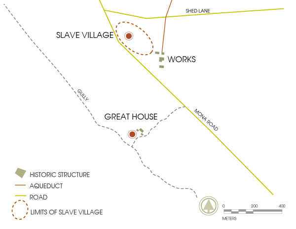
Mona Estate: History and Overview
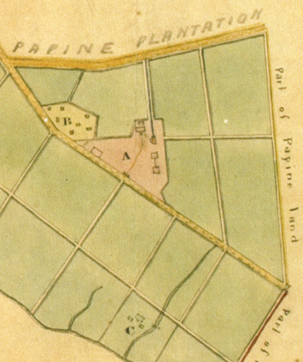
1779 survey map of Mona Estate showing (A) Mona Works, (B) Mona Village, and (C) Mona Great House. Library of Jamaica.
The Mona Estate was the last sugar estate operating in the parish of St Andrew, Jamaica, ceasing operations by the end of the first decade of the 20th century. The 1910 Handbook of Jamaica carries a final production entry for the estate – 25 hogsheads of sugar and 20 puncheons of rum – compared with a quarter century before when, with 101 East Indian workers in the field, the estate had produced 135 hogsheads of sugar and 109 puncheons of rum. By 1914, Mona was sold to the Kingston General Commissioners, completing their purchase of the estates along the Hope River with rights to water that would be diverted to serve the growing city of Kingston.
Estate Owners
The name, Mona, may have been given to the estate when it was owned by Philip Pinnock and his wife Grace. According to an 1845 text discussing the origin of the Hope water supply, around 1757 “Philip Pennock (sic) of St Andrew was seized of a plantation or sugar-work called Yeomans (sic) which is now called Mona Estate.” The origins of the estate’s name remains something of a mystery though Geoffrey Yates suggested in a 1955 issue of the Jamaica Historical Society Bulletin that it may be an allusion to the Roman version of the name given at various times to Anglesey and the Isle of Man in the British Isles.

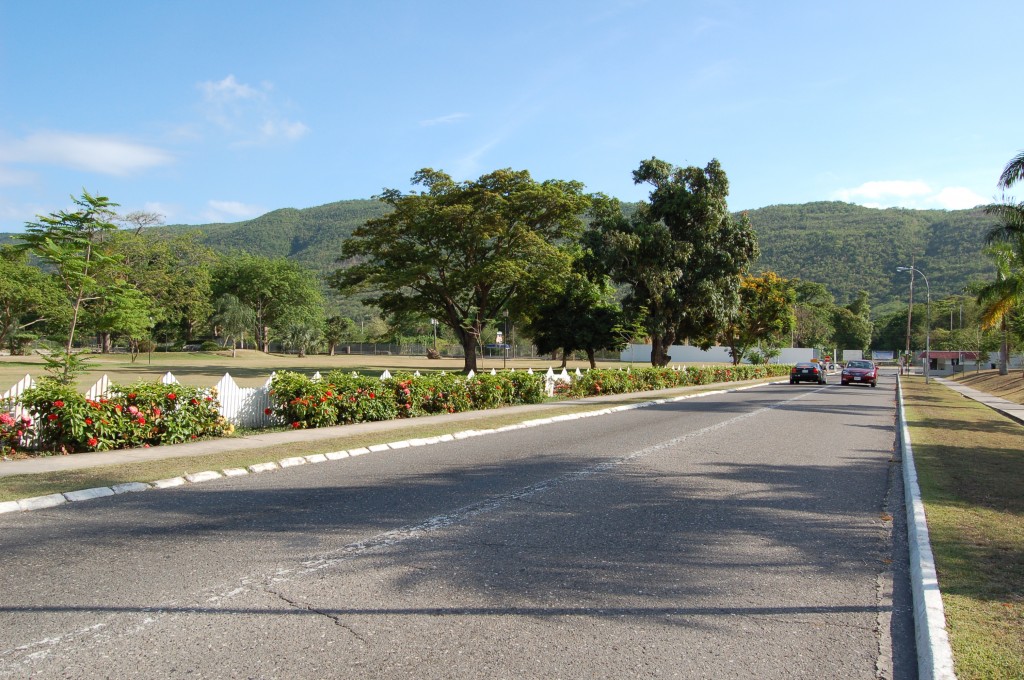
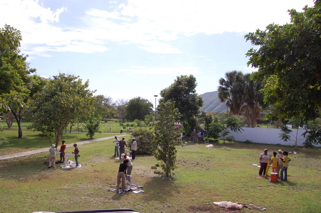
Photograph of Mona Village area, currently located on UWI Mona campus, looking north.
The estate had previously belonged to Edward and Judith Yeamans, who mortgaged it to planter Thomas Pinnock and Dr Thomas Cockburn in 1738. Eleanor Angelina Yeamans, who inherited the estate in 1754, sold it to Philip Pinnock who by then owned some 4,000 acres in the parish of St Andrew.
The land comprising Mona included several lots of land patented in the 1660s to 1680s by officers who had served in the capture and settlement of Jamaica in 1655. The names of these early patentees included Benjamin Brayne, Richard Brayne, and Elias Southern.
Philip Pinnock, a planter and member of the House of Assembly, appears to have invested in the estate. The cut stone aqueduct, which spans the Mona, Papine, and Hope estates, and the Mona works buildings may date to his tenure. Certainly the ruin of the still house or distillery and rum store still carries the capstone with the date 1759 incised in it.
Around 1767, the estate was sold to John Kennion, with its enslaved population and all stock. A 1774 map of the neighbouring Papine Estate shows its southern boundary as ‘Mona Estate belonging to John Kennion Esquire formerly Philip Pinnock’. However, subsequent estate maps dated 1779, 1785, and 1831, also in the collection of the National Library of Jamaica, were done at the behest of William and Thomas Bond, a London merchant and magistrate respectively, or their heirs.

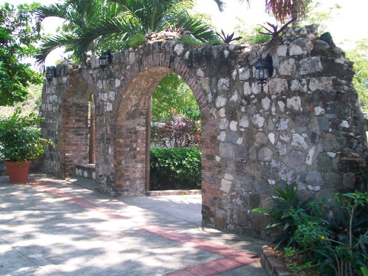
Mona Boiling House ruins, currently part of UWI Mona Conference Center.
The Bond estate owned Mona throughout the period of greatest change in Jamaica’s sugar industry – from the period of relative prosperity in the late 18th century, through the abolition of the transatlantic trade in enslaved Africans, the failed period of amelioration and the coming of abolition of slavery in 1834 and emancipation in 1838. It may have been the further blows to the industry with the end of protective duties at mid-century that finally led to the sale of Mona to Louis Verley, Jamaican planter and merchant. Between the 1860s and the 1890s, Verley purchased Mona, Latimer Pen, Papine, and Hermitage Pen, consolidated holdings of more than 2,600 acres. Mona’s acreage was just around 1,000 acres.
Enslaved Population
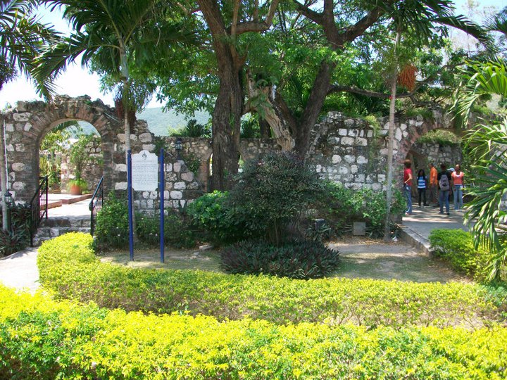
Mona Works building, also currently part of UWI Mona Conference Center.
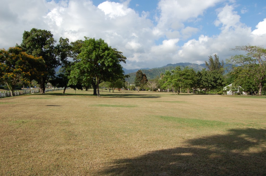
The enslaved population living on the Mona Estate is commemorated on a modern cut stone obelisk that stands within the area shown on estate maps as being the site of the village where they had their homes. Ackee and mango trees, accepted botanical markers for such communities, still dot the location, though much of the area is now under a car park for the Natural Sciences faculty of the University of the West Indies.
Attached to the obelisk are lists of men and women, boys and girls who researchers believe could have been living in the area at the time of emancipation from slavery – the state in which most plantation labourers, imported from Africa or born in Jamaica lived for nearly two centuries.
The existing data suggests that the enslaved population at Mona generally numbered between 160 – 190 persons. Statistics for 1817, available from an island-wide Return of Slaves, show two lists totaling 187 persons – 88 men and 99 women, ranging in age between 3 months and 81 years, a little less than two thirds of them Creole or Jamaican born, the rest having been brought from Africa before the ending of the trade 10 years before. In 1832, the number of enslaved persons was 165.

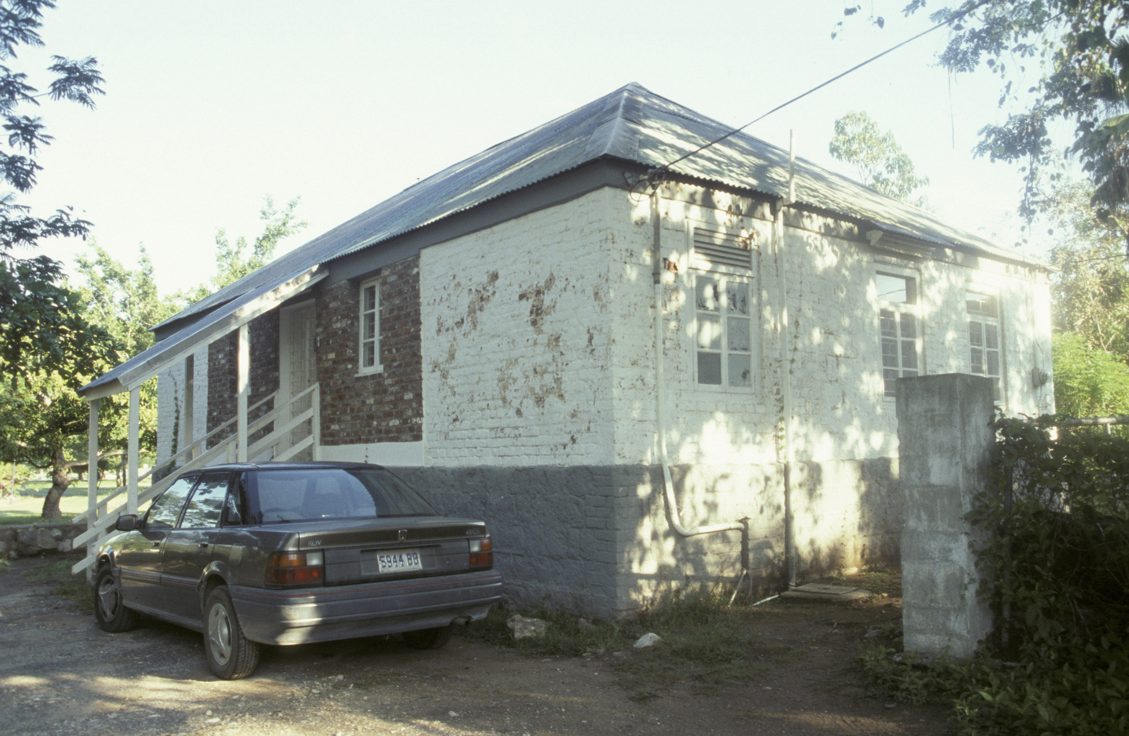
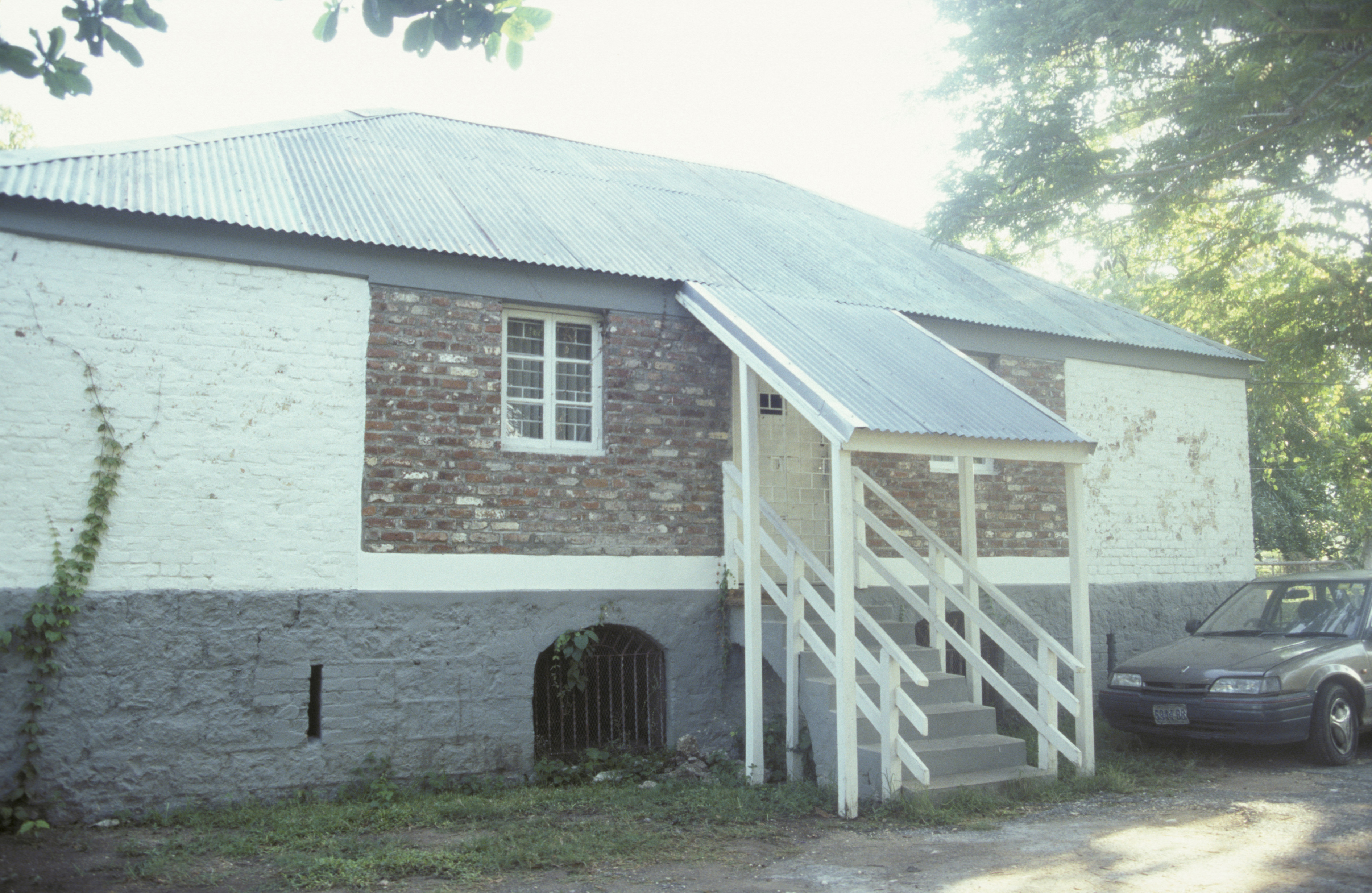
Mona Estate Bookkeeper’s House, currently UWI Mona Archaeology Lab.
Both the 1779 and 1831 estate maps clearly show the estate village to the west, north-west of the works yard, within sight of the overseer’s and bookkeeper’s houses.
Archaeological investigation using survey test pits (STPs) was conducted at Mona in 2010, in collaboration between the UWI and DAACS. The aim was to confirm the site of the Mona – and neighbouring Papine – village and to gain insights into the material culture of the inhabitants.
Industrial Complex
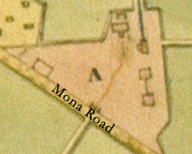
Blowup of 1779 survey map showing Mona Works buildings. Jamaica National Library.
The material aspects of the Mona Estate are described in some detail in 1797, in a Chancery Court document stored at the UK National Archives. Besides the mansion house, overseer house, kitchen, and iron store, it includes “a new Boiling House laid with rangers and Milasses Cistern leaded and Aquaduct of fifty one Arches for carrying the water to the Wheel, a Mill House and liquor receiver leaded containing five hundred gallons, a Necessary House, a Compleat Mill House…a Curing House…a Rum Store…a Carpenters shop and shed for carriages, a Horse Stable and wash house under one Roof, Hot House containing a Hall and two rooms and Piazza…”
Great Houses
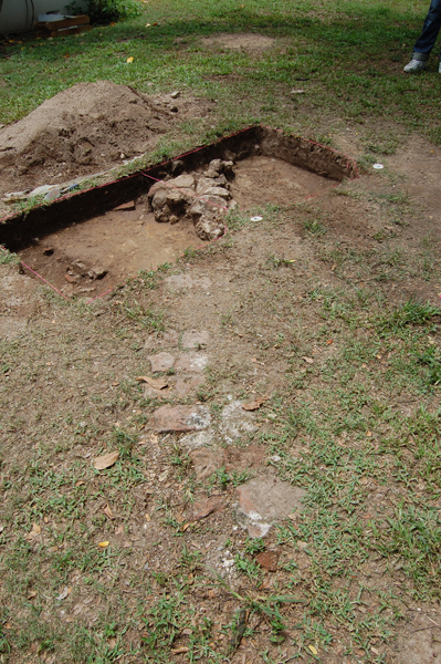
Excavation units opened in May 2011 around what are likely the remains of the middle period Mona Great House foundation, visible on the ground surface.
The Mona property appears to have had not one Great House, but two, during different periods of the estate’s history. At least one map, dated 1785 and commissioned by James Wildman, owner of the neighbouring Papine Estate, shows two Mona houses. Other maps show one or the other. The 1779 plan of Mona Estate, for instance, shows one great house and outhouses on eight acres of land, about 12 chains south of the Mona Works. That area, now called College Common, is the site of university housing, with no historic house extant.
The present house known as Mona Great House is perhaps a mile west of the Works Yard, on a site identified as one of two on the 1785 map; not shown at all in 1779; and then shown as the single great house in 1831. This house sits on an old foundation, which had artifacts associated with it ranging from 1660 to 1880, according to a report shared by the owner.
Speculation that remains of the middle period house must still lie in College Common was borne out during an archaeological field school for students of the UWI Department of History & Archaeology, co-directed by UWI and DAACS in May 2011. Foundations of a potential main building and dependencies were located, including the base of what appears to be a well. Artifacts found in the area appeared consistent with a mid- to late-18th century occupation.
Water
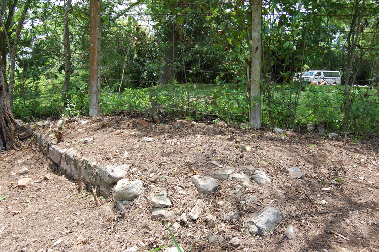
Foundation of a dependency related to the middle period Mona Great House, cleared in May 2011 during field school.
The water to turn the overshot wheel at the Mona Estate was drawn from the higher reaches of the nearby Hope River and conveyed via a wooden gutter and later a cut stone aqueduct first to Hope Estate, then Papine, and finally Mona. The collaboration dates back to the mid-18th century, to an act of the Assembly that confirmed to the owners of each of the three estates the right to one-third of the stream of water conveyed by the aqueduct from the river. These proportions were later adjusted, based on deeds between the respective parties, and this water became a major part of the value of the estates.
Archaeological Investigations at the Mona Estate
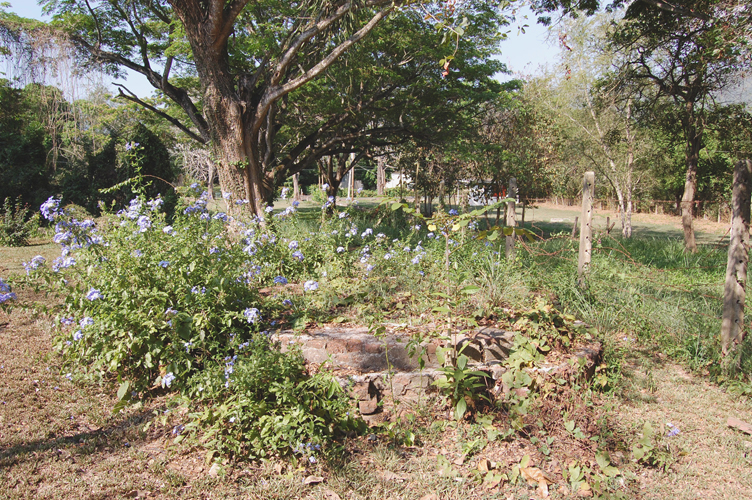
Well at the middle period Mona Great House, photographed May 2011.
The Digital Archaeological Archive of Comparative Slavery, in collaboration with the University of the West Indies, Mona Archaeological Field School, began and completed a shovel-test-pit survey of what remains of the Mona Village during the January 2010 field season. The following year, in May 2011, the UWI Field School and DAACS undertook an STP survey of the College Common Mona Great House site. These surveys are part of the DAACS Caribbean Initiative (DCI), a large-scale, internationally collaborative initiative to document archaeologically through survey, excavation, and collections analysis, the trajectories of change in slave lifeways on the north and south coasts of Jamaica, and on the small islands of Nevis and St. Kitts during the 18th and 19th centuries. DCI’s primary method for understanding change in slave lifeways is use of systematic shovel-test-pit survey to document change in the material record over time and space. These surveys are modeled on other DCI shovel-test-pit surveys on the north and south coasts of Jamaica, and on Nevis and St. Kitts.
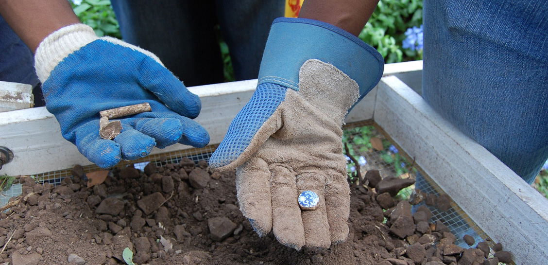
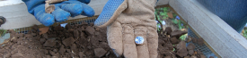
Artifacts recovered from an STP at Mona Village, including a tobacco pipe fragment and a transfer printed ceramic sherd that was ground into a circular gaming piece.
Preliminary analysis of the recovered artifacts has established the temporal and spatial occupations of both the Great House and Village sites. The College Common Great House site was tightly dated by the ceramic ware types found on site to between the 1750s and late 1770s. What remains of the Mona Village site dates from the late 1750s through the early-19th century. The village was likely occupied through emancipation, however we hypothesize that evidence for this later occupation was obliterated by the parking lot and buildings associated with UWI’s Natural Sciences Complex. The archaeological sites pages for the Mona Village site and Mona Great House site provide detailed data on the individual sites’ chronologies, excavation methods, research results, maps, and site images.
Suzanne Francis-Brown with contributions on the archaeology by Jillian Galle
The University of the West Indies, Mona and The Digital Archaeological Archive of Comparative Slavery
September 2011


