
| Location: | Monticello, Charlottesville, VA, United States |
|---|---|
| Occupation Dates: | Last quarter 18th/first quarter 19th century. Phasing and mean ceramic dates can be found on the Chronology page. |
| Excavator(s): | Oriol Pi-Sunyer (1957) and William Kelso (1979, 1986). |
| Dates excavated: | 1957, 1979, and 1986. |

Overview
Building i, located on the western end of Monticello’s Mulberry Row, was identified by Jefferson in the Mutual Assurance Declaration of 1796 as a house “used at times as a carpenter’s shop”. Aside from Jefferson’s brief description and accompanying plat, no historical references to a structure in this location are known. In 1957, Pi-Sunyer placed two long trenches in an area west of Building C, or the Joinery, but reported finding no architectural remains to the west of the Joinery’s stone foundation. Twenty-nine years later, Kelso directed excavations in the presumed area of Building i, uncovering a series of postholes that closely matched the structure’s dimensions provided by Jefferson. Kelso’s work at the site in 1986 represents the final coordinated effort to document archaeologically the Mulberry Row structures recorded on the 1796 plat.
Documentary evidence
Two early sketches, one schematic (Jefferson: N85) and one measured (Jefferson: N87), depicted a line of buildings in what are believed today to be largely unrealized versions of Mulberry Row. Although a carpenter’s shop appeared in both, in one it is shown east of the extant stone workman’s house and in the other it is located just west of the stone house rather than on the far western end of the Row, where the excavation site of Building i is located.
On the 1796 Mutual Assurance Declaration, Jefferson (Jefferson: N133) identified Building i as:
a house 30 by 18 ½ f. all of wood, the floor of earth, in which is stored plank and such things. It is used at times as a carpenter’s shop, and sometimes a little fire is made on the floor. From this house is 56. feet to C. the joiner’s shop
The size and location of the structure “used at times as a carpenter’s shop” corresponded to what archaeologists uncovered in 1986 on the far western end of Mulberry Row, leading them to confidently interpret the structure as Jefferson’s Building i.
Excavation history, procedure and methods
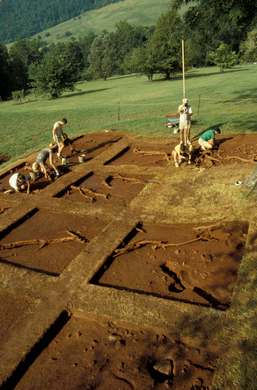
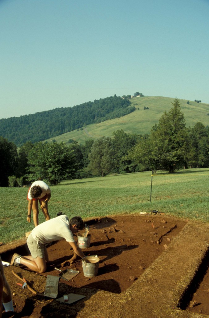
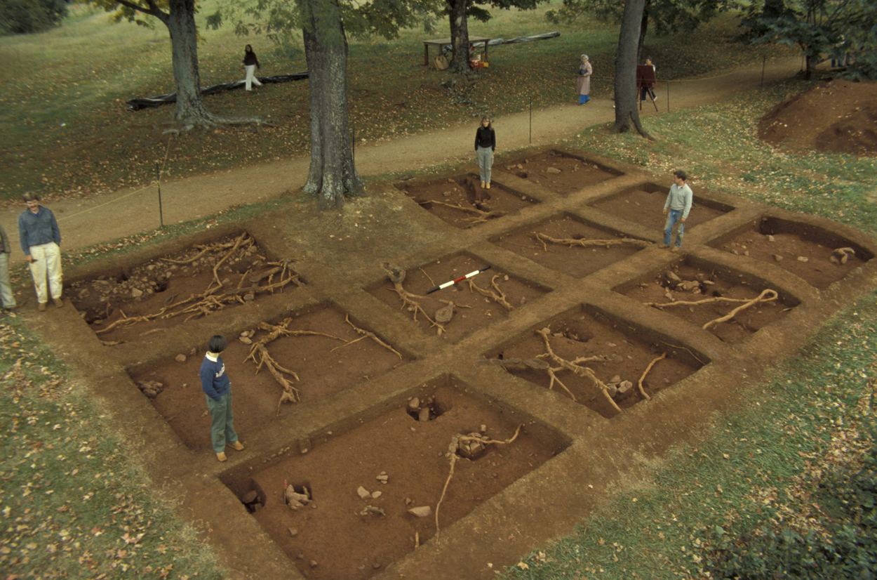
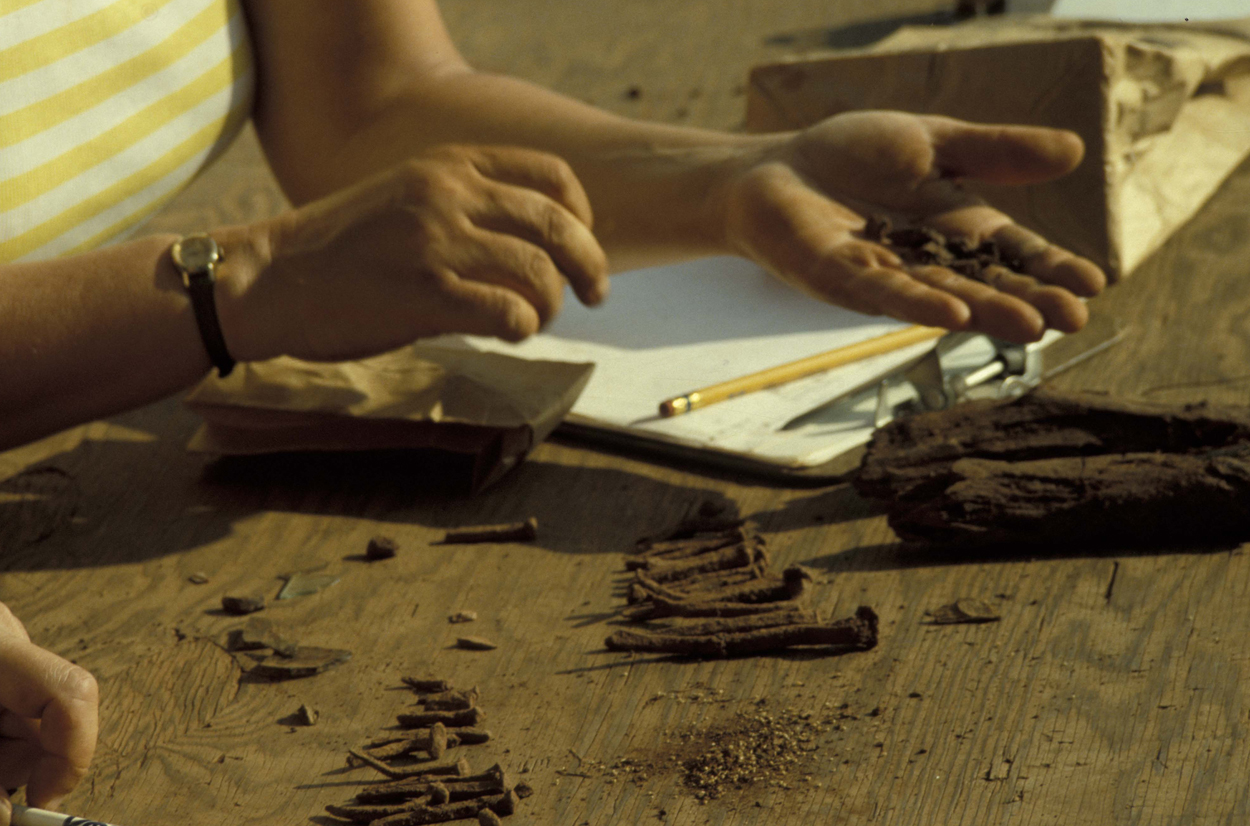
In-progress excavation (facing southwest).
Oriol Pi-Suyner, who worked extensively on Mulberry Row in the summer of 1957, conducted the first archaeological investigations in the area of Building i. Upon completion of the Joinery excacations (Pi-Sunyer Structure I; Jefferson Building C), Pi-Sunyer (1957:21) described running two parallel trenches west of the Joinery for a distance of 80 feet but reported finding “nothing of importance, either structurally or in the way of artifacts”. Sediment was not screened, and, although some artifacts were curated, the criteria for artifact collection remains unclear. In addition, spatial control of artifact recovery exists only at the site level for Pi-Sunyer’s work. Thus, artifact data from the trenches in the area of Building i are not provided by the archive at this time.
William Kelso placed two 4-by-5 foot quadrats (ER120 and ER122) on either side of Building i in 1979 to document the northern perimeter of the garden fence. Although the contextual and artifact data from these units are included in the archive, the quadrats did not intersect the structure proper.
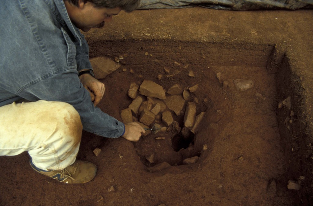
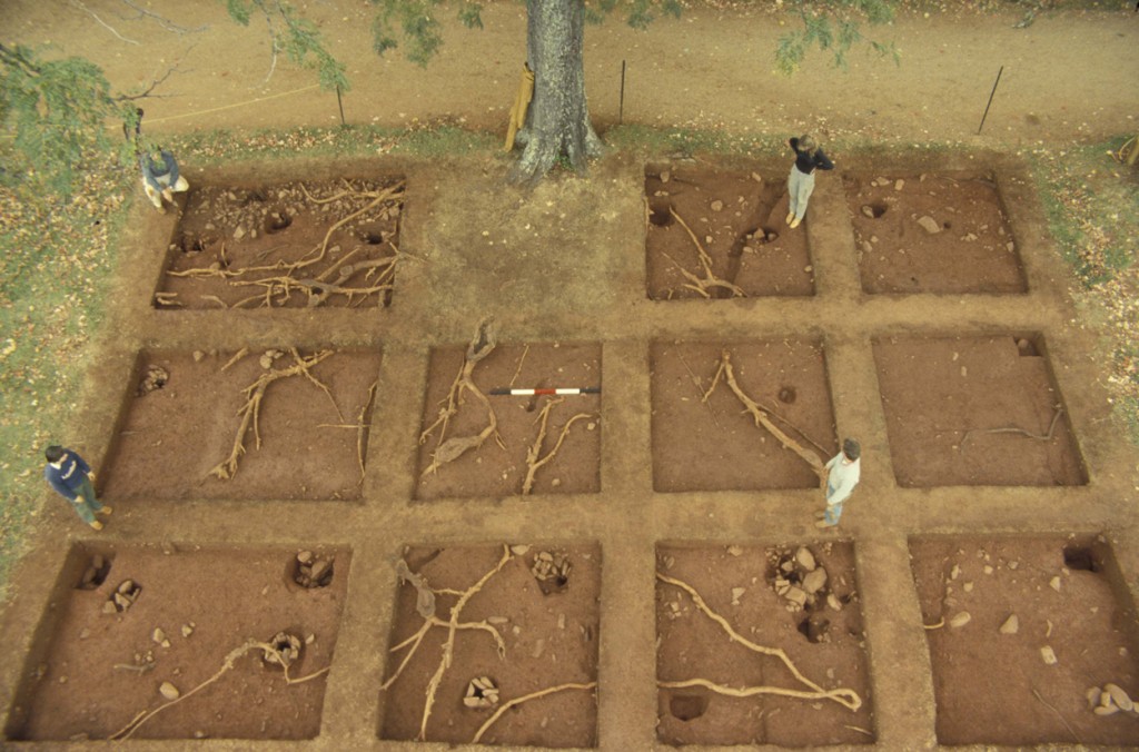
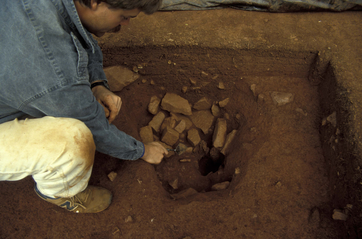
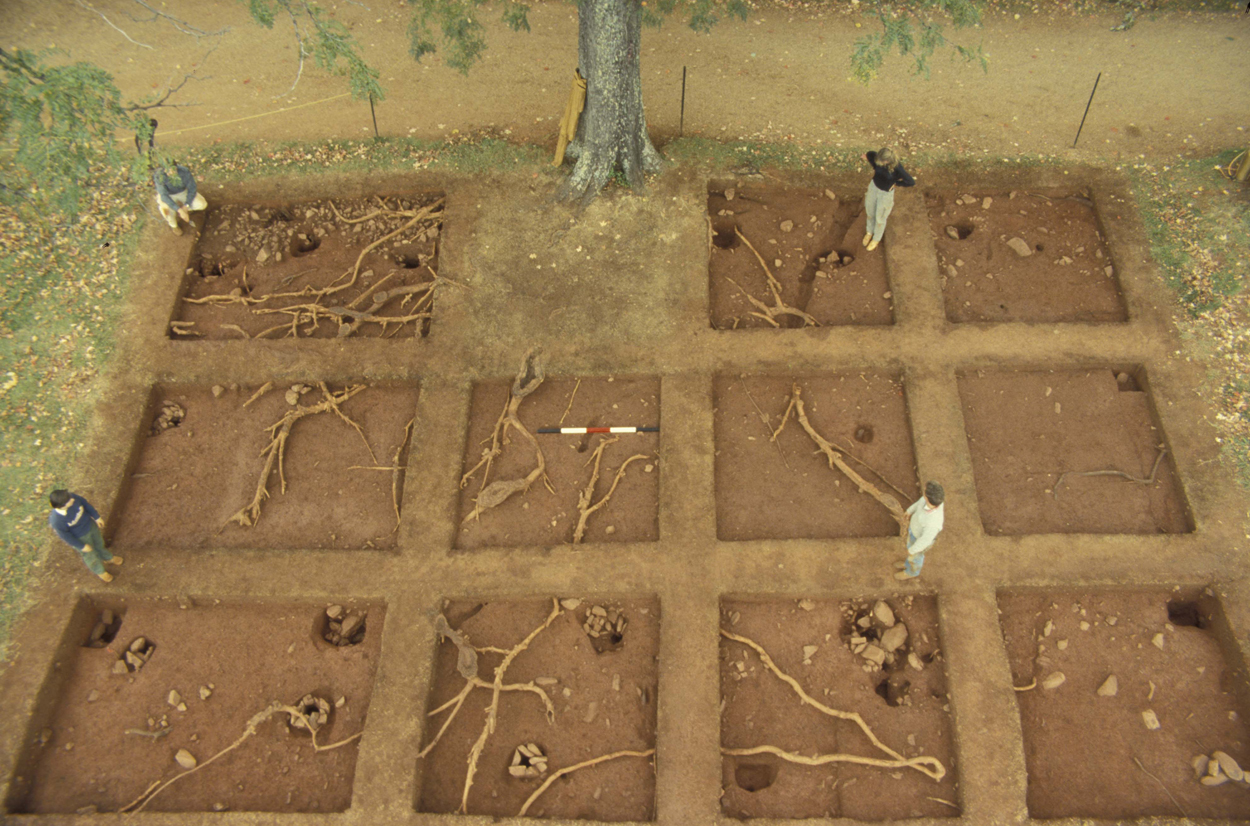
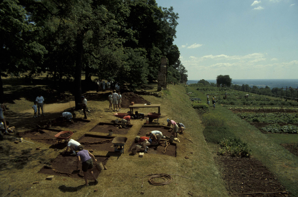
Seven years later, in 1986, Kelso returned to the western end of Mulberry Row specifically to uncover archaeological evidence for Building i. Twelve 8-by-8 foot quadrats, separated by 2-foot wide baulks, were placed on a grid already known to align with Mulberry Row structures identified in the 1796 plat. Six of these quadrats contained postholes that Kelso inferred belonged to the structure identified by Jefferson as Bulding i. The balks and one 8-by-8 foot quadrat were not excavated. Three 4-by-8 foot units on the far west end of the excavation area exposed the western line of structural posts.
Summary of research and analysis
Kelso
Kelso (1997:79) summarized the results of Building i excavations in a discussion about the shops on Mulberry Row:
Excavations…revealed…seven postholes where main support posts…had been seated in the ground, two lines of three on the north and south and one at the center of the west wall. It is possible that the single west wall hole is evidence of a door or chimney hood. No earth floor levels survived and…few artifacts except for nails were found.
He goes on to suggest the discovery of small, double-pointed nails during excavation may indicate shoemaking activity described in documents.
Hill
Five years later, Martha Hill provided an historical and archaeological assessment of the structure for the Mulberry Row Reassessment (2002a;2002b; 2003). In terms of architecture, Hill noted that Kelso’s
units neatly captured the features that define [the shop]: seven posts seated in the earth, probably joined by an eighth…which was not excavated. These postholes describe a three-bay, post-in-the-ground, 30′ x 18 1/2′ building. The structure was flimsy…[and] probably was thrown up, along with the similarly constructed Blacksmith’s Shop and Nailery in the early 1790s. It was intended to be a temporary shelter for materials, activity and labor for the construction of Monticello II.
Hill also remarked on the lack of interior features associated with the structure, including anything that could be construed as evidence for the occasional maintenance of a “little fire” on the floor. Hill noted the absence of evidence for a hard-packed earthen floor, and both Kelso and Hill suggested the living surface may have been removed.
In concluding, Hill identified two questions that an artifact and contextual reanalysis might answer:
- How long into the 19th century was the building in use?
- With the completion of Monticello II, was it demolished, allowed to collapse or rededicated to a new function?
DAACS
Even preliminary analysis by the Archive suggests these and other lingering questions can be addressed with available archaeological data. For example, Monticello staff have identified and dated a deposit (SG01) south of the south wall of Building i (FG01). The ceramic content of SG01 rather clearly suggests an early 19th century Jefferson-period occupation of the area and probably the structure (see Chronology section). A noticeable post-Jefferson ceramic deposit is contained within SG02 and may reflect mid-19th century occupation in the immediate area. A second line of posts (F13, F19, and F21) positioned at an angle to Building i is worth additional consideration but has not been assigned Feature Group status at this time.
Karen Smith
Thomas Jefferson Foundation
December 2009
Things you need to know about Building i before you use the data:
- The entire site was carefully hand-troweled and screens were not used for artifact recovery.
- Measurements are in feet and tenths of feet.
- The excavation grid for Building i was established using the “Wheeler Box” system of 8-by-8 foot quadrats with 2-foot baulks. Although the 8-by-8 foot units were excavated, the baulks were not. Three additional 4-by-8 foot quadrats expanded the excavation grid to encompass the west line of structural posts. Finally, two 5-by-4 foot quadrats follow a garden fenceline.
- In the DAACS database, the Carpenter’s Shop project is designated as Project “101”. Artifact ID numbers for artifacts associated with the project therefore begin with the 101 prefix.
Feature Numbers
The original excavators of the Building i site did not assign numbers to individual features. DAACS staff has assigned feature numbers using the original excavation records. Feature Numbers assigned by DAACS have a F-prefix, which precedes the number (i.e. F01 equals Feature 1).
Excavated contexts that belong to the same depositional basin (e.g. a posthole and postmold or the layers in a single pit) have been assigned a single feature number. In addition, single contexts have been given feature numbers when the original field records indicate that the excavators recognized a context’s spatial distinctiveness from surrounding contexts.
Feature Groups
Feature groups are sets of features whose spatial arrangements indicate they were part of a single structure (e.g. structural postholes, subfloor pits, and hearth) or landscape element (e.g. postholes that comprise a fenceline). Feature Groups assigned by DAACS have a FG-prefix, which precedes the number (i.e. FG01 equals Feature Group 1).
| Feature | Feature Type | Contexts |
|---|---|---|
| F03 | Posthole | 1139D, 1139E |
| F05 | Posthole | 1141C, 1141F, 1141G |
| F10 | Posthole | 1177D, 1177E |
| F11 | Posthole | 1178C, 1178D |
| F14 | Posthole | 1179G, 1179H |
| F15 | Posthole | 1180B, 1180C |
| F18 | Posthole | 1182D, 1182E |
| F20 | Posthole | 1185D, 1185E |
| Feature | Feature Type | Contexts |
|---|---|---|
| F04 | Posthole | 1139F |
| F06 | Posthole, possible | 1141J |
| F07 | Posthole | 1142B |
| F08 | Posthole | 1144C, 1144D |
| F09 | Posthole, possible | 1177C |
| F12 | Posthole, possible | 1179D |
| F16 | Posthole | 1180D, 1180E |
| F17 | Unidentified | 1181B |
| F01 | Posthole | 120A, 120B |
| F02 | Posthole | 122B, 122C |
| F13 | Posthole | 1179E, 1179F |
| F19 | Posthole | 1182F, 1182G |
| F21 | Posthole | 1185F, 1185G |
Building i Chronology
DAACS has developed a uniform set of methods to infer intra-site chronologies for the sites included in the Archive. Using them, we have assigned most excavated contexts at each site to a set of site-specific phases. The use of common methods is designed to increase comparability among phases at different sites. The methods and the phase assignments they produced are summarized below. For some sites, the original excavators developed intra-site chronologies and where these exist, they are included on the Background page for the site. DAACS encourages users of Archive data to help explore improvements.
DAACS Seriation Method
This page summarizes a frequency-seriation based chronology for the Building i site that was developed by DAACS (see Neiman, Galle, and Wheeler 2003 for technical details). DAACS seriated ceramic assemblages, with more than five sherds, from individual excavated contexts and from stratigraphic groups—groups of contexts that field records indicate were part of a single stratigraphic layer or deposit. Stratigraphic Groups have a SG-prefix, which precedes the group number (e.g. SG01 equals Stratigraphic Group 1). For example, at the Building i site, two portions of a single layer, described by the excavators as ‘brown-red loamy clay’, spanned two adjacent quadrats (1141 and 1144). The layer segments were excavated as 1141B and 1144B. DAACS assigned these contexts to a single stratigraphic group (SG01). Not all contexts have stratigraphic group assignments.
DAACS chose to base the seriation chronology for the Building i site on ceramic assemblages aggregated at the level of contexts and stratigraphic groups, and not at the level of features. This is because most contexts and stratigraphic groups on the site were not parts of features. In the few cases where stratigraphic groups and contexts were parts of features, the relevant feature numbers and descriptions are included in the seriation chronology table below.
DAACS computed the frequency of mean-ceramic-date (MCD) types in stratigraphic groups and in individual contexts when those contexts had no stratigraphic group assignment. The seriation chronology is derived from a correspondence analysis of these MCD-type frequencies. Seriated assemblages were assigned to phases. Phases are groups of assemblages that have similar correspondence-analysis scores and are therefore inferred to be broadly contemporary. Phases assigned by DAACS have a P-prefix that precedes the phase number (e.g. P01 equals Phase 1).
The stratigraphic relationships among stratigraphic groups and unassigned contexts are summarized in the Harris Matrix for the site. Phase assignments from the seriation are shown on the Harris Matrix in color, facilitating comparison of the seriation chronology and the stratigraphic chronology of the site.
Building i Phases
Based on the correspondence analysis, DAACS divided the Building i site into two phases. Mean ceramic dates for these phases are given in the table below. The table also includes two estimates of the TPQ for each phase. The first TPQ estimate is the usual one – the maximum beginning manufacturing date among all the MCD types in the assemblage. The second estimate — TPQp90 — is the 90th percentile of the beginning manufacturing dates among all the sherds in the assemblage, based on their MCD-types. This TPQ estimate is more robust against excavation errors and taphonomic processes that might have introduces a few anomalously late sherds in an assemblage.
| Phase | MCD | TPQ | TPQp90 | Total Count |
|---|---|---|---|---|
| P01 | 1802 | 1820 | 1775 | 42 |
| P02 | 1847 | 1840 | 1820 | 255 |
Phase one is a small assemblage derived from excavation of a deposit south of the south wall of the Carpenter’s Shop, assigned by DAACS staff to SG02 and interpreted by the original excavators as a ‘terracing fill layer’. These assemblages attest to the presence of a limited Jefferson-period occupation at the site. Phase two (assigned to SG03 and SG04) contains a signficant amount of post-Jefferson ceramics and may mark a post-Jefferson occupation, even though SG03 was originally described as a ‘Jefferson Pd. Occupation Zone’.
A Seriation Chronology for the Building i Site
The following table presents a seriation chronology for the Building i site. We use the indefinite article to signify that it is not the only chronology possible, nor the best. DAACS encourages users of Archive data to help explore improvements.
Building i Harris Matrix
The Harris Matrix summarizes stratigraphic relationships among excavated contexts and groups of contexts that DAACS staff have identified as part of the same stratigraphic group. Stratigraphic groups and contexts are represented as boxes, while lines connecting them represent temporal relationships implied by the site’s stratification, as recorded by the site’s excavators (Harris 1979).
Stratigraphic groups, which represent multiple contexts, are identified on the diagram by their numeric designations (e.g. SG02), followed by the original excavator’s descriptions of them (e.g. “Jefferson Pd. Occupation Zone”). Contexts that could not be assigned to stratigraphic groups are identified by their individual context numbers (e.g. 1179B).
Boxes with color fill represent contexts and stratigraphic groups with ceramic assemblages large enough to be included in the DAACS seriation of the site (see Chronology). Their seriation-based phase assignments are denoted by different colors, to facilitate evaluation of the agreement between the stratigraphic and seriation chronologies. Grey boxes represent contexts that were not included in the seriation because of small ceramic samples.
This Harris Matrix is based on data on stratigraphic relationships recorded among contexts in the DAACS database. It was drawn with the ArchEd application. See http://www.ads.tuwien.ac.at/arched/index.html.
See Building i Chronology for stratigraphic and phase information.
For a printable version, download the Harris Matrix [280.79 KB PDF].


PDF of composite excavator’s plan, compiled by Monticello staff from original field drawings, with excavation units and features labeled.
PDF of composite excavator’s plan, compiled by Monticello staff from original field drawings, with only excavation units labeled.
PDF of composite excavator’s plan, compiled by Monticello staff from original field drawings, with only features labeled.
PDF of a typical profile for Building i (Quadrat 1141, East Wall Profile).
PDF of a typical profile for Building i (Quadrat 1141, North Wall Profile).
Harris, Edward C.
1979 Principles of Archaeological Stratigraphy. Academic Press, London, England.
Hill, Martha
2003 Mulberry Row Project 15 vols. Unpublished report on file at the Jefferson Library, Thomas Jefferson Foundation, Charlottesville, Virginia.
Hill, Martha
2002a Summary of Archaeological Excavations by Site. Mulberry Row Project. Unpublished report on file at the Jefferson Library, Thomas Jefferson Foundation, Charlottesville Virginia.
Hill, Martha
2002b Summary of Archaeological and Documentary Evidence for Excavated and Standing Buildings on Mulberry Row., Mulberry Row Project. Unpublished report on file at the Jefferson Library, Thomas Jefferson Foundation, Charlottesville Virginia.
Jefferson, Thomas
n.d. Monticello: outbuildings and garden (early study). N85; K55a. Thomas Jefferson Papers: An Electronic Archive. Massachusetts Historical Society, Boston, MA. http://www.thomasjeffersonpapers.org
Jefferson, Thomas
1776a Monticello: outbuildings and garden (study), circa 1776-1778. N87; K56. Thomas Jefferson Papers: An Electronic Archive. Massachusetts Historical Society, Boston, MA. http://www.thomasjeffersonpapers.org
Jefferson, Thomas
1796 Monticello: building insurance. N133; K136. Thomas Jefferson Papers: An Electronic Archive. Massachusetts Historical Society, Boston, MA. http://www.thomasjeffersonpapers.org
Kelso, William M.
1997 Archaeology at Monticello: Artifacts of Everyday Life in the Plantation Community. Monticello Monograph Series. Thomas Jefferson Foundation, Charlottesville, Virginia.
Neiman, Fraser D.
2008 The lost world of Monticello: an evolutionary perspective. Journal of Anthropological Research 64(2):161-193.
Neiman, Fraser D., Jillian E. Galle , and Derek Wheeler
2003 Chronological Inference and DAACS. Unpublished paper presented at the annual meeting of the Society for Historical Archaeology, Providence, Rhode Island. On file at the Department of Archaeology, Thomas Jefferson Foundation, Charlottesville, Virginia.
Pi-Sunyer, Oriol
1957 Archaeological Excavations at Monticello, Charlottesville, Virginia. Manuscript on file at the Department of Archaeology, Thomas Jefferson Foundation, Charlottesville, Virginia.